Planning a Freeway
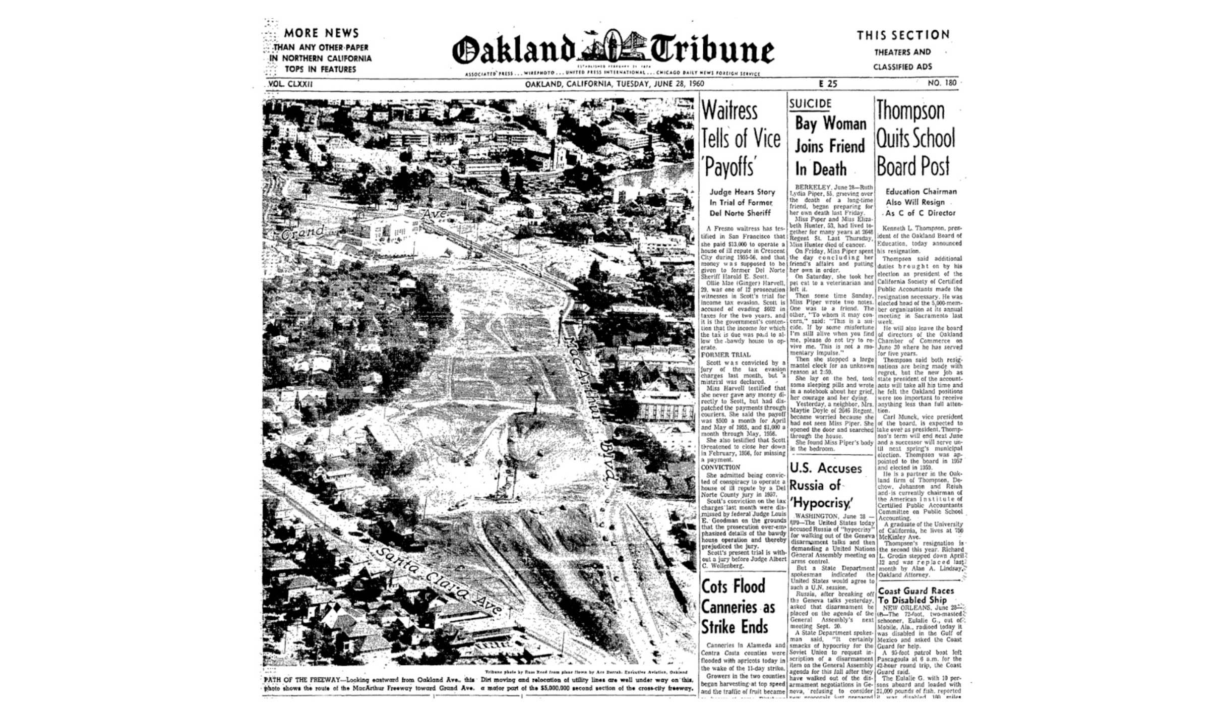
By mid-1960, the challenging task of inserting a freeway paralleling and within the MacArthur Blvd. corridor was well underway between the bridge and Park Blvd. The circumstances leading to the freeway construction follows.
L245-05-Courtesy Oakland History Room, Oakland Public Library, (Image 1 of 27)

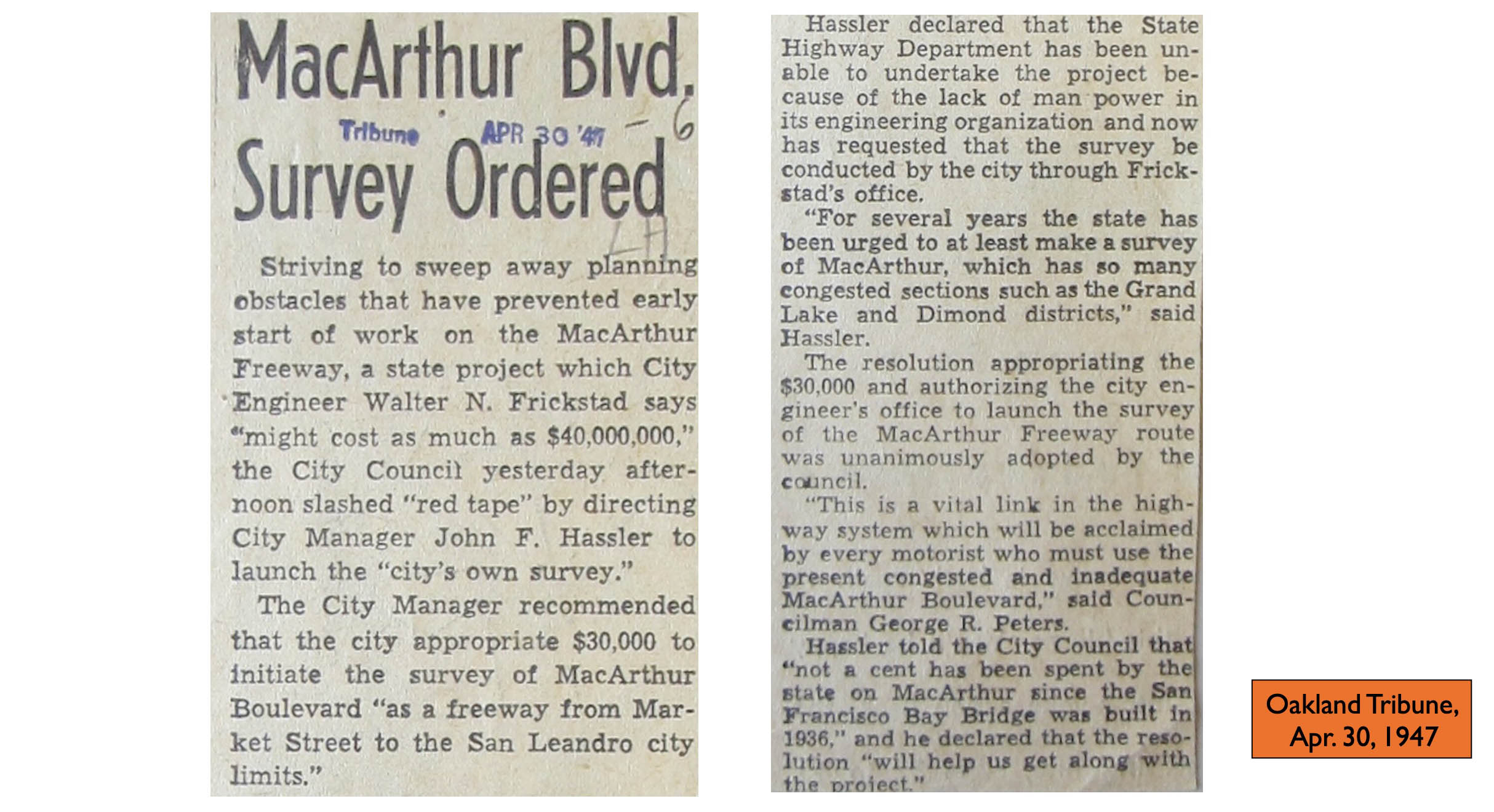
It took only a few years after the completion and naming of MacArthur Blvd. to realize that the new thoroughfare was inadequate to handle the post-WWII boom in auto traffic along the new Route 50. This article is one of the earliest public acknowledgements that addition of a freeway was being considered.
L245-10-Courtesy Oakland History Room, Oakland Public Library, (Image 2 of 27)
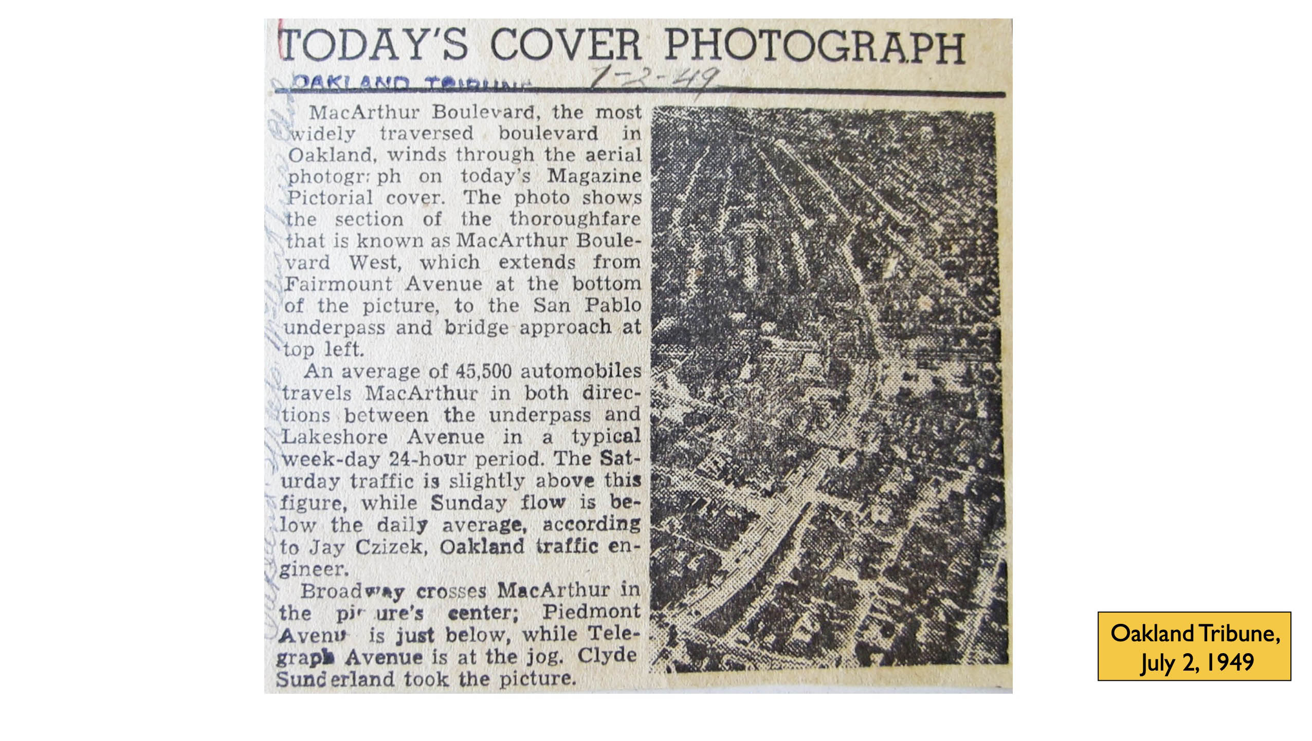
The mention of a freeway is absent from this article two years later extolling the virtues of MacArthur Blvd. However, the Department of Public Works, Division of Highways, District IV would soon be calling on Clyde Sunderland to begin a detailed aerial survey for a new freeway.
L245-15-Courtesy Oakland History Room, Oakland Public Library, (Image 3 of 27)
Sunderland’s crew begin this contracted survey by the bridge approach on July 10, 1951, left, and headed east, right. The blue dot marks Oaks Park, or Oakland Baseball Park as it was first called, at San Pablo Ave. and 45th St. in Emeryville.
L245-20-Copyriight California Department of Transportation, 2218-0, l, 2218-2, r , (Image 4 of 27)
The survey followed MacArthur Blvd. east past Broadway, left, and to Grand Ave., right. The Vernon St. intersection is easily differentiated as the width and color of the road surface changes indicating the end of MacArthur Blvd. 1930s construction as detailed in the last update.
L245-25-Copyright California Department of Transportation, 2218-12. l, 2218-13, r, (Image 5 of 27)
Then a turn at Lake Merritt, and past Trestle Glen to Park Blvd. The survey continued past Mills College, but that will be addressed at a later time.
L245-30-Copyright California Department of Transportation, 2218-16, l, 2218-18, r, (Image 6 of 27)
Sunderland and crew were back at it on Apr. 8 1953, this time with low obliques starting at the bridge, west view, left, and following MacArthur Blvd., blue arrow, right, to the east.
L245-35-Copyright California Department of Transportation, 3300-5, l, 3300-1, r, (Image 7 of 27)
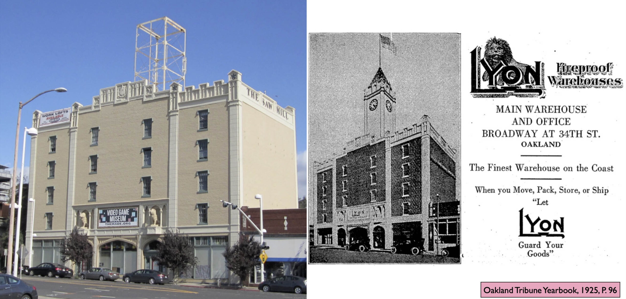
3400 Broadway is a Gothic Revival-Beaux Arts derivative warehouse designed by architects C.E. Richardson and Clay Burrell, and built by F.A. Muller in 1916-1917, permit 41460, for 60k dollars. Lyon Storage and Moving used the building into the 1950s, but in the 20th century it is probably best known as the home of the Saw Mill furniture store. The scaffolding is the skeleton of the tower, the brick cladding removed after the 1989 earthquake. In 2021, the Video Game Museum-Museum of Art and Digital Entertainment occupies the building.
L245-40-Courtesy Oakland History Room, Oakland Public Library, (Image 8 of 27)
With 3400 Broadway boxed in turquoise, the east view of MacArthur Blvd. from Broadway, left, followed by a west view from Vernon St., right, both from 1953 will be studied in more detail.
L245-45-Copyright California Department of Transportation, 3300-13, l, 3300-18, r, (Image 9 of 27)
Starting at Broadway, it can be appreciated how MacArthur Blvd. had truncated both Moss Ave., Santa Clara Ave., and left only a stub of Perry St. as Perry Place. An annotated version follows.
L245-50-Copyright California Department of Transportation, 3300-13, Detail, (Image 10 of 27)
An annotated version of the previous east view is shown here.
L245-51-Copyright California Department of Transportation, 3300-13, Detail, (Image 11 of 27)
A complementary west view of the alteration of streets in creating MacArthur Blvd. is shown here. Again, the official end of the MacArthur Blvd. construction in the 1930s is easy to spot by the change in road width and surface color from light to dark at Vernon St. An annotated version follows.
L245-55-Copyright California Department of Transportation, 3300-10, Detail, (Image 12 of 27)
An annotated version of the previous west view is shown here.
L245-56-Copyright California Department of Transportation, 3300-10, Detail, (Image 13 of 27)
Moving further east, this east view approaches Lake Merritt, with Lakeview Elementary School marked by the orange border. An annotated version follows.
L245-60-Copyright California Department of Transportation, 3300-19, Detail, (Image 14 of 27)
An annotated version of the previous east view is shown here.
L245-61-Copyright California Department of Transportation, 3300-19, Detail, (Image 15 of 27)
A complementary west view is presented here, with the green arrow showing the separation of MacArthur Blvd. and Santa Clara Ave., and the yellow arrow where the boulevard took over Perry St. all the way to the lake.
L245-65-Copyright California Department of Transportation, 3300-28, Detail, (Image 16 of 27)
Following our boxed marker, these panels show east, left, and west views, right, of the southern portion of Trestle Glen.
L245-70-Copyright California Department of Transportation, 3300-21, l, 3300-29, r, (Image 17 of 27)
A detailed west view of Trestle Glen is provided with three key structures identified for orientation. Speaking of Key, the three arrows, turquoise, blue and purple arrows mark the Northvale, Grosvenor and Underhills Key System B-line shelters, the latter with two “bridge-units” parked by its side. As for the shelter at the Sunnyhills stop, between Northvale and Grosvenor, its presence is obscured by surrounding trees.
L245-75-Copyright California Department of Transportation, 3300-30, Detail, (Image 18 of 27)
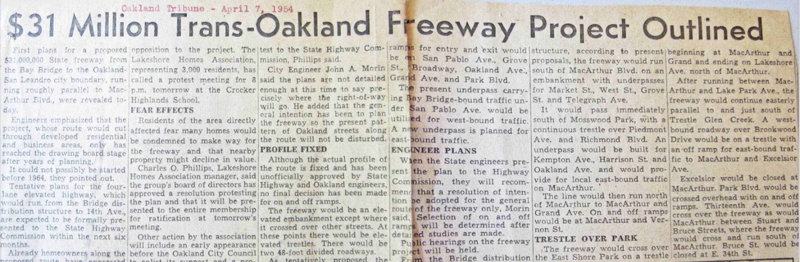
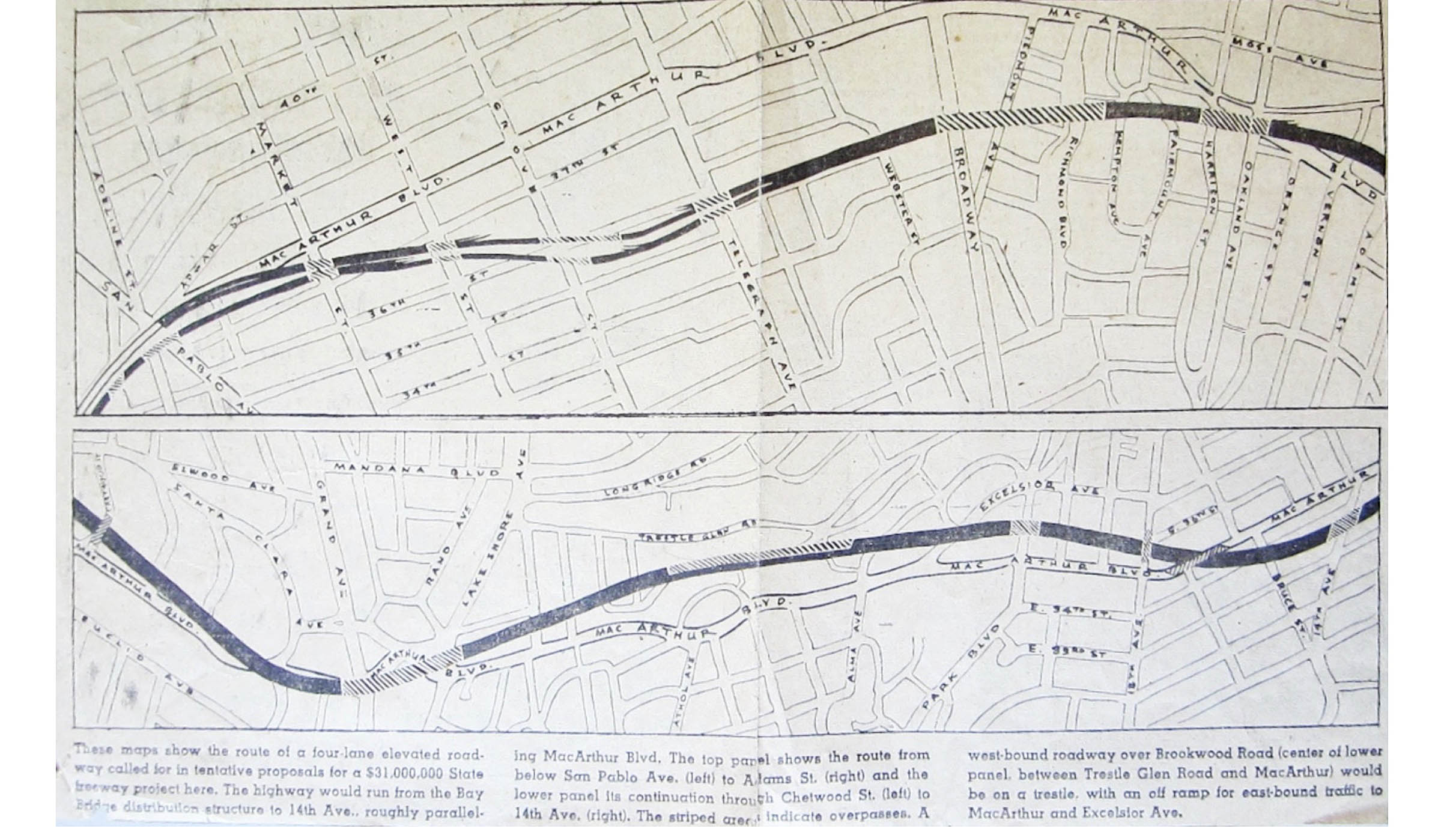
By the spring of 1954, all the details of the path of the new freeway were known, and the expected opposition was organizing against its construction. It is fairly humorous to note in the second and third paragraphs that the project was said to only be on the drawing board, and “could not be possibly be started before 1964.”
L245-80-Courtesy Oakland History Room, Oakland Public Library, (Image 19 of 27)
The diagram of the freeway route is a continuation of the previous article from 1954.
L245-85-Courtesy Oakland History Room, Oakland Public Library, (Image 20 of 27)
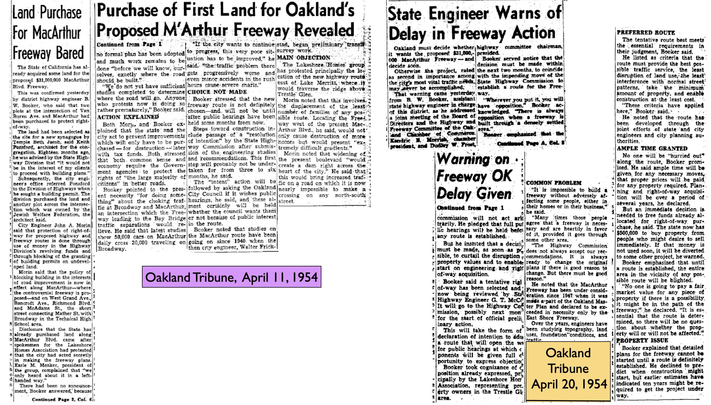
More details of the opposition, and the details of the first land purchase, that of the proposed site for Temple Beth Jacob. The Beth Jacob Congregation would eventually start construction of its synagogue on Park Blvd. in 1954.
L245-90-Courtesy Oakland History Room, Oakland Public Library, (Image 21 of 27)
The aforementioned purchase of land by the State from Beth Jacob is marked in this west view by the red dot. The turquoise arrow points to Temple Beth Abraham, that structure surviving the freeway build.
L245-95-Copyright California Department of Transportation, 5982-4, Detail, (Image 22 of 27)
More details of the protestations and other important events involved in coming to a final highway plan are presented here.
L245-100-Courtesy Oakland History Room, Oakland Public Library, (Image 23 of 27)
Ironically, one last photographic sweep of the Trestle Glen-Lakeshore-Grand Lake districts was made in 1958, just three days after the abandonment of the Key System, starting here with this southwest view.
L245-105-Copyright California Department of Transportation, 5982-2 , (Image 24 of 27)
Then to the northeast …
L245-110-Copyright California Department of Transportation, 5982-5, (Image 25 of 27)
… the northwest …
L245-115-Copyright California Department of Transportation, 5982-4, (Image 26 of 27)
… and to the east. Next time, building the first part of the MacArthur Freeway.
L245-120-Copyright California Department of Transportation, 5982-7, (Image 27 of 27)