The Man Who Mistook a Driveway for A Creek
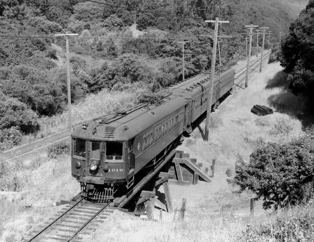
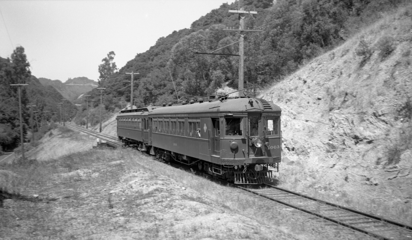
In the Landmark, “Trestles in the Trees”, this image of SN 1016 leading three-car train number 2 toward Moraga from May 26, 1940 was shown noting “Appreciate the proximity of the trestle to Pinehurst Rd, and that the breach in the right-of-way continues to road level”.
L106-05-Wilbur C. Whittaker Photo, Courtesy Garth Groff, (Image 1 of 12)

This north view of the same trestle with SN 1003 and a Niels trailer on Aug. 18, 1940 provides a blurry image of the mile 14 marker beside the track, the same as the trestle at Eastport, but little additional information beyond that in L106-05.
L106-10-Art Alter Photo, Moreau Collection, Courtesy BAERA, Western Railway Museum Archives, 81721sn, (Image 2 of 12)
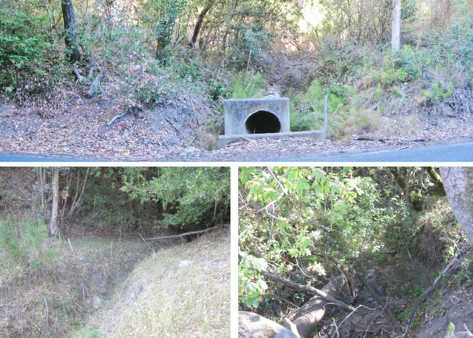
Passing by this area in 2015, an east view from Pinehurst Rd toward the right-of-way, top, a view on the hill just east of the right-of-way, bottom left, or from the road looking west, bottom right, are consistent with this breach of the right-of-way as being a creek or gully.
L106-15-Stuart Swiedler Photos, (Image 3 of 12)
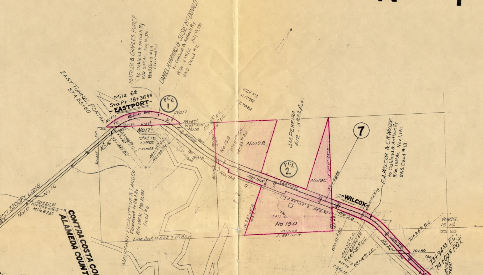
This map provides the name of the owner of the land where the trestle was located, J.M. Pereira, patriarch of one of the original ranching families in Canyon. Janet McEwen, in her master’s thesis from Holy Names “Canyon, A History, 1840-1939”, provided evidence from deeds and water rights that Pereira’s land was an important source of water, even attracting the attention of water maverick William Dingee in the late 19th century.
L106-20-Board of Equalization Map, Courtesy BAERA, Western Railway Museum Archives, 77723 , (Image 4 of 12)
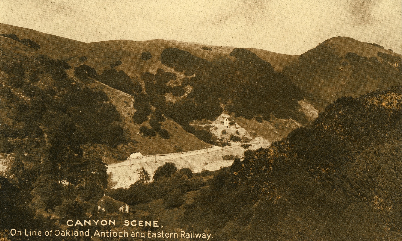
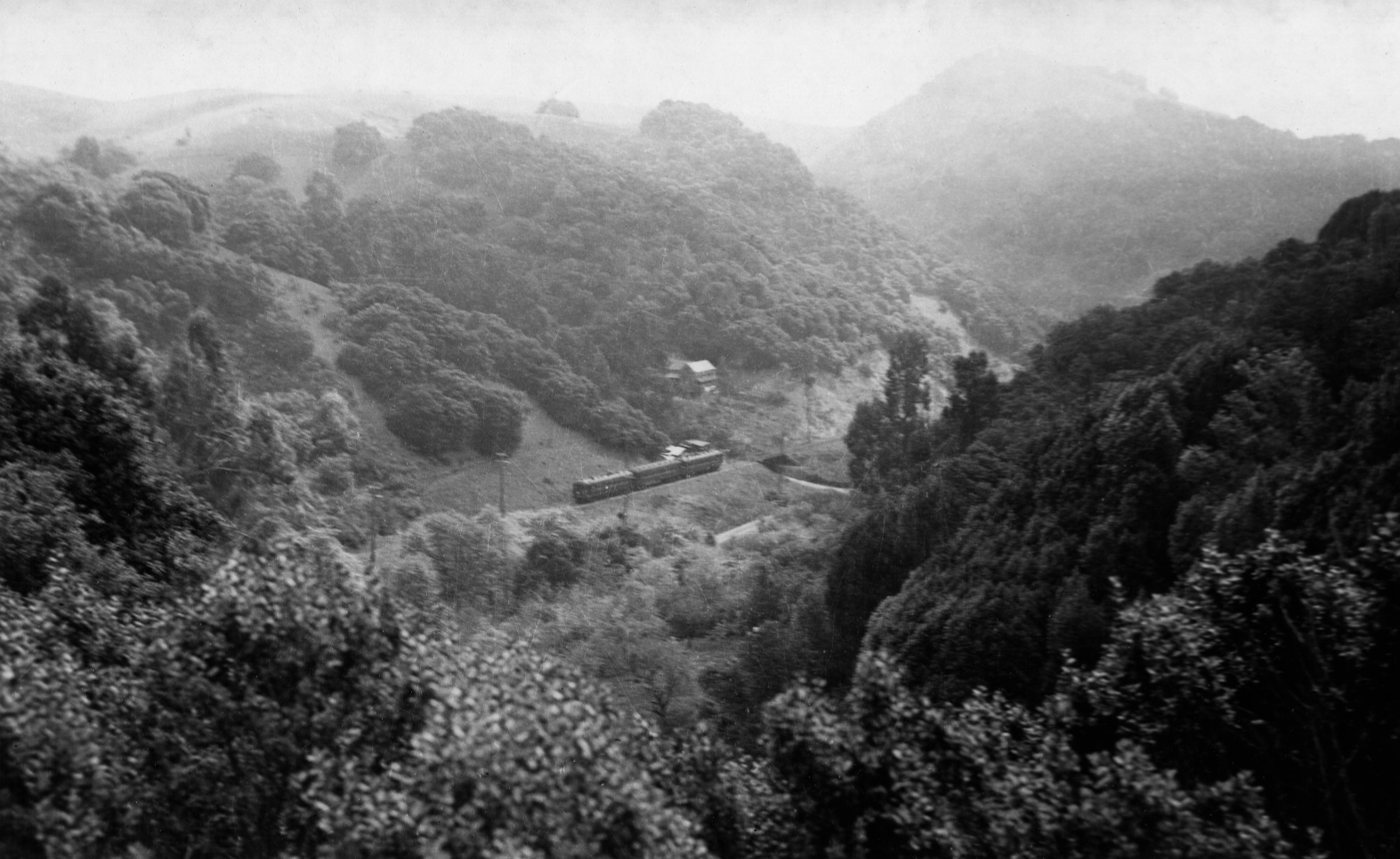
This 1910s southeast image, taken from near or on one of the Pinehurst Rd. switchbacks, however, suggests something quite beyond the proposal that the trestle spanned just a creek or gully.
L106-27-Courtesy BAERA, Western Railway Museum, 93155sn, (Image 5 of 12)
Ahead to circa 1940, the same southeast image, taken from near or on one of the Pinehurst Rd. switchbacks.
L106-27-Courtesy BAERA, Western Railway Museum Archives, 85920sn, (Image 6 of 12)
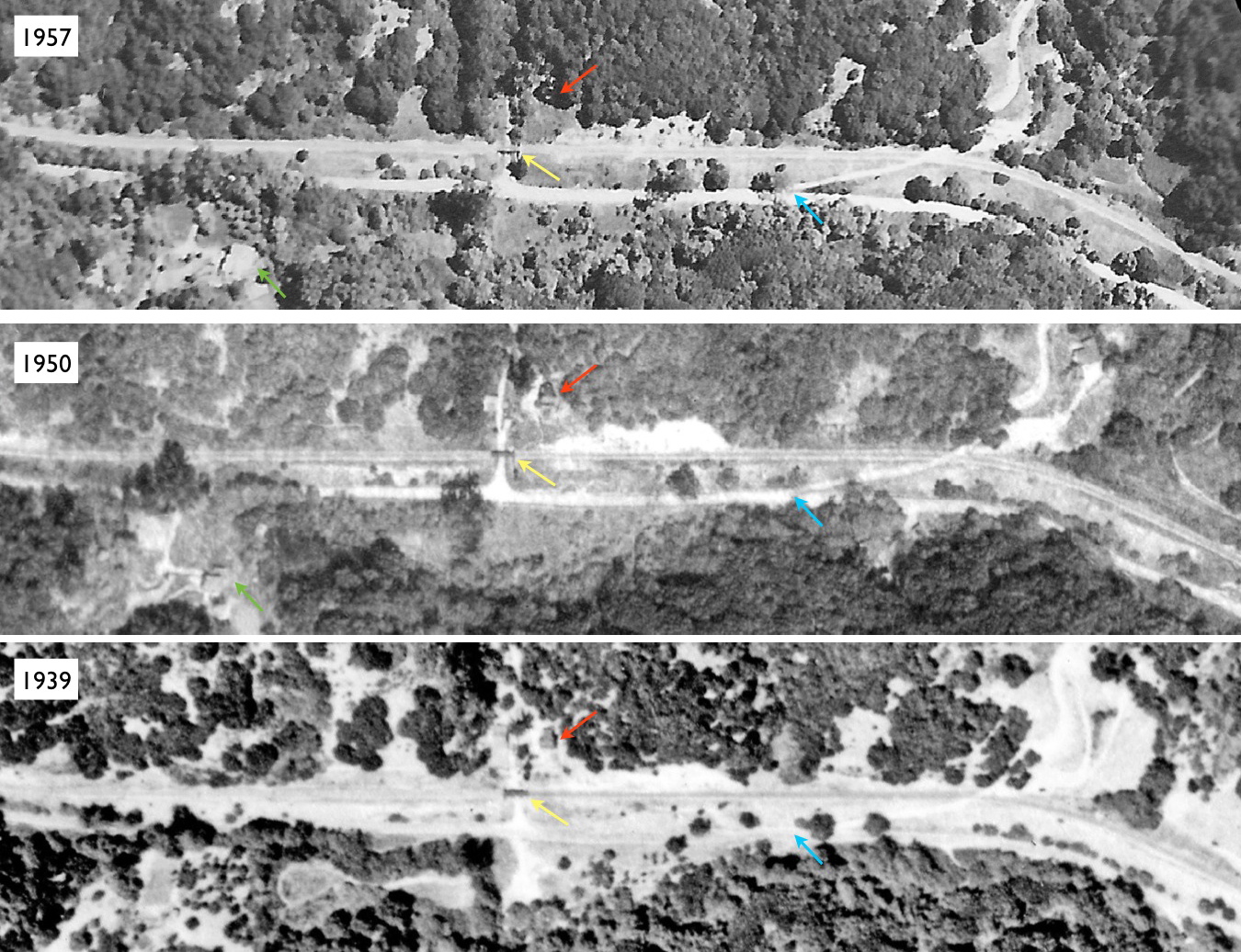
A more extensive examination of several aerial views confirmed the presence of a house, red arrow, in 1939 and 1950, by the trestle, yellow arrow, to the west of Wilcox and the John McCosker Ranch Road, turquoise arrow, and east of the home known as “The Farm”, green arrow. The presence of the house in 1957 based on this evidence is equivocal, but read on ... Refs: left, USDA AAA Western Division BUT-BUU-283-80, Jul. 30, 1939; middle, USDA AAA Western Division BUT-8G-83, Mar. 30, 1950; right, Hamman, Jensen, Wallen, AV 253 12-23, May 4, 1957.
L106-30-Multiple Attributions, See Legend, (Image 7 of 12)
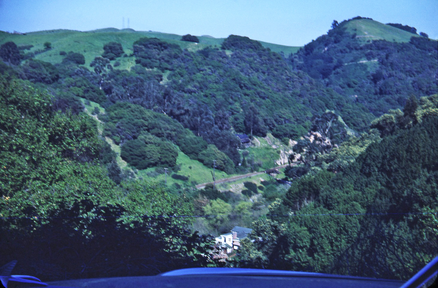
A series of kodachromes taken by EK Muller provides a more extensive analysis of the area, starting with a view similar to L106-25, taken from a Pinehurst Rd. switchback sometime in the first half of the 1950s. Note the presence of “The Farm” just above the car hood in the center of the image.
L106-35-EK Muller Photo, Courtesy BAERA, Western Railway Museum Archives, 85886sn , (Image 8 of 12)
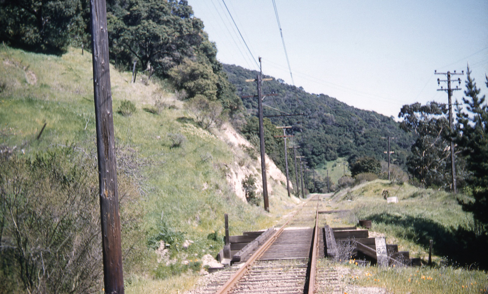
First, the trestle, here in a southeast view showing the unreadable mile marker, circa 1950.
L106-40-EK Muller Photo, Courtesy BAERA, Western Railway Museum Archives, 85898sn, (Image 9 of 12)
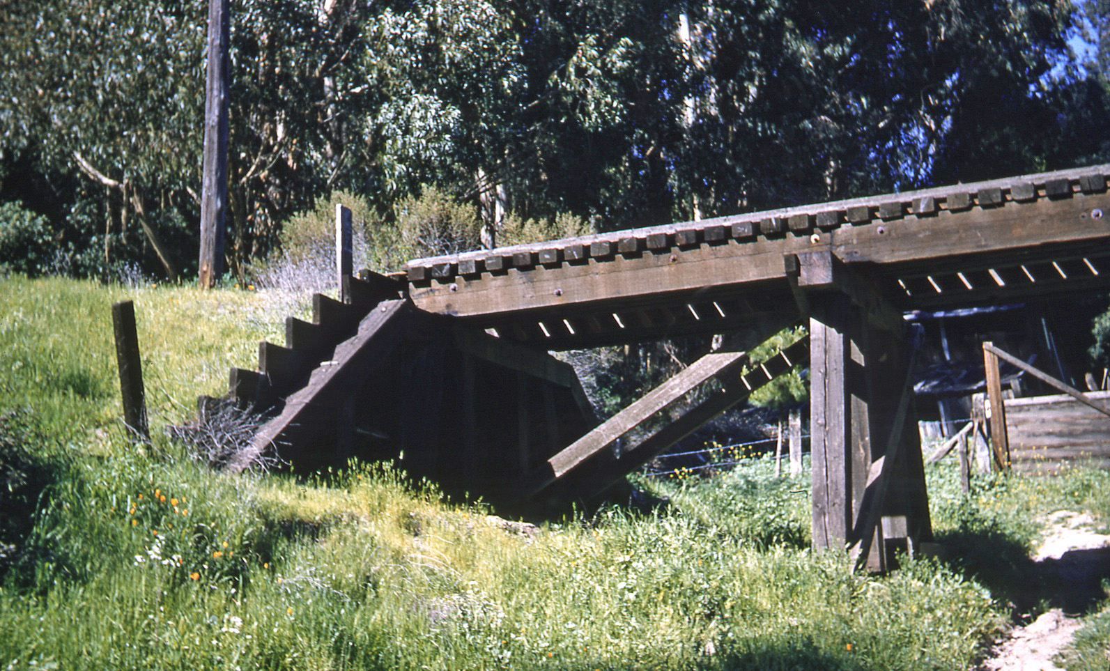
Next, a northeast view of the western-most abutment, also revealing structures and a wood barrier that might have served as a gate, circa 1950.
L106-45-EK Muller Photo, Courtesy BAERA, Western Railway Museum Archives, 85897sn, (Image 10 of 12)
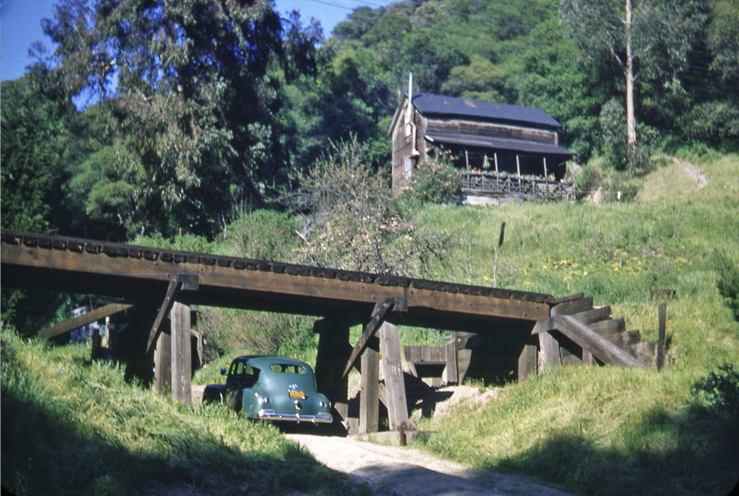
An east view of the eastern-most abutment and the house, with a car in the driveway with a license plate color consistent with those before 1951 or after 1955. The red sticker on this type of plate and the catenary wire across the top of the image is most consistent with 1957. Note the flowers along the railing of the front porch suggesting the house is in use.
L106-50-EK Muller Photo, Courtesy BAERA, Western Railway Museum Archives, 85889sn, (Image 11 of 12)
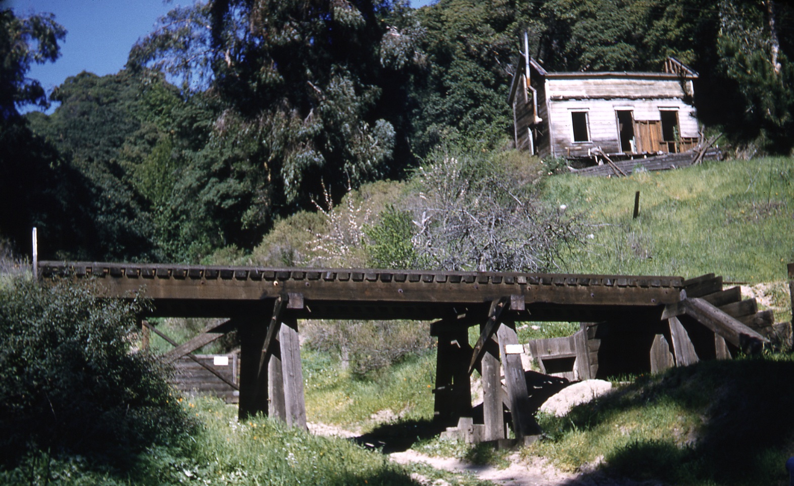
This last image shows the house in great disrepair with no car in the driveway. The shot was taken at such an angle that is too low to verify the presence or absence of catenary wire. There is no date attributed to the image. No sign of the house remains today. One mystery solved, that the driveway was mistook for a creek, but another one left unanswered, the history of this house.
L106-55-EK Muller Photo, Courtesy BAERA, Western Railway Museum Archives, 85894sn, (Image 12 of 12)