Introduction and Avon
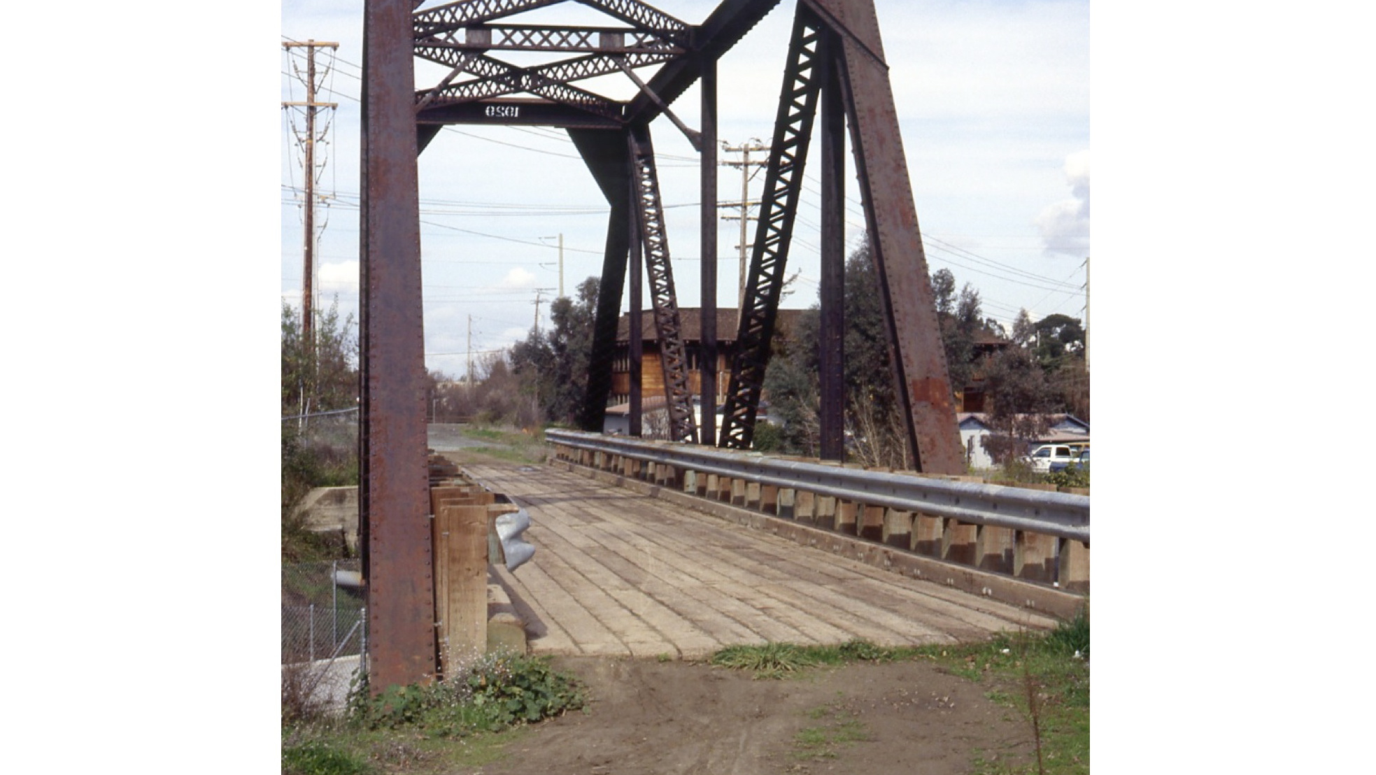
Was the Iron Horse Trail (IHT) created from the abandoned right-of-way (ROW) of the Southern Pacific San Ramon Branch (SPSRB?) A former railroad bridge over the Walnut Creek at Arroyo Way in Walnut Creek, north view, Feb. 1993.
L195-05-Louis L. Stein Photo, Courtesy BAERA, Western Railway Museum Archives, 118569sp, (Image 1 of 31)

Based on this north view from 2018 of the IHT taken a few yards south of the previous image, the extreme curvature of the IHT would rule against this section being created by merely removing railroad track and ties and laying down asphalt.
L195-10-Stuart Swiedler Photo, (Image 2 of 31)
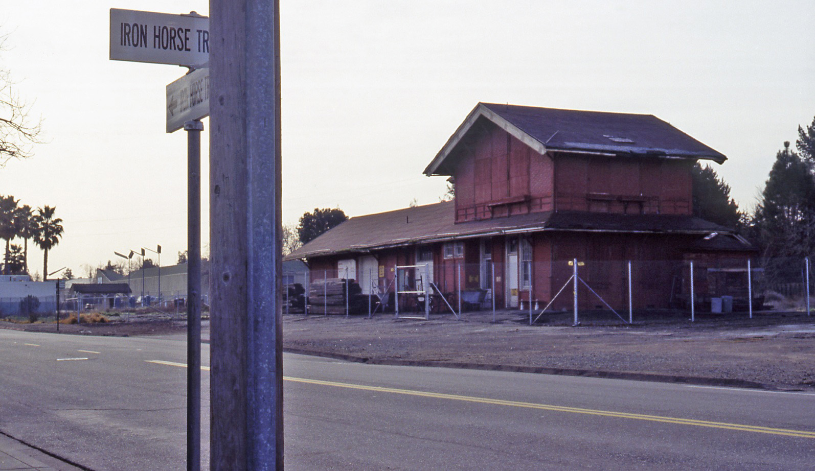
This southwest view shows the rear of the SPSRB station in Danville in Feb. 1993, prior to its move in 1996 to its present location. The signs for the IHT again would suggest a deviation of the trail relative to the SPSRB ROW.
L195-15-Louis L. Stein Photo, Courtesy BAERA, Western Railway Museum Archives, , (Image 3 of 31)
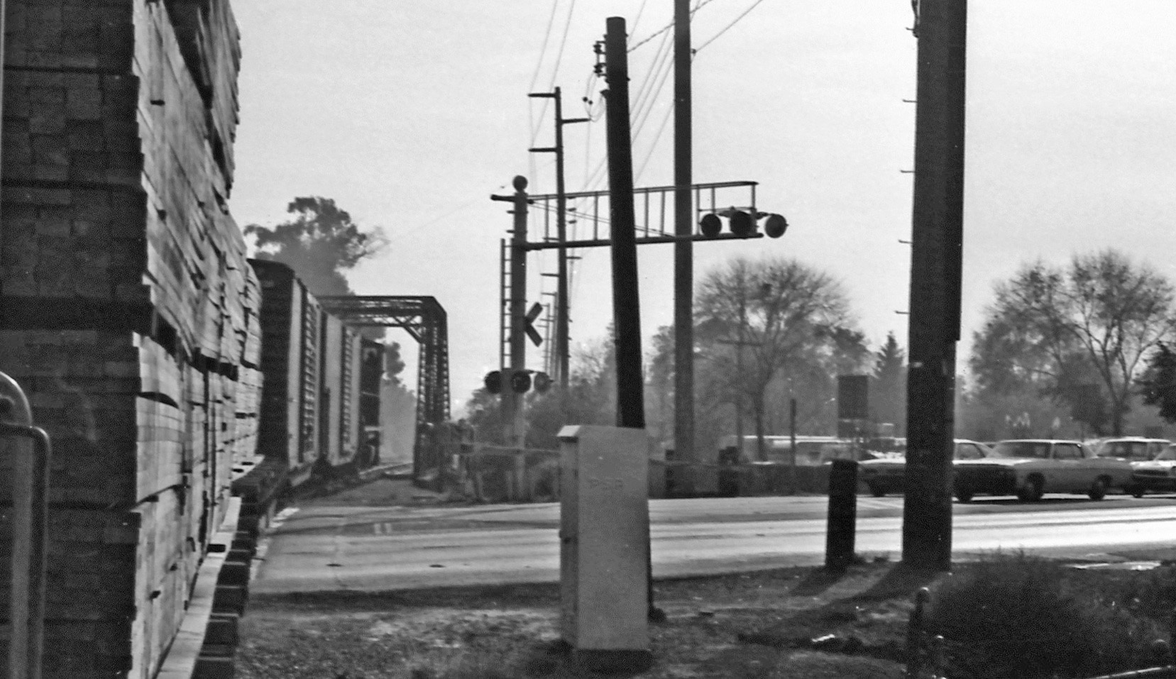
Louis Stein wrote "Last SP Rails, Feb. 1993” on the border of this kodachrome taken in Concord at Concord Ave., south view. Since it will be unequivocally proven that these rails were indeed part of the SPSRB mainline, the IHT does not traverse this section of Concord to the east of Highway 242. Next to lay the groundwork.
L195-20-Louis L. Stein Photo, Courtesy BAERA, Western Railway Museum Archives, , (Image 4 of 31)
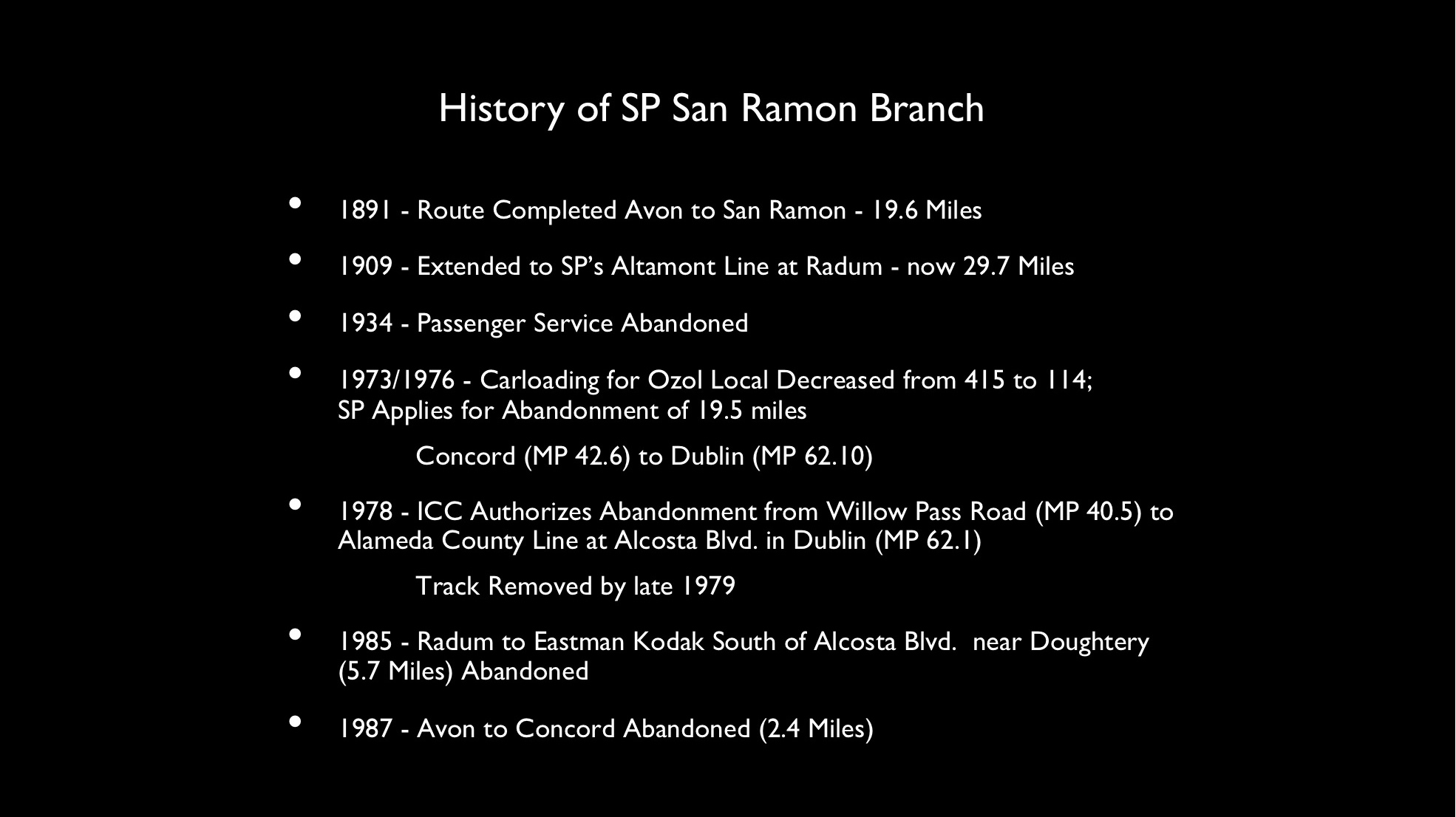
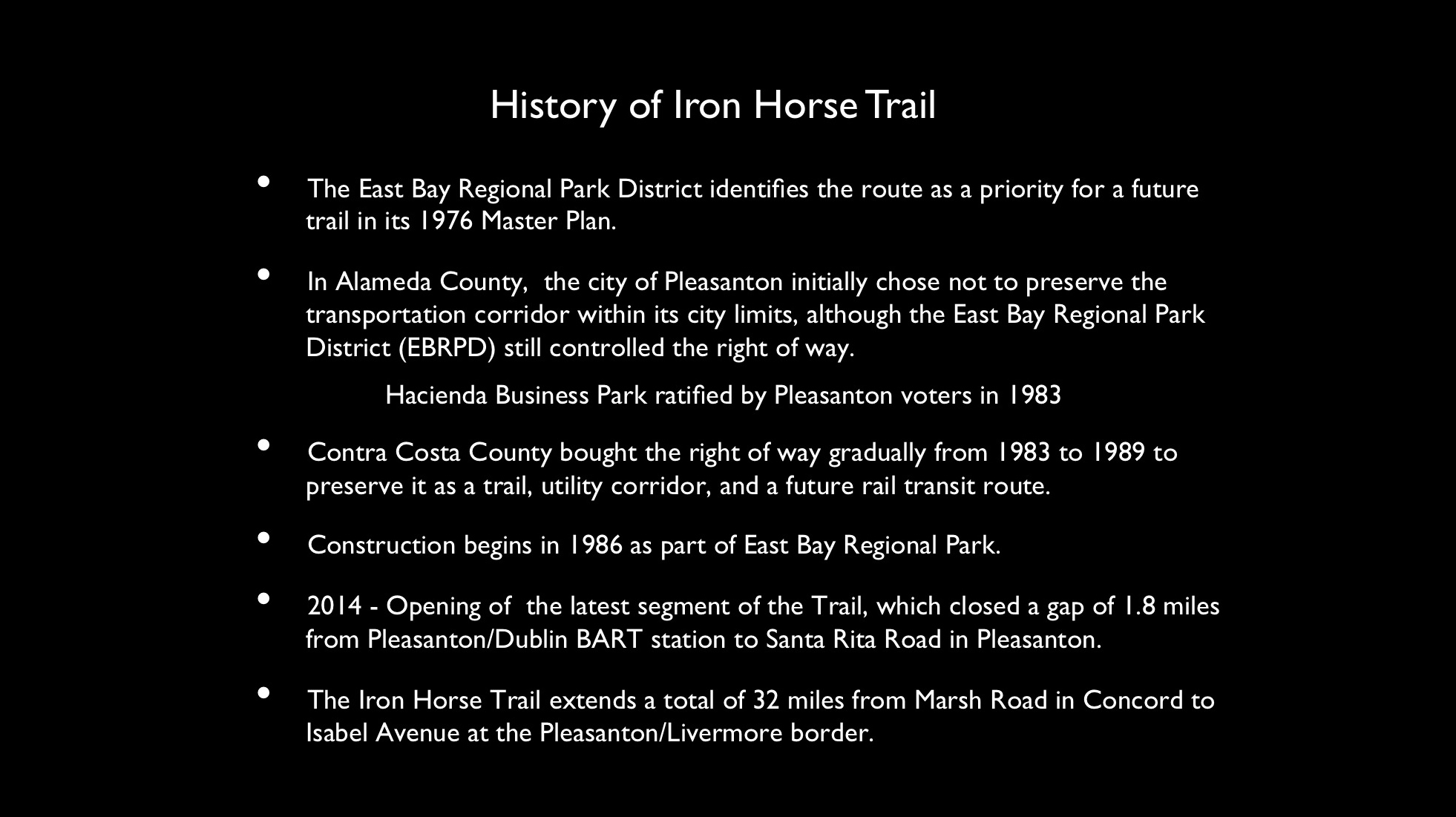
Irma M. Dotson’s book, “San Ramon Branch Line of the Southern Pacific” published by the Museum of the San Ramon Valley in 1991 is the widely acknowledged single authoritative source of that railroad’s history. Key elements have been summarized as shown.
L195-25-Extracted from San Ramon Branch Line of the Southern Pacific by Irma M. Dotson, (Image 5 of 31)
The general history of the IHT is shown here, condensed here from Dotson’s book and multiple sources from printed materials and the internet produced by the East Bay Regional Park District.
L195-30-Multiple Sources, (Image 6 of 31)
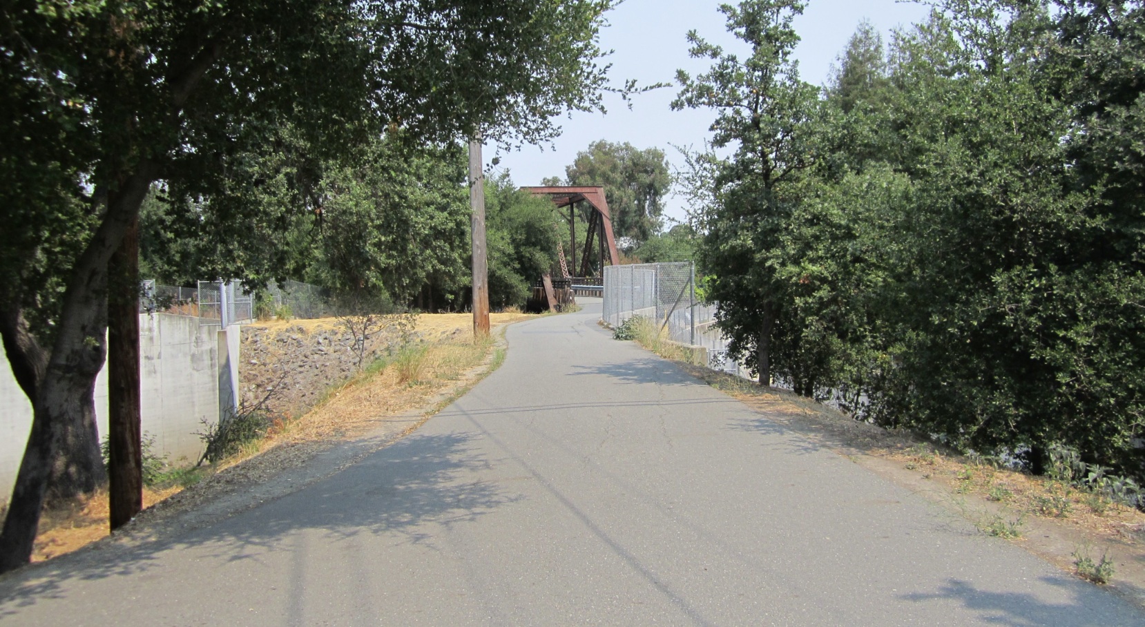
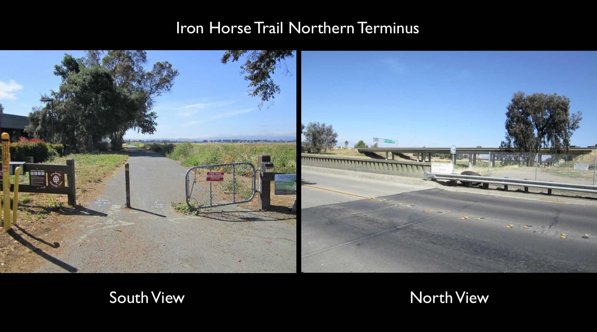
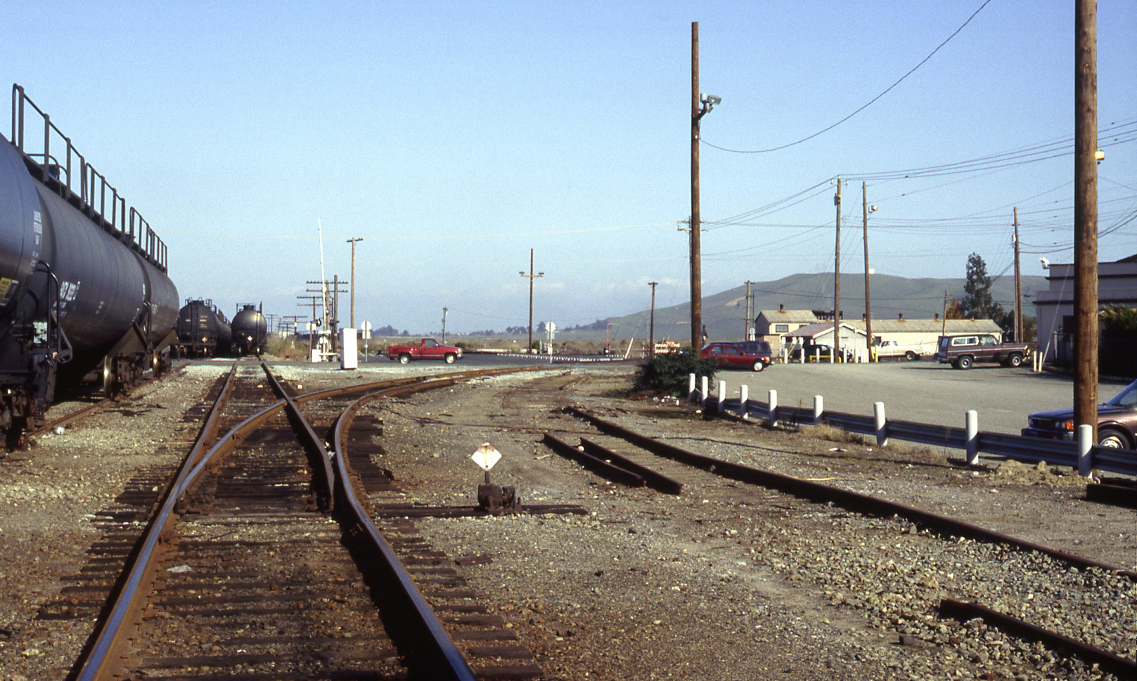
The northern terminus of the IHT in 2018 is shown here. Of particular note is that a trail does exist to the north heading under Highway 4, but as of 2019 this path remains fenced off.
L195-35-Stuart Swiedler Photos, (Image 7 of 31)
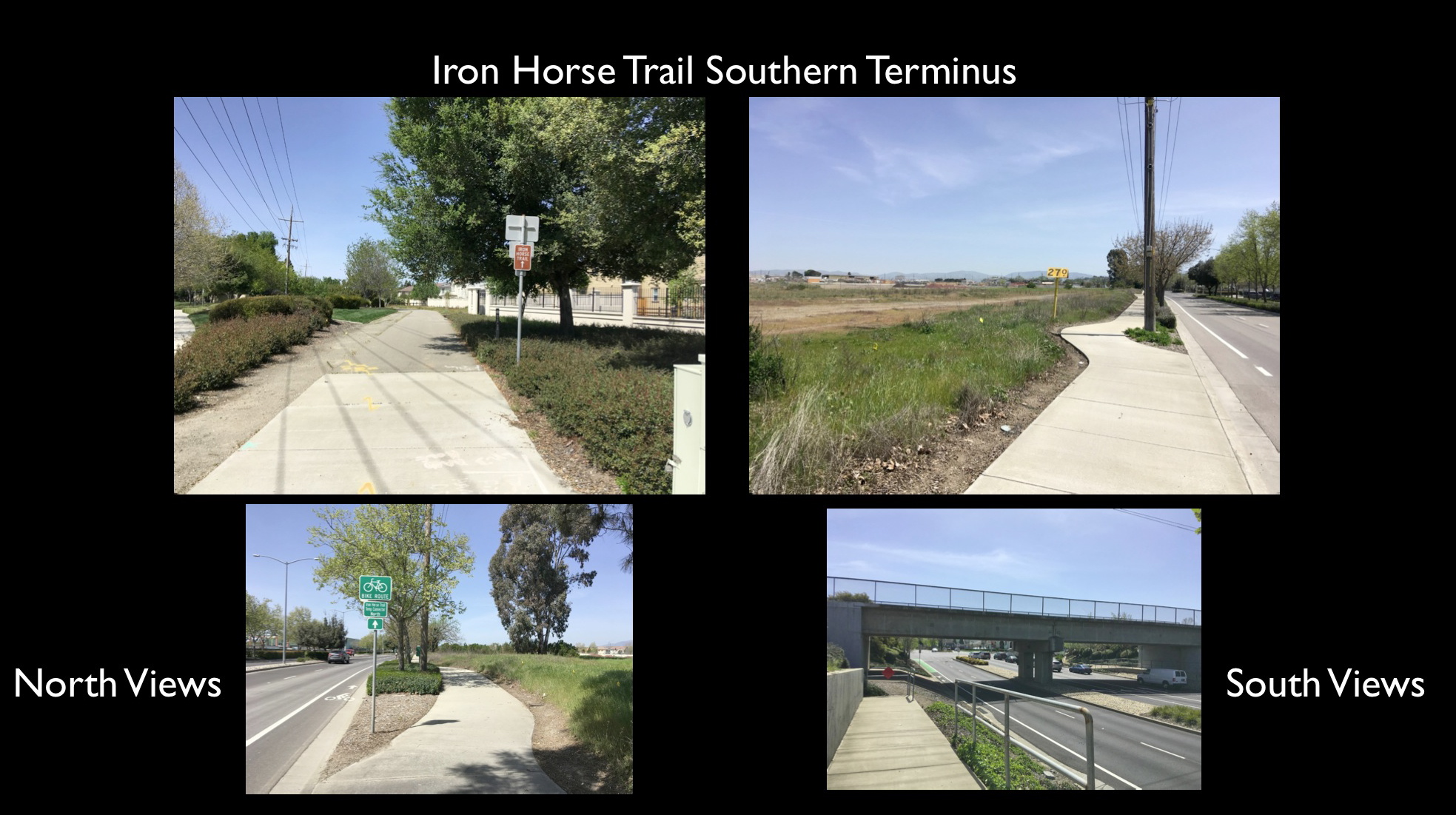
The actual southern terminus of the IHT as of 2019 is not a continuous dedicated path.The upper left north view taken at Busch Rd. in Pleasanton is truly part of a dedicated trail, but to the south until the Union Pacific overpass east of Stanley Blvd., lower right, is in fact a sidewalk that leads to limbo.
L195-40-Stuart Swiedler Photos, (Image 8 of 31)
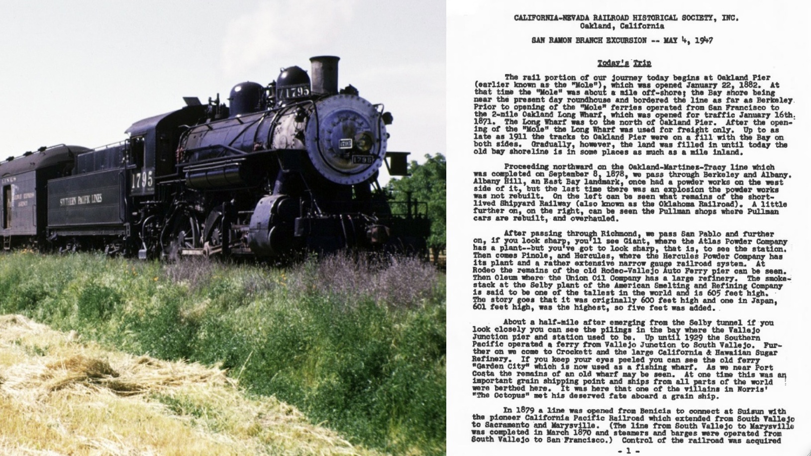
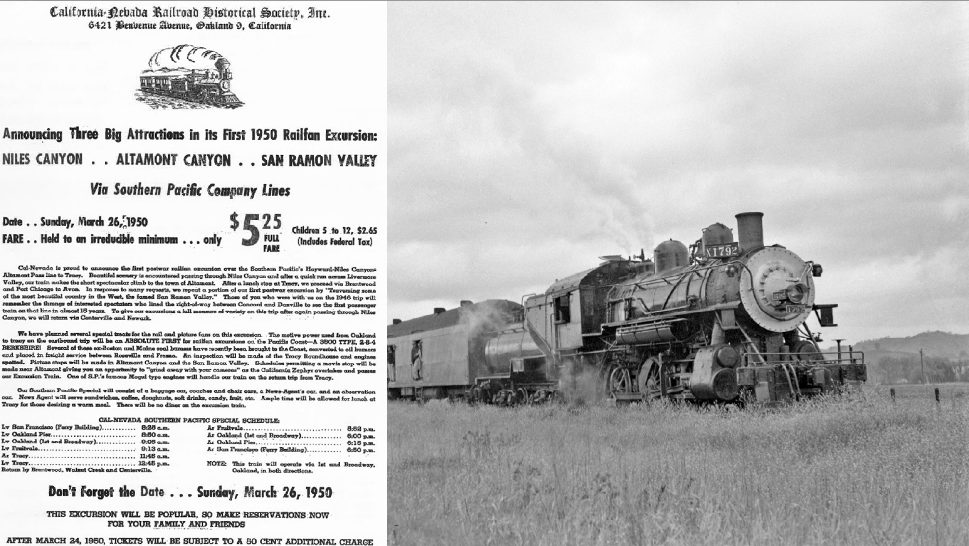
Where and how much does the IHT vary from the SRSPB ROW? Several types of images will be used to address this question. Images of California-Nevada Railroad Historical Society steam excursions on the SPSRB, of which there were three, are an important source of images, starting with the first excursion with SP 1795 following a southerly course on May 4, 1947 ...
L195-45-Insley J. Brain Photo, Courtesy BAERA, Western Railway Museum Archives, 75236sp, (Image 9 of 31)
... and this south-bound trip on Mar. 26, 1950, here with SP 1792 south of the present location of the 680 overpass in Danville ...
L195-50-Arthur Lloyd Photo, Courtesy BAERA, Western Railway Museum Archives, 116089sp, (Image 10 of 31)
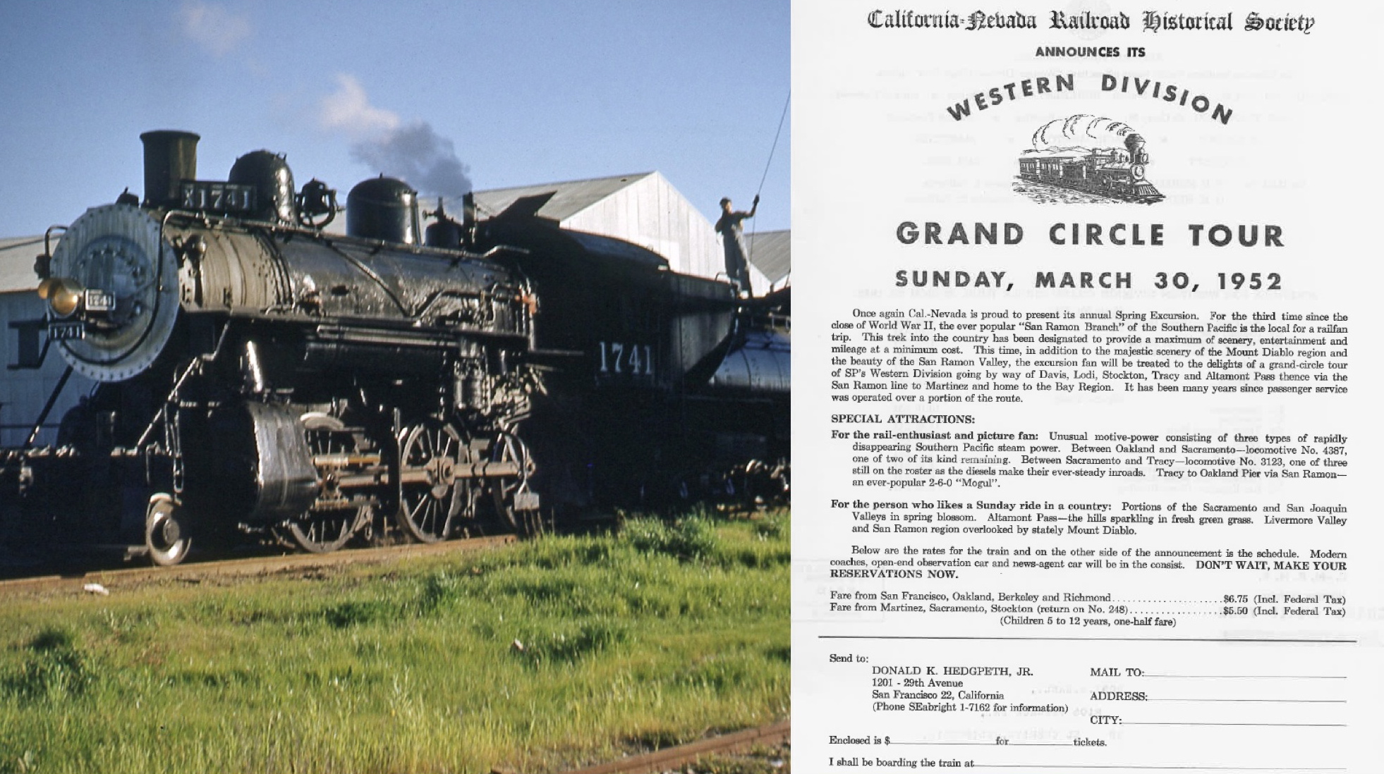
... with the finale on Mar. 30, 1952 with SP 1741 north-bound at Concord.
L195-55-Dudley Westler Photo, Courtesy BAERA, Western Railway Museum Archives, 119454sp, (Image 11 of 31)
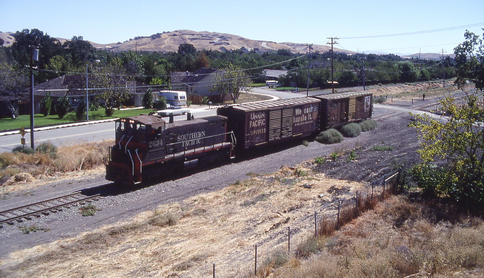
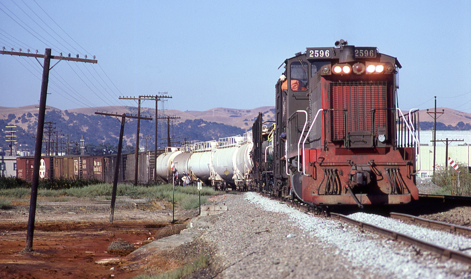
Critical to the task are ground images taken by railroad historian and activist Wayne Monger during the final months of operation. Here SP 2634 leads the last train out of Danville on Sept. 19, 1978, southeast view.
L195-60-Wayne Monger Photo, Courtesy Wayne Monger, (Image 12 of 31)
In addition, the experience of riding on a train is provided by trainman Dan Engstrom from his ride in Feb. 1978 on the Ozol Local servicing between Concord and San Ramon. Dan published an account of this trip in SP Trainline’s Summer 2015, no. 124 issue. Here a south view from the caboose, SP 2597 leads two boxcars, two flatcars with lumber south across Monument Blvd. and onto the bridge at mile 44.64, the border of Concord and Pleasant Hill.
L195-65-Dan Engstrom Photo, Courtesy Dan Engstrom, (Image 13 of 31)
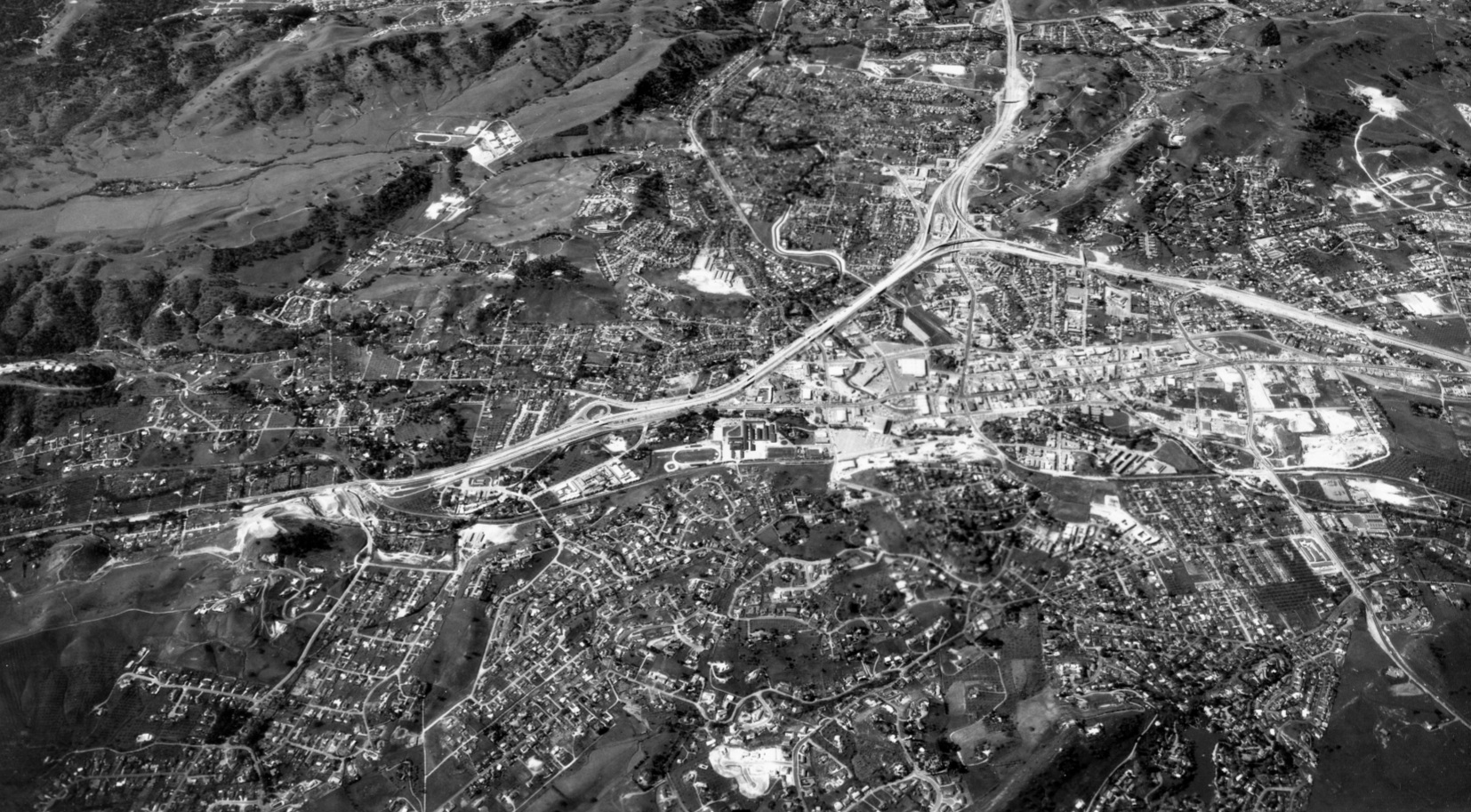
Combine the ground views with aerial obliques, such as this west view above the city of Walnut Creek during the construction of Highway 680 at the Walnut Creek-Alamo border and south from Aug. 8, 1966, to verify the path of the original SPSRB ROW through Walnut Creek and the northern part of Alamo. The ROW is marked on the next image.
L195-70-Herrington-Olsen Photo, Courtesy BAERA, Western Railway Museum Archives, 133236cv , (Image 14 of 31)
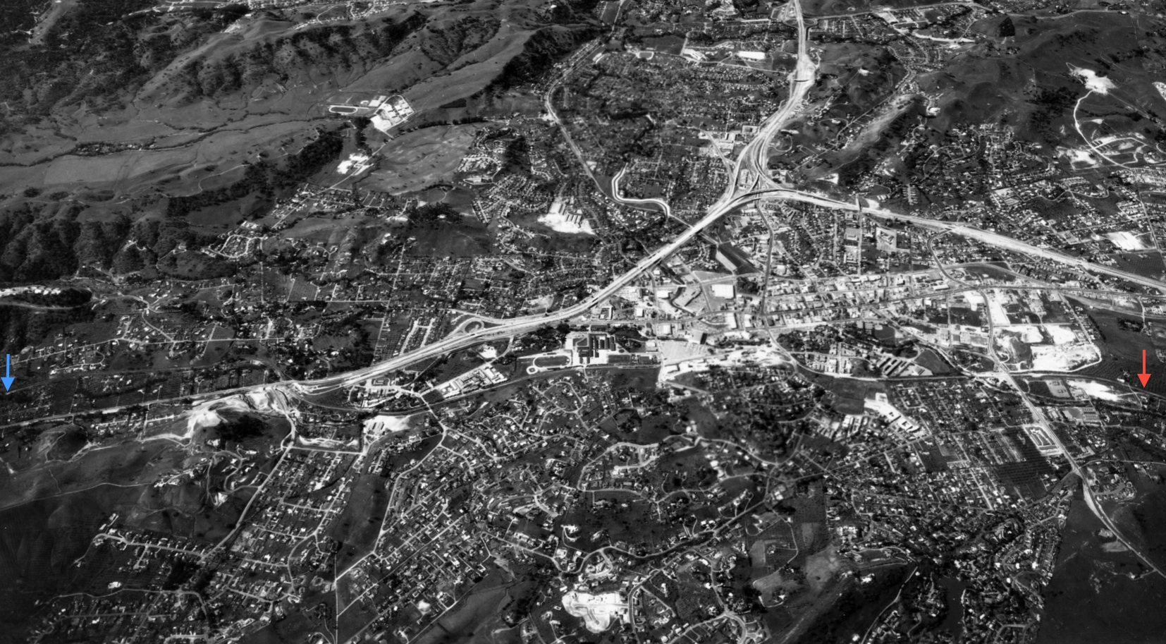
The north end of the SPSRB ROW is marked with a red arrow, the south end with a blue arrow in this west view above Walnut Creek from Aug. 8, 1966. Where is the largest deviation in the IHT relative what is marked? Stay tuned.
L195-71-Herrington-Olsen Photo, Courtesy BAERA, Western Railway Museum Archives, 133236cv , (Image 15 of 31)
Vertical aerials allow evaluation of the ROW and surrounding structures in fine detail, such as in this north-oriented view from Mar. 3, 1952 versus 2019 in Alamo. Note the path of the former Oakland, Antioch and Eastern Danville Branch passing over the SPSRB.
L195-75-Courtesy California Department of Transportation, 2481-5, Detail and Google Maps, (Image 16 of 31)
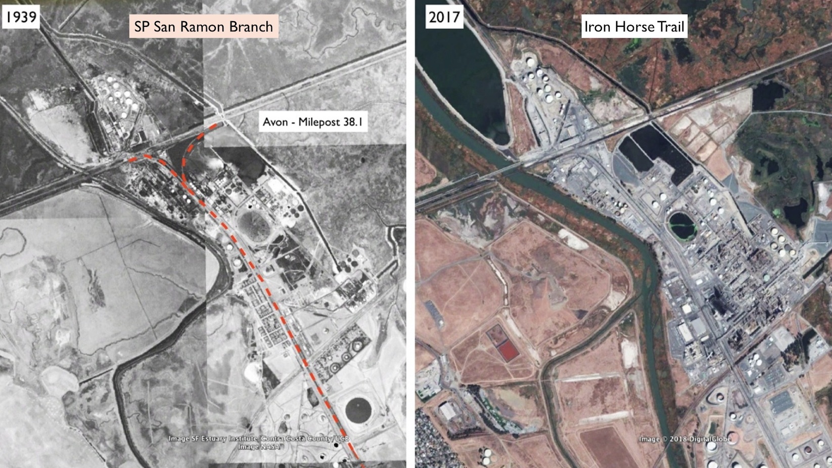
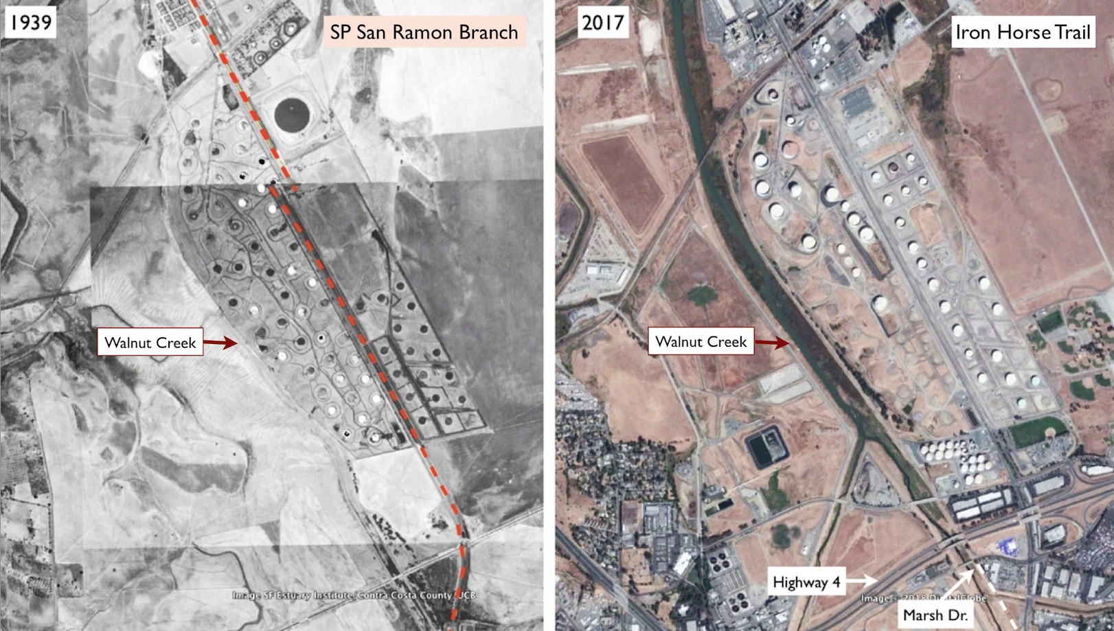
The analysis begins in Avon, milepost 38.1, north of the present Highway 4 as seen on this 1939 versus 2017 comparison. Three observations are that the IHT doesn’t go this far north, train tracks are still present in this section including the terminal wye or “Y” structure, and the Walnut Creek has been widened and altered during this time interval. More on this later.
L195-80-Courtesy Google Earth, (Image 17 of 31)
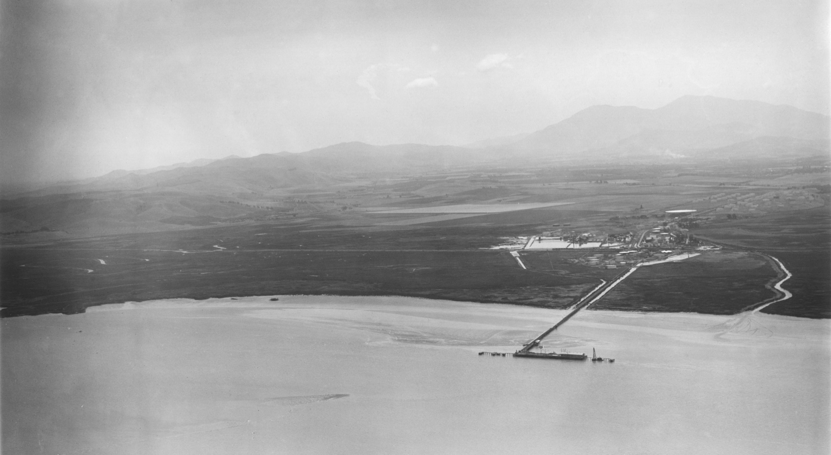
Join George Russell as he flies in from the north to the unincorporated town of Avon, here a south view circa 1929. A detail follows. Ref: API 563_20_BOX 59121
L195-85-George Russell Photo, Courtesy the California State Lands Commission, (Image 18 of 31)
A detail of the previous image, a south view circa 1929 showing the industrialized town of Avon. Ref: API 563_20_BOX 59121
L195-90-George Russell Photo, Courtesy the California State Lands Commission, Detail , (Image 19 of 31)
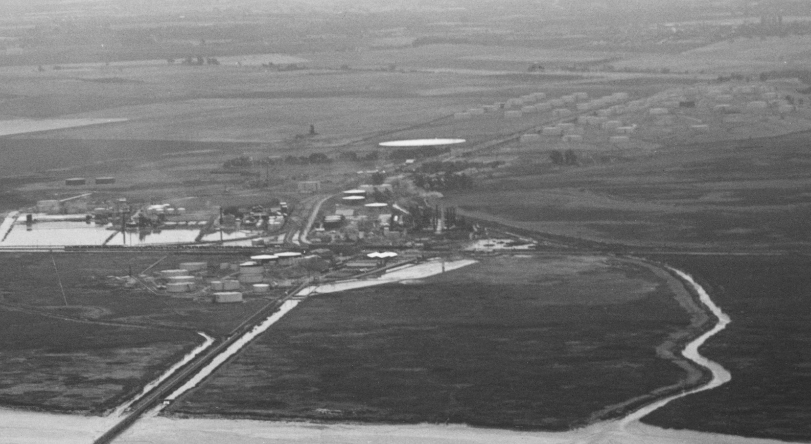
Since 1913 when the Avon refinery was first built, this area has produced gasoline and other related products. In 2019 it is called the Andeavor Martinez Refinery. The Southern Pacific mainline, seen along the left side of this circa 1929 northeast view, continues to Bay Point, and further on in the background, Nichols. The town of Clyde is seen along the right upper border. Ref: API 563_7_BOX 59
L195-95-George Russell Photo, Courtesy the California State Lands Commission, (Image 20 of 31)
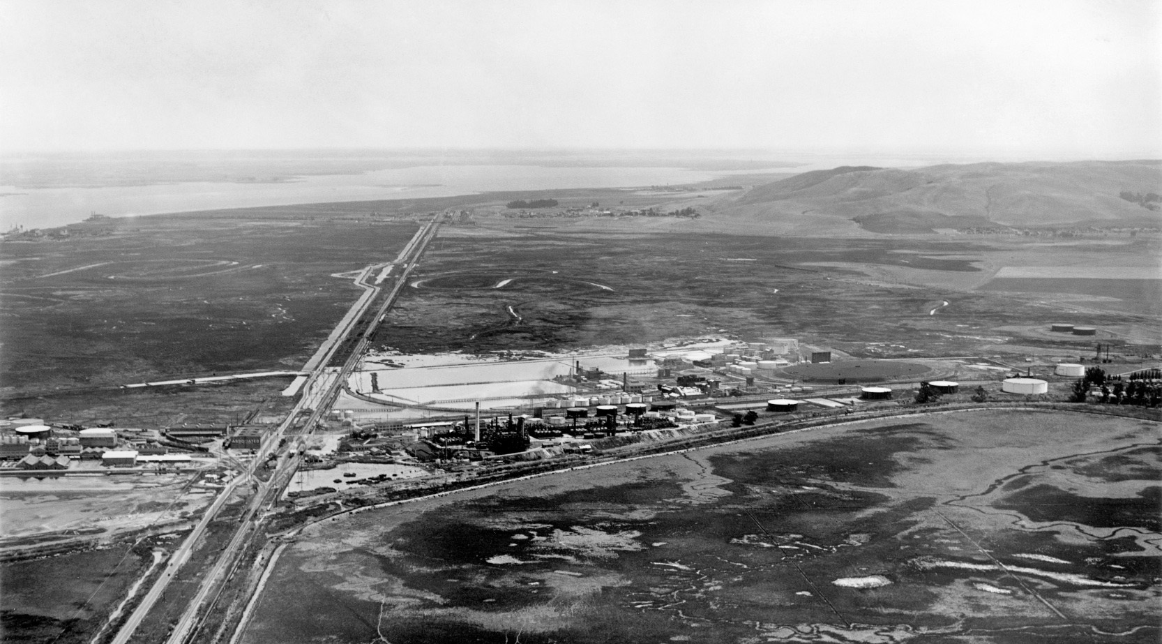
This east view circa 1929 shows the relationship of the SPSRB interchange with the SP mainline. Ref: API 563_9_BOX 59115
L195-100-George Russell Photo, Courtesy the California State Lands Commission, (Image 21 of 31)
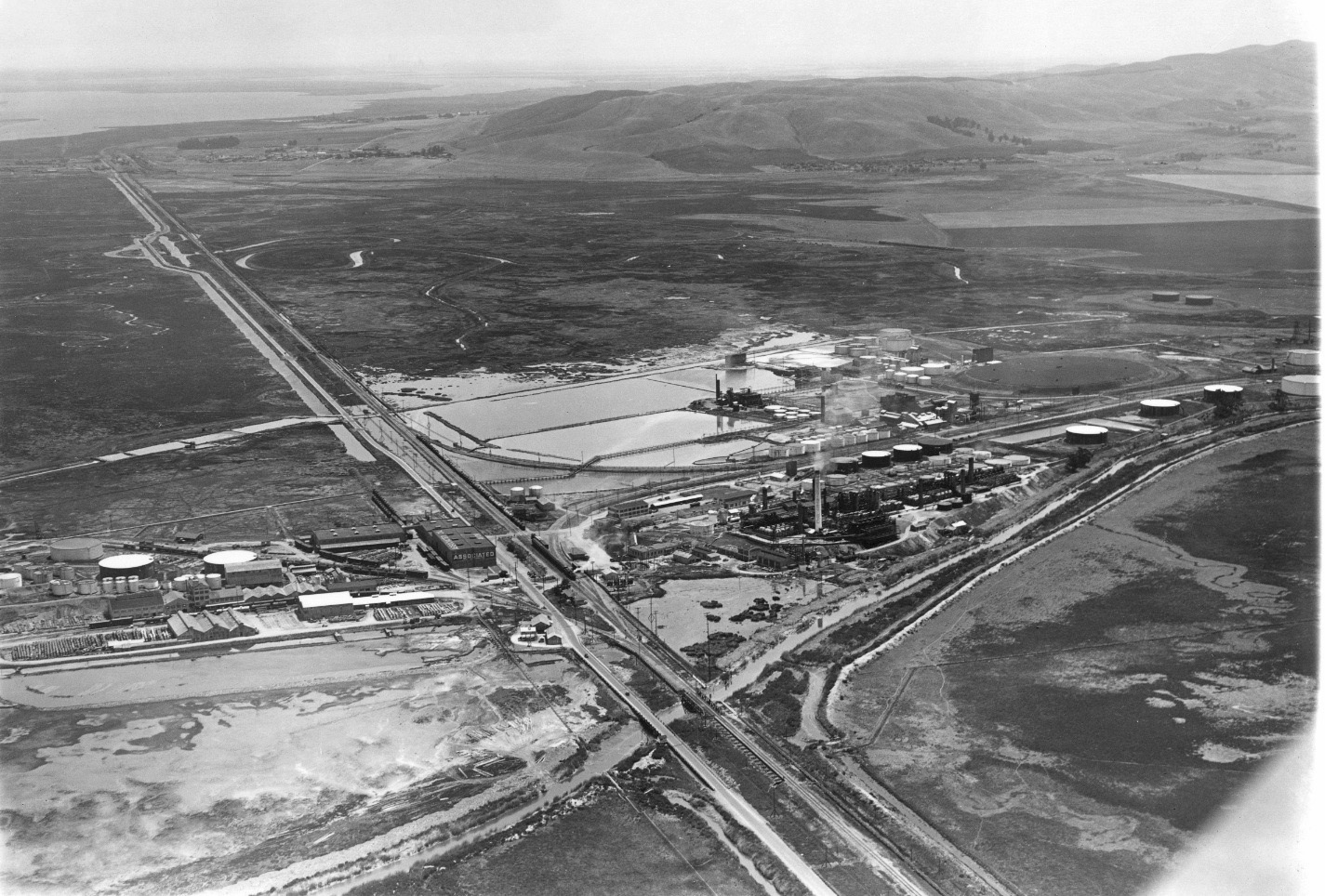
This detail of an east view circa 1929 shows the wye structure with a SP passenger train on the mainline stopped at the passenger station. Ref: API 563_9_BOX 59115
L195-105-George Russell Photo, Courtesy the California State Lands Commission, Detail, (Image 22 of 31)
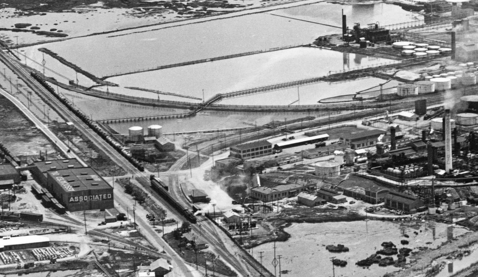
No longer freely accessible unless walking on the Union Pacific mainline, this northeast view shows the western arm of the wye in Feb. 1993.
L195-110-Louis L. Stein Photo, Courtesy BAERA, Western Railway Museum Archives, 118564sp, (Image 23 of 31)
SP 2586 sits moves onto on the eastern arm of the wye in this west view from Sept. 7, 1978 ready to discharge its oil tankers. In less than two weeks time, the Ozol Local to San Ramon will be history. Thanks to Ted Moreland for correctly identifying the location.
L195-115-Wayne Monger Photo, Courtesy Wayne Monger, (Image 24 of 31)
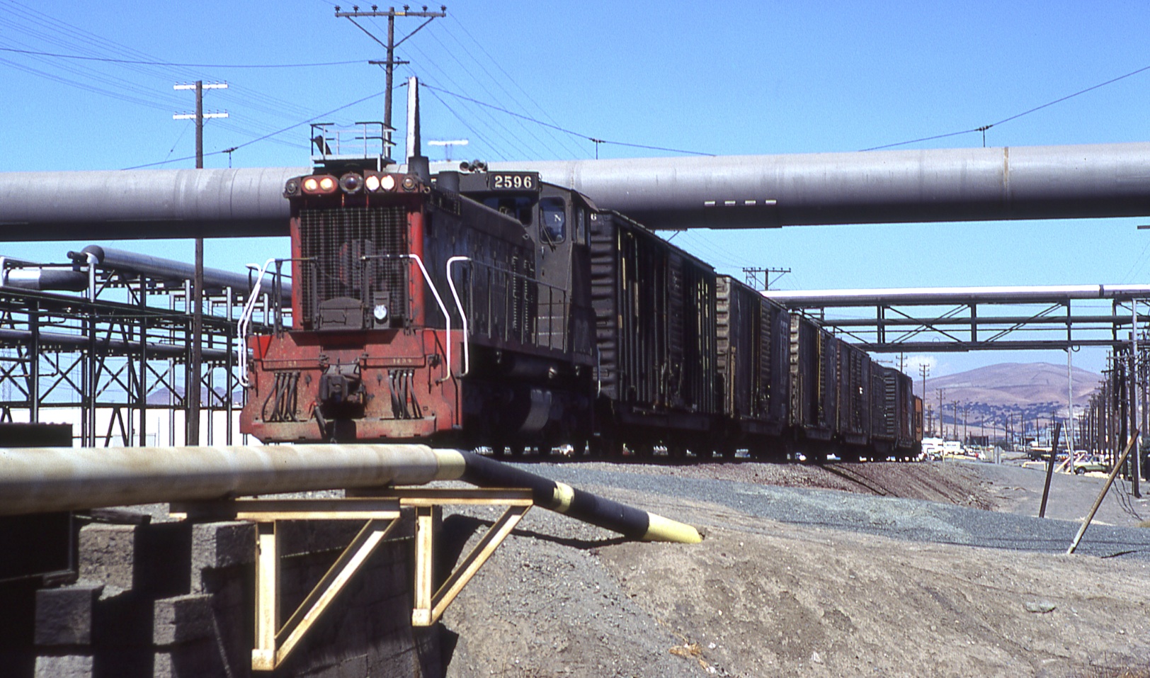
After completing its business at the refinery, SP 2586 sets off with its load south to service the few remaining SRSPB customers on Sept. 7, 1978, north view. The train is just north of its overpass of the Santa Fe Railroad, now BNSF.
L195-120-Wayne Monger Photo, Courtesy Wayne Monger , (Image 25 of 31)
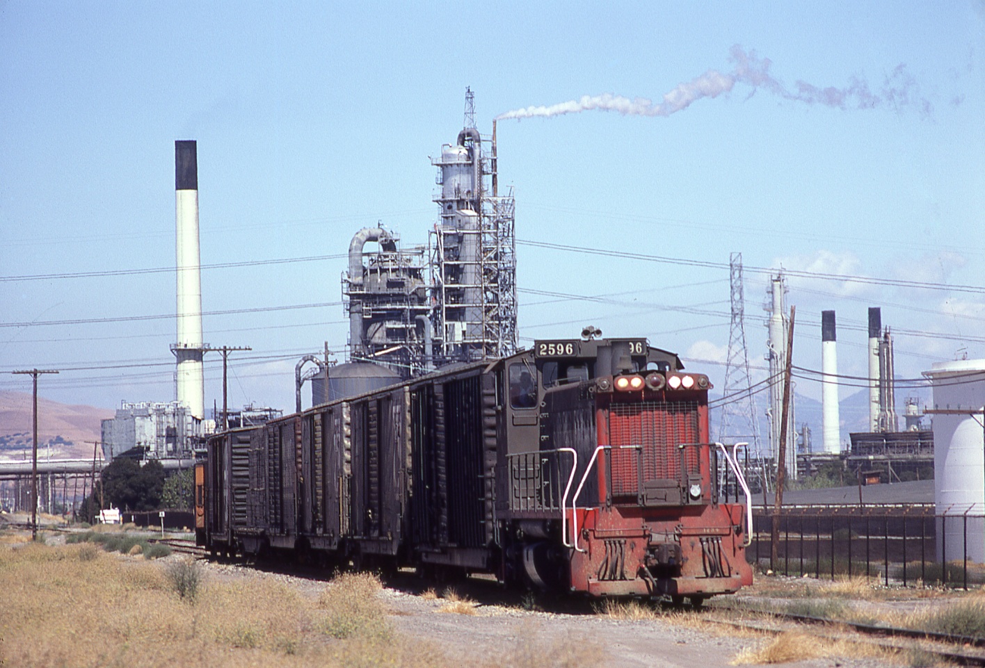
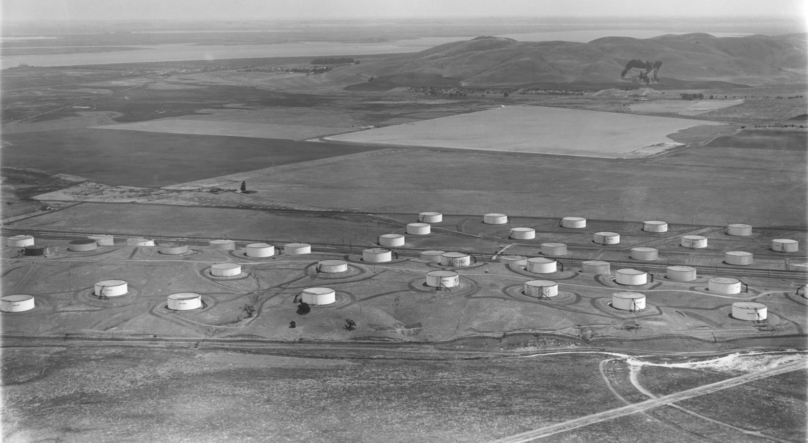
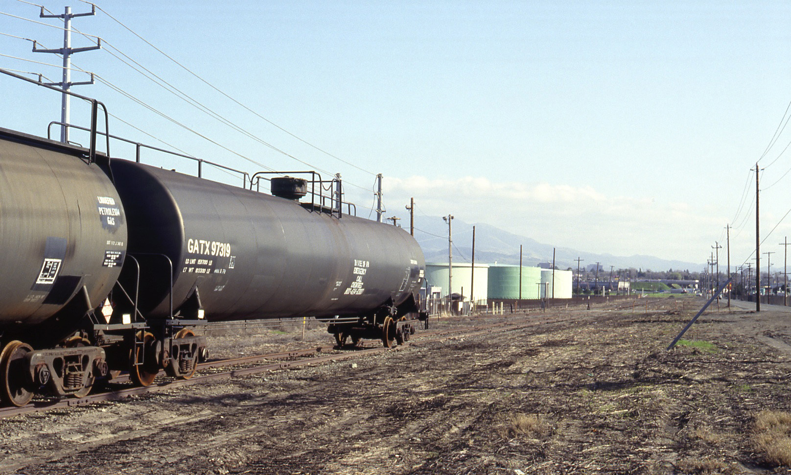
Further along to the south, the freight train reaches the first of many petroleum product storage tanks that have served as a marker for this location for over a century. Sept. 7, 1978, northeast view.
L195-125-Wayne Monger Photo, Courtesy Wayne Monger , (Image 26 of 31)
George Russell documented this storage area in this circa 1929 northeast view with the town of Clyde as a backdrop. Ref: API 563_1_BOX 59112
L195-130-George Russell Photo, Courtesy the California State Lands Commission , (Image 27 of 31)
The abandoned railroad ROW continues past the Arnold Industrial Highway, the latter replaced today by Highway 4. The IHT begins south of this point. The Walnut Creek was widened by the Army Corp of Engineers starting in 1963 to combat flooding due to replacement of water-porous farmland by concrete and asphalt.
L195-135-Courtesy Google Earth, (Image 28 of 31)
A south view showing the end of storage tanks relative to the end of track, and the new Highway 4 overpass in the distance in Feb. 1993.
L195-140-Louis L. Stein Photo, Courtesy BAERA, Western Railway Museum Archives, 118566sp, (Image 29 of 31)
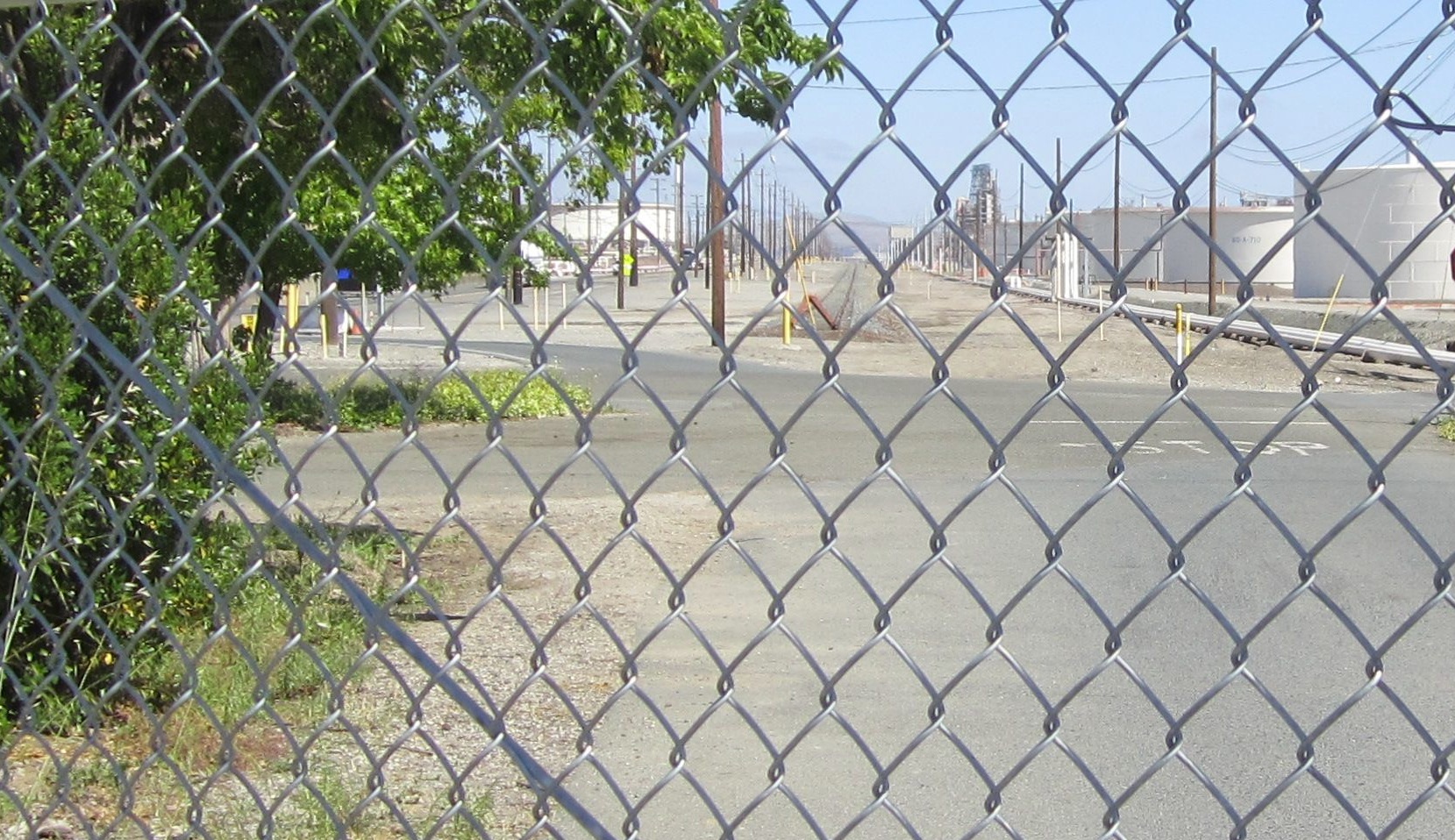
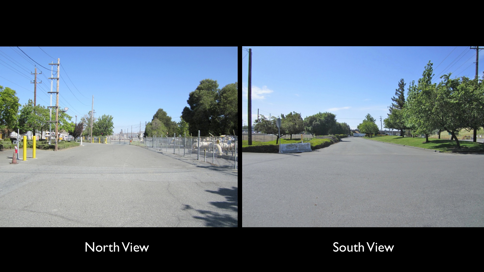
A gate prevents approaching the end of track as seen in this north view, May 2018. Irma Dotson has noted a flag stop named Hapress that had once existed in this general area to the north.
L195-145-Stuart Swiedler Photo , (Image 30 of 31)
Backing up on the position of the former ROW shows the view in both directions up until the highway, the next stop on this historical journey.
L195-150-Stuart Swiedler Photos, (Image 31 of 31)