The Freeman-Kaiser Crossing

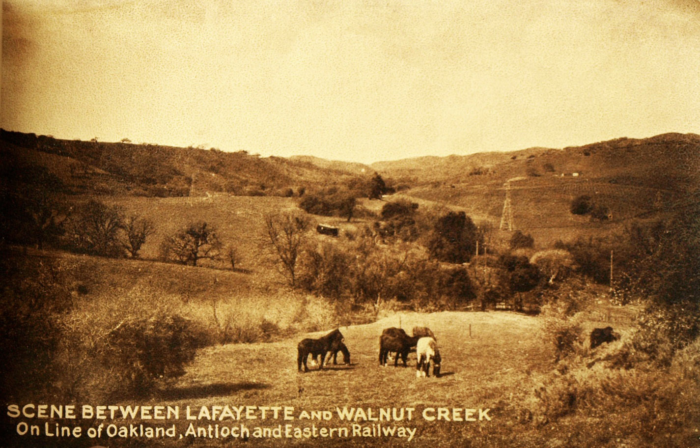
From the inception of the Oakland, Antioch and Eastern, the section between Reliez Station Road and the area today marked by the intersection of Pleasant Hill Rd. and Olympic Blvd. was marked by the Great Western Power Company’s electric transmission towers whose lines crossed over the right-of-way. Northwest view, circa 1939.
L97-05-From the family photo collection of Mary Mangini , (Image 1 of 14)

SN 228 as part of a two-car train glides down the right-of-way in this west view from Feb, 28, 1937. Since leaving the Saranap shelter at Tice Valley Boulevard, this train encountered no grade crossings or homes, but the Reliez Station Rd. grade crossing can be seen in the distance as well as homes on the hill above Las Trampas Creek.
L97-10-Dudley Thickens Photo, Courtesy BAERA, Western Railway Museum Archives, 59995sn, (Image 2 of 14)

Between 1940 and 1958 notable additions to the area included the large estate at 940 Reliez Station Ln., blue arrow, to the north of the cut, green arrow, through which passed the right-of-way, yellow arrow, and a grade crossing at Andraesen (Andreasen) Dr., red arrow. Las Trampas Creek is marked by the purple arrow. Newell (West Newell) Ave. will be covered elsewhere.
L97-15-Courtesy Contra Costa County Historical Society, 13560 and 13563 Details, (Image 3 of 14)

By Dec. 1946 when this aerial of an east view of Lafayette was taken, the home of William H. Freeman of publishing fame, red arrow, rimmed the right-of-way to the north of the railway cut, blue arrow, that today delineates Olympic Blvd. Freeman Rd. also appeared to the east, green arrow. The purple arrow marks the Reliez Station Rd. grade crossing.
L97-20-RL Copeland Photo, Courtesy Contra Costa County Historical Society, 7348 Detail , (Image 4 of 14)

Standing on the SN right-of-way at the railway cut and facing west in Oct. 1949, a grade crossing at Andraeson Dr. has been added. Andreasen Dr. does not cross Olympic Blvd. in 2021. In the enlargement, right, the back of one sign, orange arrow, and a white sign, red arrow, can be seen along the right-of-way.
L97-25-Dudley Thickens Photo, Courtesy BAERA, Western Railway Museum Archives, 81403sn , (Image 5 of 14)

A few months earlier in May 1949, a west view from west of the Andraeson Dr. grade crossing shows SN 606 and 605 with freight approaching the two signs, the one to the right or north indicating the mile 25 marker.
L97-30-Dudley Thickens Photo, Courtesy BAERA ,Western Railway Museum Archives, 81408sn, (Image 6 of 14)

Dudley Thickens caught the rear of the same train in this east view from May 1949, and the other sign, indicating “Saranap Half Mile”. Given that the SN station at Saranap at Tice Valley Blvd.-Boulevard Way is listed as mile 25.8 in railway documents, this must be referring to a border, as this spot is at least a mile away from the station.
L97-35-Dudley Thickens Photo, Courtesy BAERA, Western Railway Museum Archives, 81406sn, (Image 7 of 14)

As with L97-10, Dudley Thickens also took many excellent photos perched on the south portion of the railway cut. Here a west view of an unusual arrangement of SN 660 separated from SN 603 and 604 by a caboose, at the Andraesen Dr. grade crossing, Oct. 1949.
L97-40-Dudley Thickens Photo, Courtesy BAERA, Western Railway Museum Archives, 81399sn, (Image 8 of 14)

A similar view as L97-40, but now Jan 13, 1957, as the last south end excursion prior to the abandoning of the route west of central Lafayette passes the grade crossing bound for Oakland with a west view of Salt Lake and Utah parlor car 751 taking up the rear with SN 1005 in the lead.
L97-45-Dudley Thickens Photo, Courtesy BAERA, Western Railway Museum Archives, 81400sn, (Image 9 of 14)

Finally, an east view down the right-of-way from 1954 from west of the Saranap Half Mile sign, the double track curve will be next.
L97-50-Dudley Thickens Photo, Courtesy BAERA, Western Railway Museum Archives, 81405sn, (Image 10 of 14)

To complement L97-50, a west view of the cut taken in Oct. 1949.
L97-55-Dudley Thickens Photo, Courtesy BAERA, Western Railway Museum Archives, 81404sn, (Image 11 of 14)

East of the cut, a two-car train speeds along to Saranap on Feb., 22, 1937, northwest view. As expected, note the absence of the Freeman estate.
L97-60-Dudley Thickens Photo, Courtesy BAERA, Western Railway Museum Archives, 81409sn, (Image 12 of 14)

A partial view of the Freeman estate is consistent with this northwest view from 1949 of SN 661 pulling a freight through the cut. Construction at the left indicates the new homes being built along the south flank of the right-of-way, to be followed up in a future review within the Saranap section.
L97-65-Dudley Thickens Photo, Courtesy BAERA, Western Railway Museum Archives, 4601sn, (Image 13 of 14)

This dramatic south view oblique from Mar. 3, 1969 shows the completed Pleasant Hill Rd.- Olympic Blvd. intersection. County records show 940 Reliez Station Lane to include a 4 bed, 12 bath 14,605 sq. ft., residence plus a 1,035 sq. ft., 1 bed, 2 bath home on 6.46 acres of land. Many thanks to Andy Smith, and Sherril Barber and Judie Peterson of the Lafayette Historical Society for their help, and what would we have done without Dudley Thickens!
L97-70-Copyright California Department of Transportation, 15606-4, Detail , (Image 14 of 14)