Spur Stories I – the Early Years

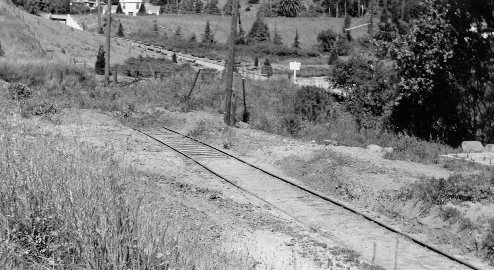
A northeast view in Chabot Canyon circa 1940 reveals remains of railroad track from another time. This section involves the area to the southeast of the SN Chabot Elementary School berm prior to 1929. This review and the one to follow will provide clues as to the significance of this image.
L79-05-Paul Smith Photo, Courtesy BAERA, Western Railway Museum, 57068sn, (Image 1 of 15)

This detail from a 1912 Rock Ridge Properties map identifies the area of interest marked by the “Proposed City Park, 19 Acres”, land owned by inventor and international businessman Charles Butters. The San Francisco Call of Jan. 6, 1912 noted the rise in property values as a result of the functional railway between 40th and Shafter Ave. and the Rock Ridge station at what was then Broadway.
L79-10-Courtesy Ray Raneri, (Image 2 of 15)

Extending east of the Broadway intersection, later Patton St., required settlement of condemnation suits brought against Butters, John McDonald and others. A plan to continue Broadway to the Claremont Country Club never happened, nor did the creation of a city park, as the Oakland and Antioch Railway secured use of the land. Full ref. for BOE figure, 862-1-1D.
L79-15-Courtesy California Board of Equalization, and Oakland Public Library, History Room, Details, (Image 3 of 15)

The Oakland, Antioch and Eastern established a small yard to the southeast of the trestle that grew in complexity over the years, much to the protest of the developing area. Note the passenger rail car in the 1913 image. Full refs: Cheney Photo D-1380-c, top; Cheney Photo, L-578B, Vernon Sappers Collection, 24121sn, bottom. The complete images are available at Bosko’s Picture Framing, 6038 College Ave, Oakland, CA and WRM, respectively.
L79-20-Eston Cheney Photos Courtesy John Bosko, top, and BAERA, WRM Archives, bottom, Details , (Image 4 of 15)

This detail of a southwest view circa 1927 through the rail yard shows the take-off point of the spur from the mainline at the Patton St. grade crossing, blue arrow, the spur following Temescal Creek to the east, yellow arrows, and additional track doubling back to the northwest, red arrows, ending with quonset hut-like structures as seen in the top panel of L79-20.
L79-25-Louis J Bradas Collection, Courtesy BAERA, Western Railway Museum Archives, 68177sn, Detail, (Image 5 of 15)

This plan circa 1926 from EBMUD for constructing a spur to aid in removing dirt from the Claremont Tunnel construction shows the basic outline of the rail yard, confirming what was interpreted from the previous images.
L79-30-Courtesy BAERA, Western Railway Museum Archives, 4633sn, (Image 6 of 15)

To travel down the spur, this northeast image from Feb. 22, 1954 of the take-off point at the Patton St. grade crossing will serve as an introduction.
L79-35-Harre Demoro Photo, Courtesy John Harder , (Image 7 of 15)

Now back to 1920, the spur initially followed the mainline prior to the beginning of the trestle that carried the latter over Chabot Rd.
L79-40-Courtesy BAERA, Western Railway Museum, 74957sn, (Image 8 of 15)

This northeast view from 1920 shows the derail rail configuration as the spur swung to the south. The sign on the mainline is a warning to not walk on the trestle. Note Roanoke Rd. and the Berkeley rim at Hillcrest Rd. in the left background, and a train approaching on the mainline.
L79-45-Courtesy BAERA, Western Railway Museum, 74961sn, (Image 9 of 15)

Similar to L70-45, this northeast view from 1920 also reveals the quonset hut-like buildings on the portion heading back to the mainline.
L79-50-Courtesy BAERA, Western Railway Museum, 74958sn, (Image 10 of 15)

Now ahead to 1925, further east on the spur to the first building in this north view taken by Harry Mitchell, longtime SN executive during the first half of the 20th century. The next two panels are the left and right sides of the this image, respectively, at higher magnification.
L79-55-Harry A Mitchell Photo, Sappers Collection, Courtesy BAERA, WRM Archives, 57464sn, (Image 11 of 15)

The left portion of L79-55 reveals the poor condition of the buildings in the railway yard, and the low-lying nature of the quonset hut-like structures in the background. North view, 1925.
L79-60-Harry A Mitchell Photo, Sappers Collection, Courtesy BAERA, WRM Archives, 57464sn, Left, (Image 12 of 15)

The right portion of L79-55, north view, 1925, shows several tracks with rolling stock aligned to the north. If you have not figured out the exact location of L79-05 based on landmarks in that image, this images provides key information. The next landmark, focusing on the spur during the SN era of the railway will provide the definitive information.
L79-65-Harry A Mitchell Photo, Sappers Collection, Courtesy BAERA, WRM Archives, 57464sn, Right, (Image 13 of 15)

The Chabot Canyon yard played a role in the delivery of pre-cast concrete liners to the tunnel in Shepherd Canyon in the 1920s to strengthen the timber-lined walls. This image supports the report that the liners were actually cast in the rail yard. Note the spur in the background. Southeast view, ca. 1920s.
L79-70-Courtesy BAERA, Western Railway Museum Archives, 89625sn, (Image 14 of 15)

The liners were loaded onto flatcars and transported to the tunnel. The two images to the left have been overlapped, while the one to the right is kept separate to view the entire background. Northeast views. See the Landmark “Tunnel Tales” to see where the liners ended up.
L79-75-Courtesy BAERA, Western Railway Museum Archives, 89628, 89627, 89624 l to r. , (Image 15 of 15)