An Electric Railway Arrives
Oroville in the 20th Century is made possible by the generosity of many organizations and individuals. Concise general historical information of the town is available in the book “Oroville California” by town historian Jim Lenhoff, published by Arcadia Publishing, 2001, and train-related information in Harre Demoro’s “Sacramento Northern”, published by Signature Press, 1991, and Ira Swett’s self-published “Sacramento Northern” from 1971.
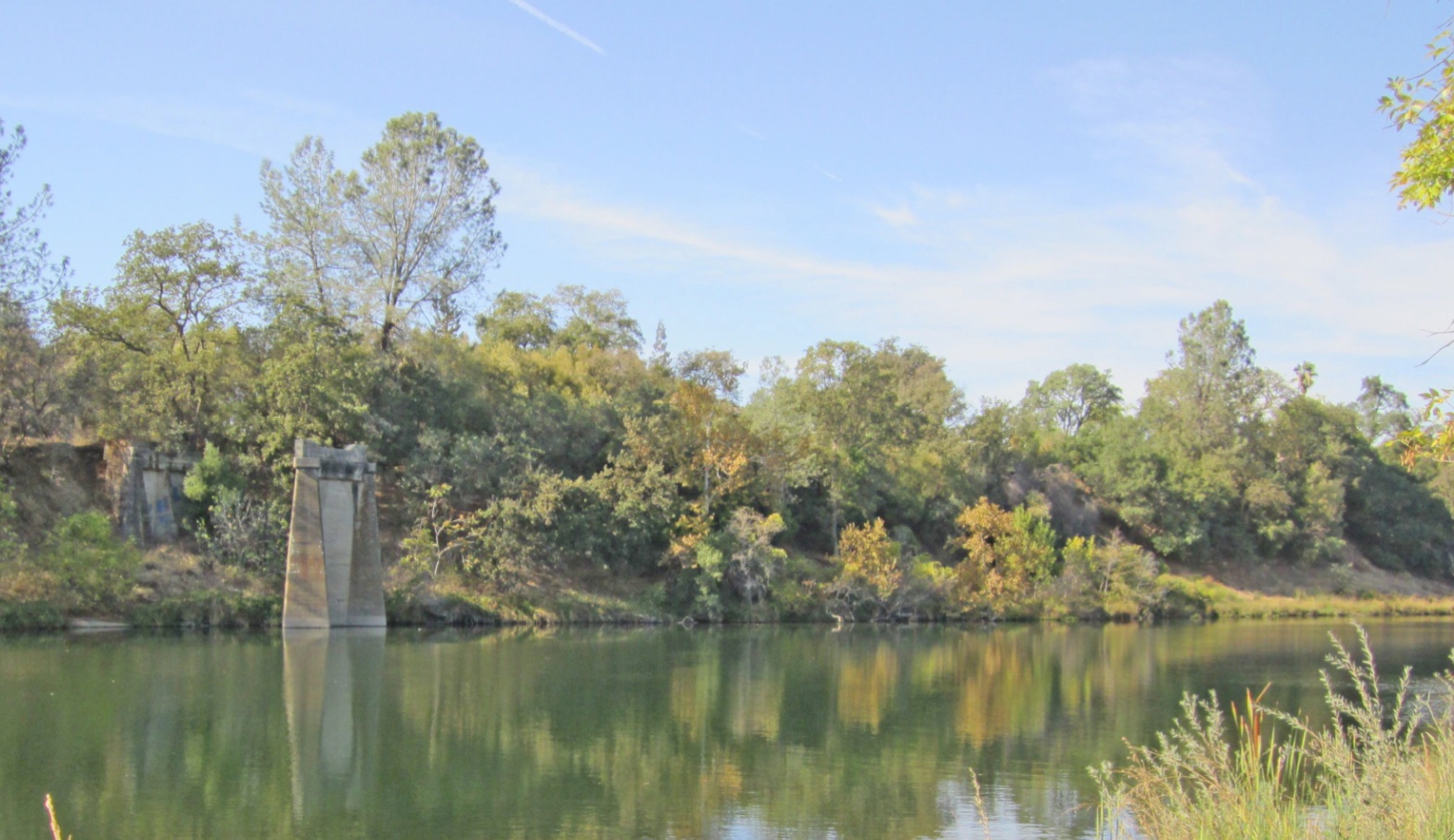
L146-01-Stuart Swiedler Photo, (Image 1 of 32)

A walk along the banks of the Feather River at Riverbend Park in Oroville is greeted by the most obvious artifacts of a past era of electric rail transportation. Imagine transporting back to the early 20th century while gazing at this northwest view toward Thermalito and you would see ...
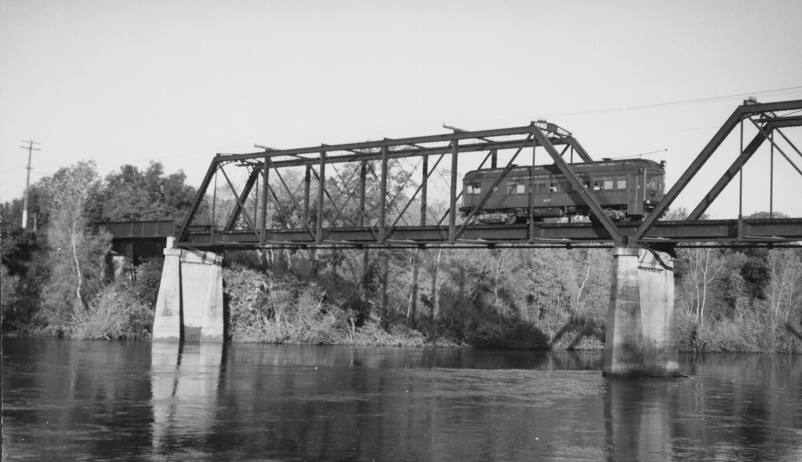
L146-05-Stuart Swiedler Photo, (Image 2 of 32)
... a steel bridge carrying SN 107 toward Oroville, northwest view, Nov. 27, 1937.
L146-10-Wilbur C Whittaker Photo, Courtesy Garth Groff , (Image 3 of 32)
The rapid growth of mid-19th century Oroville, or Ophir as it had been called up until 1856, was the result of the gold mining activities that became more widely publicized in 1848 when John Bidwell discovered gold in the Feather River just east of town. The town became a center of the gold mining industry by the mid-1850s and the Butte County seat. Southeast view, 1958.
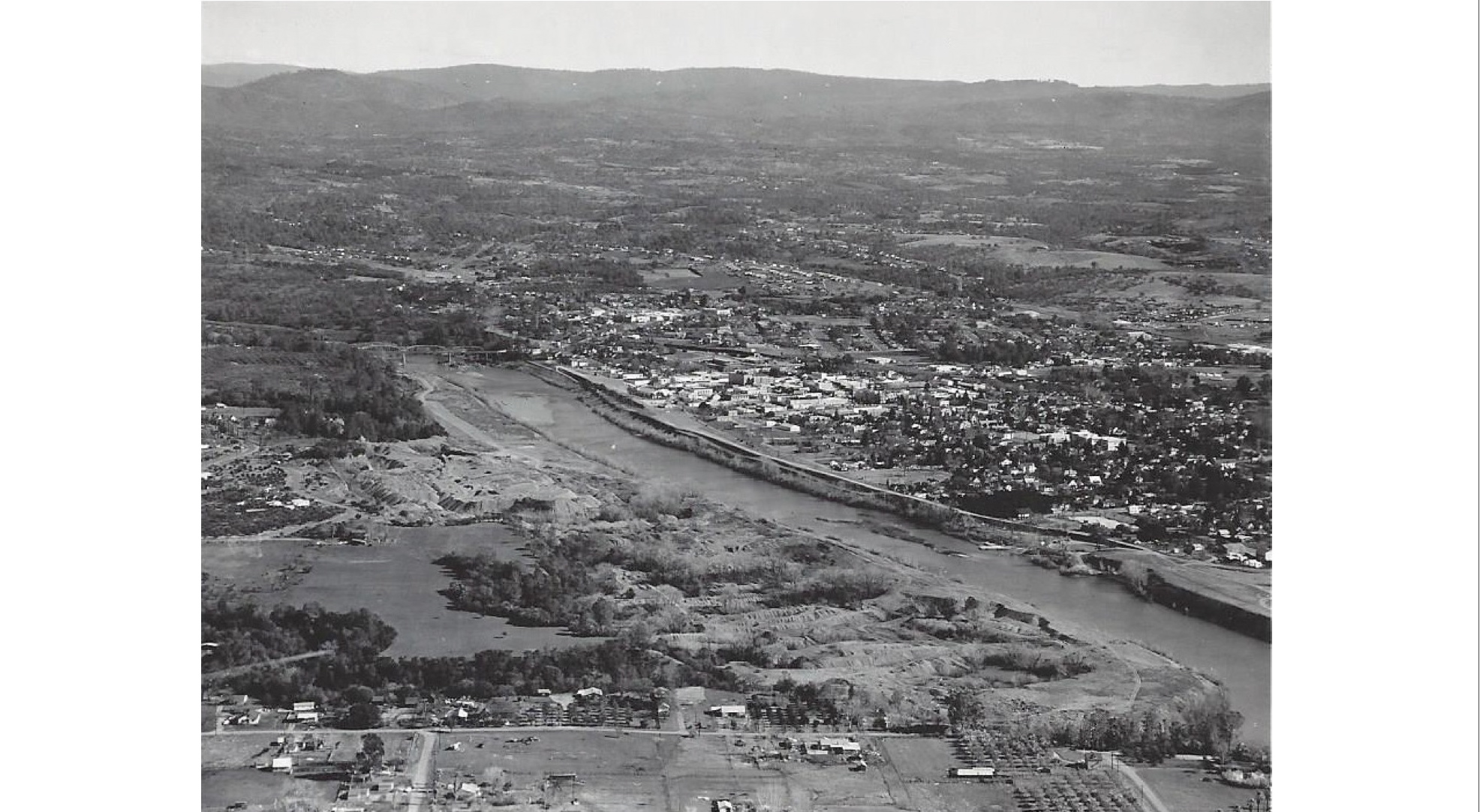
L146-15-Courtesy Butte County Historical Society, Business Air Photos, 2012-50-13.2 , (Image 4 of 32)
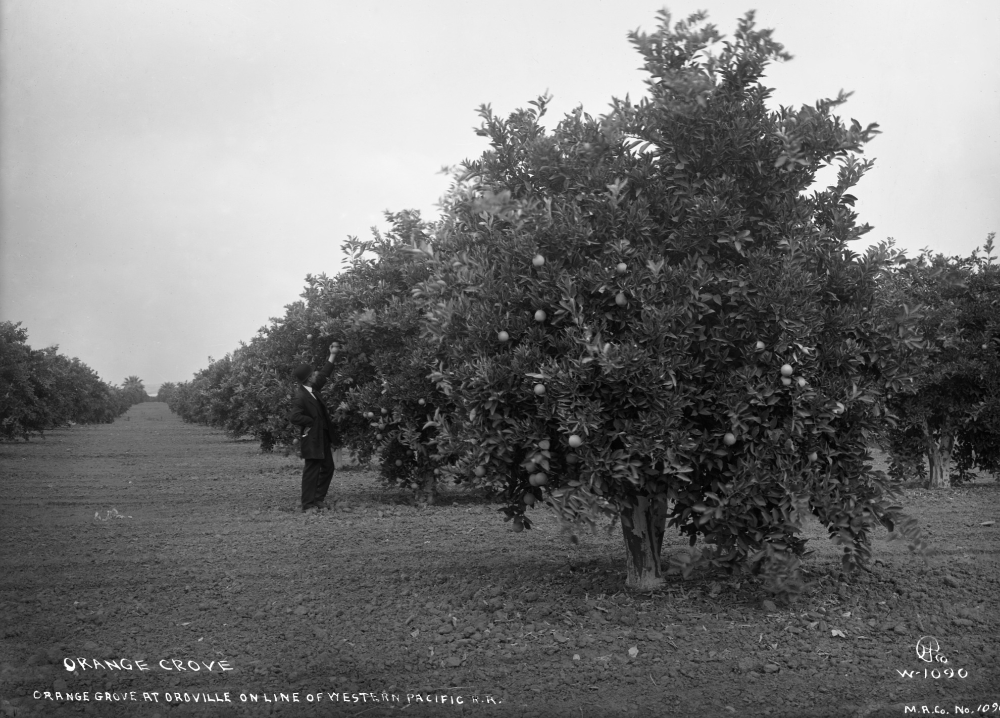
Advances in agriculture by the turn of the century produced orange groves, and farmer Freda Ehmann’s process perfecting olive preservation created a thriving olive industry for the region. As the gold mining industry began to fade in most parts of California by the end of the 20th century, there was a resurgence in that industry in Oroville. And this is where our story begins. Southwest view, Nov. 6, 1962.
L146-20-Courtesy Butte County Historical Society, Business Air Photos, 2012-50-13 , (Image 5 of 32)
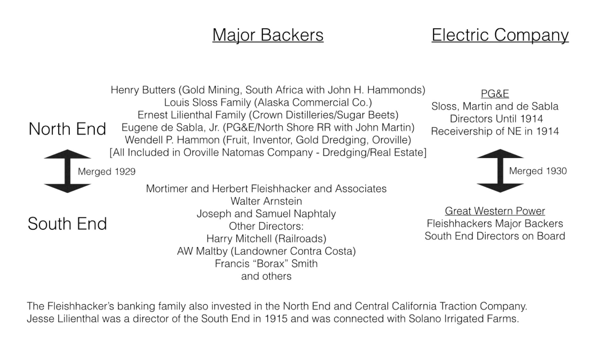
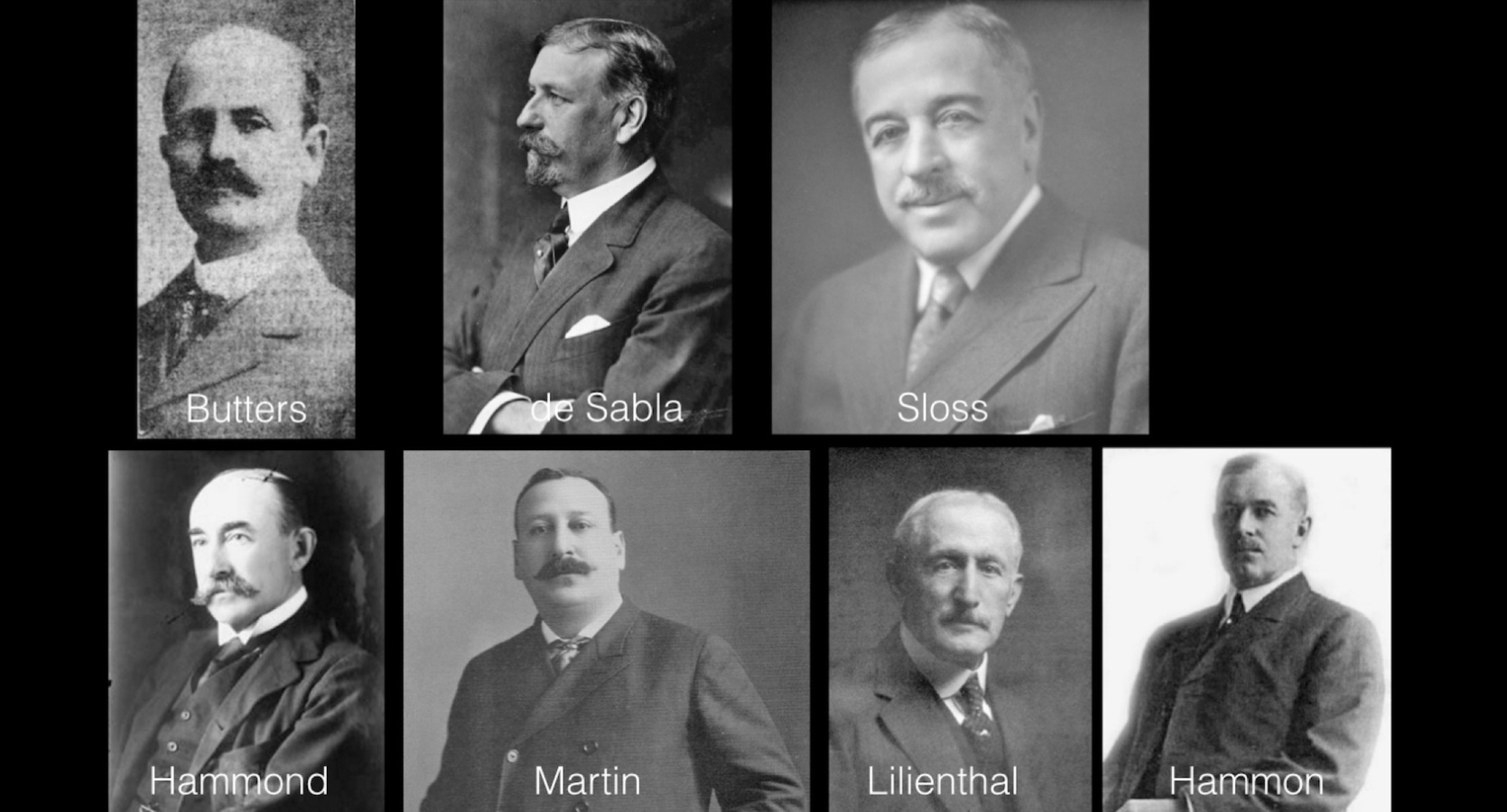
The Northern Electric, referred herein as NE, provided local and long-range electric rail transportation north of Sacramento. Although eventually merged with its south-end counterpart to form the SN, it was developed for the most part independently by a cast of investors with alliances to Pacific Gas and Electric. Henry Butters was the primary financial investor and visionary force behind the NE.
L146-25-Courtesy Stuart Swiedler, (Image 6 of 32)
The devastating flood of 1907 damaged much of the NE. The Panic of 1907 added to Henry Butters financial ruin, and he would pass away in Oct. of 1908. Louis Sloss and Ernest Lilienthal took over corporate control looking to expand to the Bay Area. As for the NE’s presence in Oroville, adopted son Wendell Hammon was most instrumental.
L146-30-Courtesy the Western Railway Museum and Google Books , (Image 7 of 32)
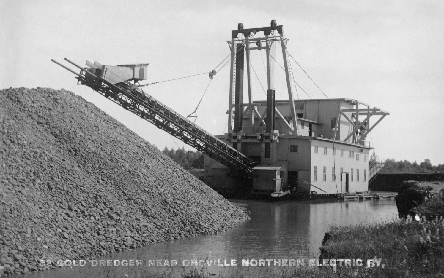
Hammon was a native Pennsylvanian who moved to Butte County in the 1890s where he became a local leader in horticulture and mining, with particular expertise in orchids and fruit cultivation. Harre Demoro in his book “Sacramento Northern” recounts the folklore that Hammon got the idea to dredge for gold when he noticed gold flakes in the soil while excavating a well in 1898. Image ca. 1915.
L146-35-Eston Cheney Photo, W-1090, Sappers Collection, Courtesy BAERA, WRM Archives, 26716 , (Image 8 of 32)
Realizing there was gold along and under the Feather River south of the city, Hammon and his partner, Thomas Couch, a Montana mining businessman, created a dredging system that sifted through gravel under and around the river using continuous bucket lines or bucket elevators. It made him a fortune and earned him the title as "Dredger King”. Image circa 1910. See http://www.oac.cdlib.org/findaid/ark:/13030/tf500003mb/entire_text/
L146-40-NE Photo, Courtesy BAERA, Western Railway Museum Archives, 108857sn, (Image 9 of 32)
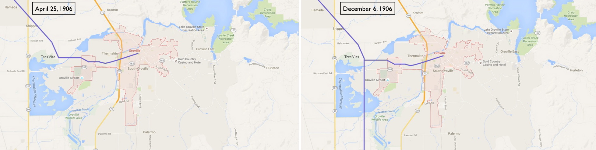
As Ira Swett pointed out in “Sacramento Northern”, “the Oroville Branch was in actuality the first line of the Northern Electric anywhere”. Construction to Chico started in Oroville, and the 25-mile line opened for public use on April 25, 1906 following the path seen in the left panel. Once service opened between Marysville and Chico on December 6, 1906 as seen in the right panel, the Oroville section officially became a branch line.
L146-45-Courtesy Google Maps, (Image 10 of 32)
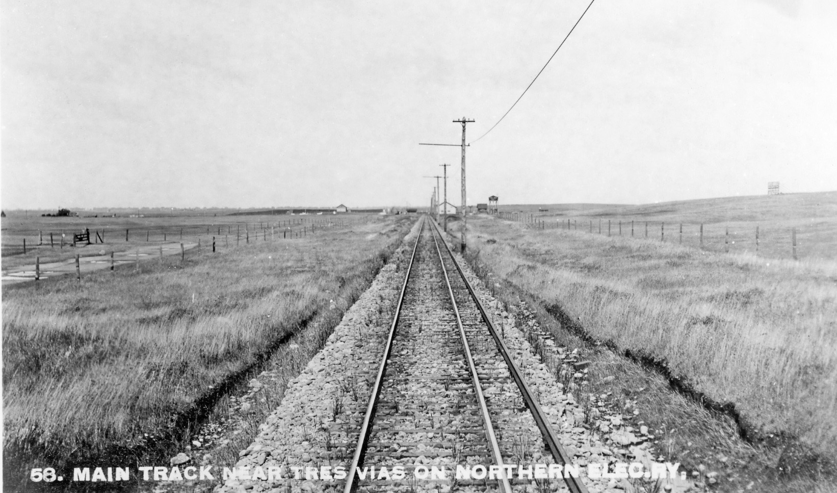
The extension of the NE south of Oroville was heavily influenced by Martin and De Sabla, who favored the recent appreciation that power from a third rail was more efficient than from overhead wire. This north view circa 1910 just south of Tres Vias shows progression of this transition. The exposed third rail proved to be a safety issue for the NE.
L146-50-NE Photo, Courtesy BAERA, Western Railway Museum Archives, 108567sn , (Image 11 of 32)
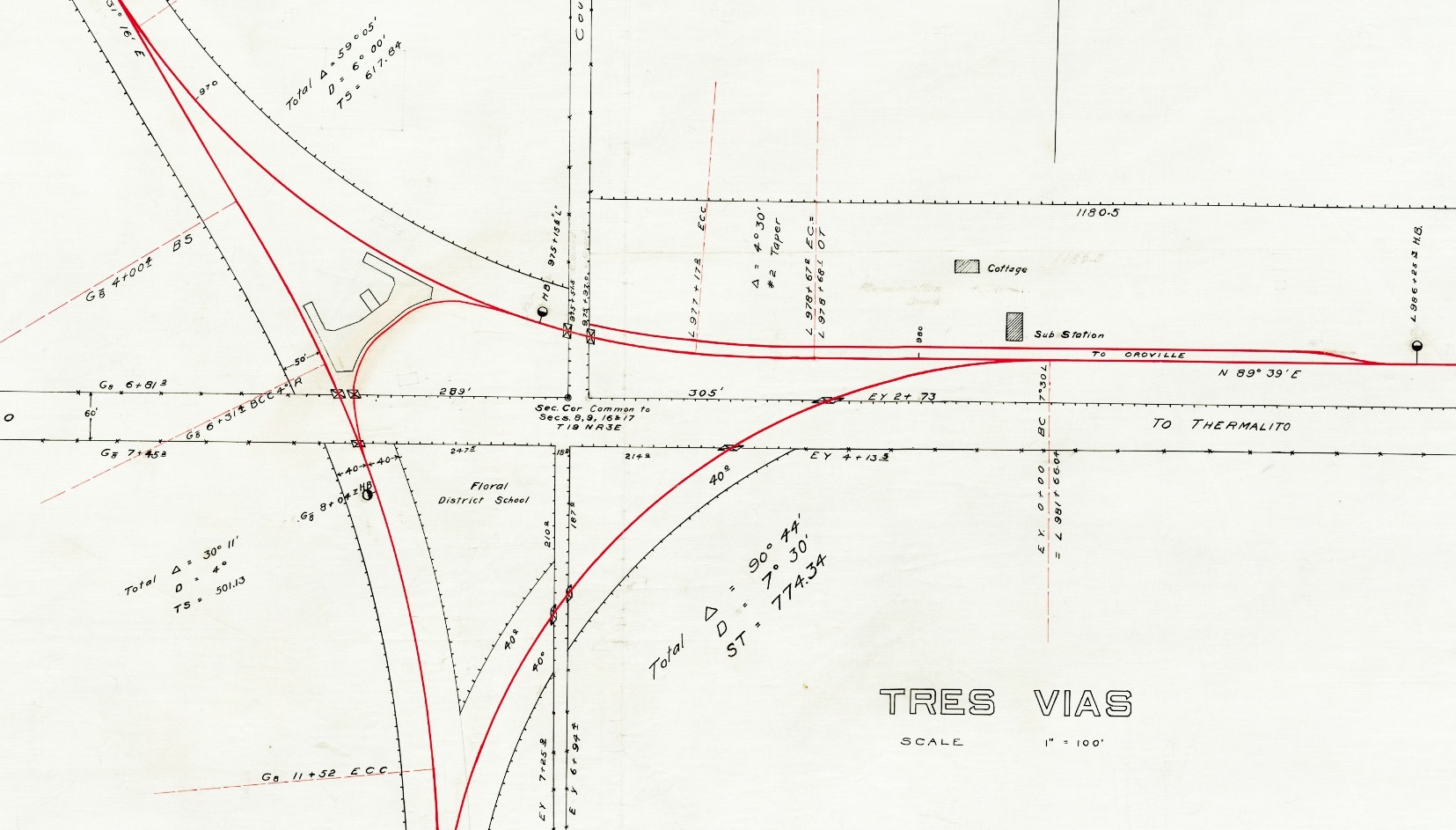
This north-oriented diagram from 1913 shows the track arrangement and supporting structures at Tres Vias. The smaller wye servicing the station platform on the northern portion was within a larger wye whose southern portion by-passed the station. In later years the spur to the substation was lengthened to allow by-pass from the north.
L146-55-Courtesy BAERA, Western Railway Museum Archives, 41, (Image 12 of 32)
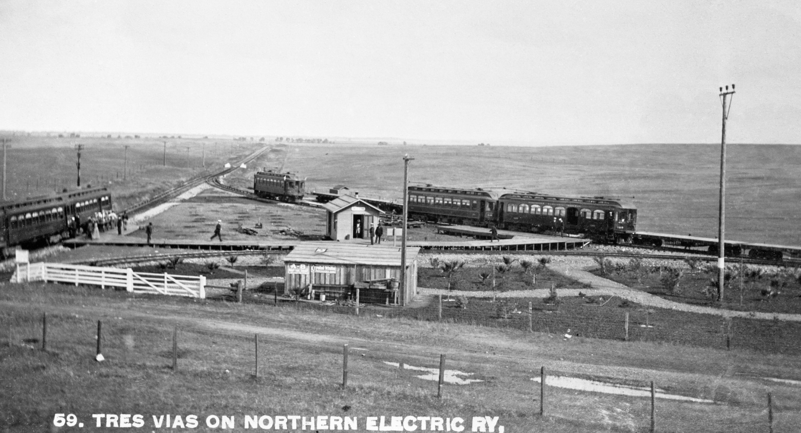
This north view circa 1906-07 shows the passenger wye of Tres Vias with three passenger trains and the station in the center. The flatcars to the north sit on the spur track that was eventually lengthened to connect to the main line to allow freight to by-pass the station.
L146-60-NE Photo, Courtesy BAERA, Western Railway Museum Archives, 80291sn, (Image 13 of 32)
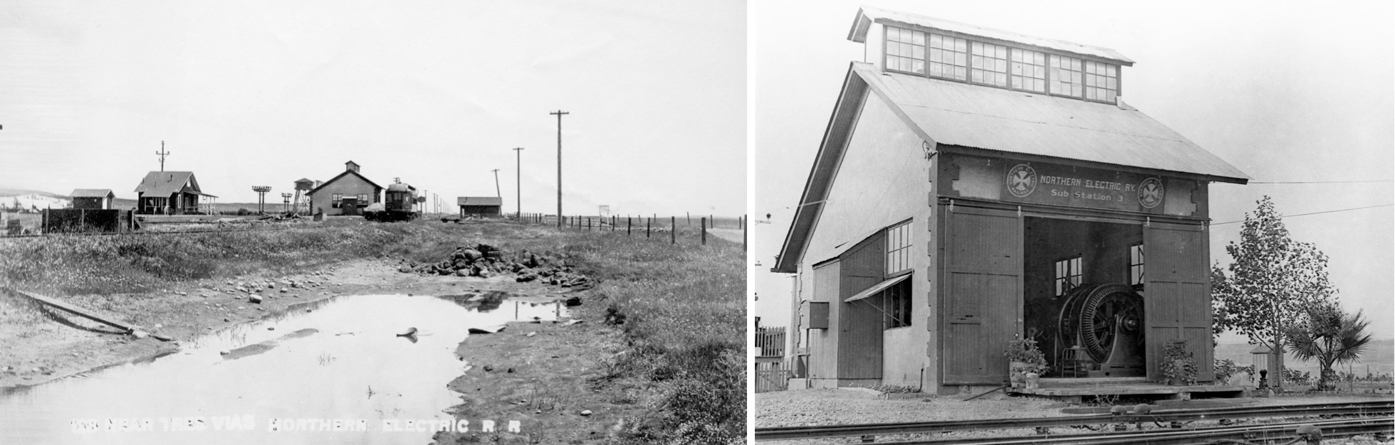
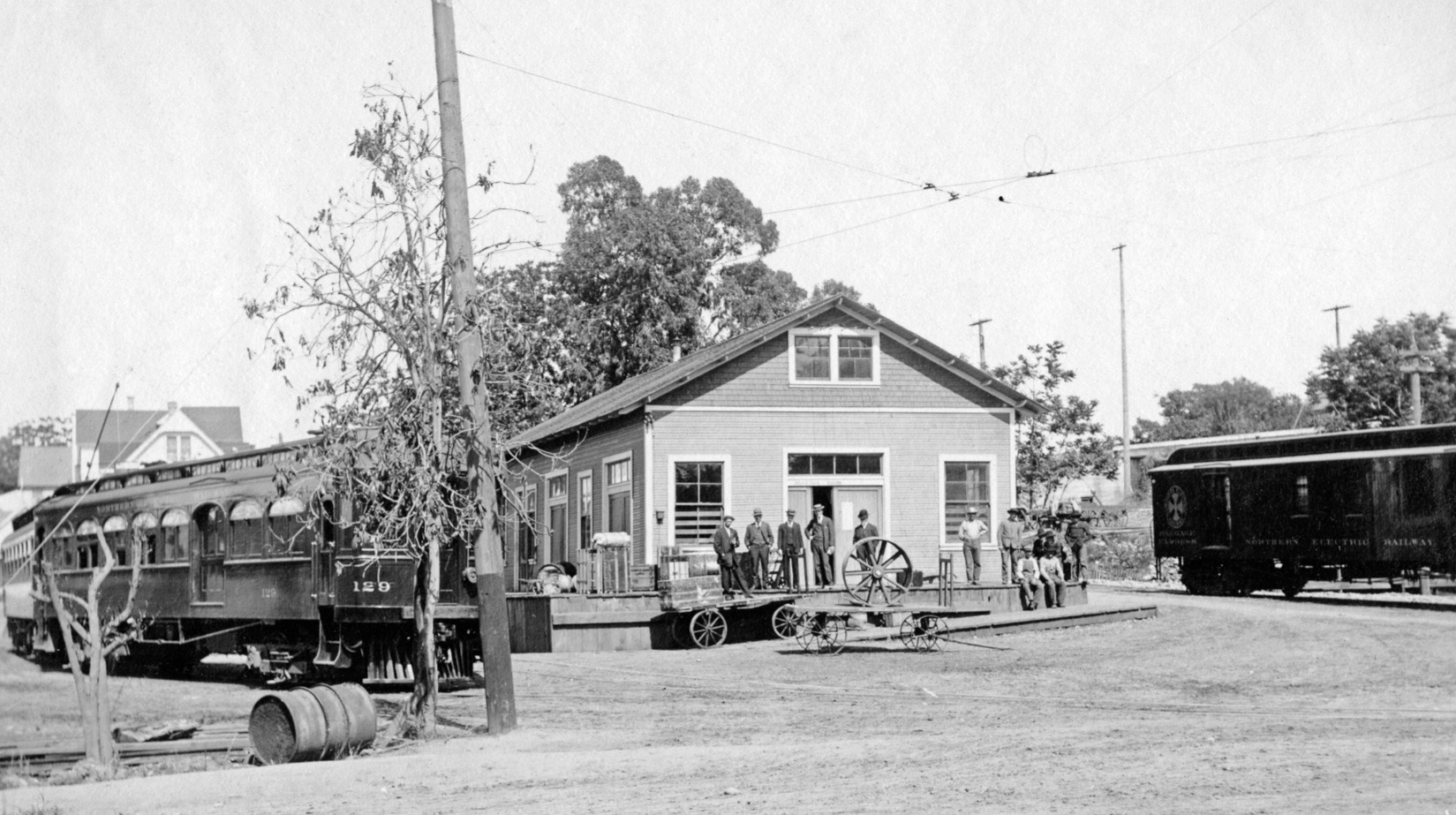
The branch line had a number of support structures seen in the left, east view circa 1910. The most important of these structures was the power sub-station, right, northeast view, undated.
L146-65-NE Photos, Courtesy BAERA, Western Railway Museum Archives, 103398sn, 108575sn , (Image 14 of 32)
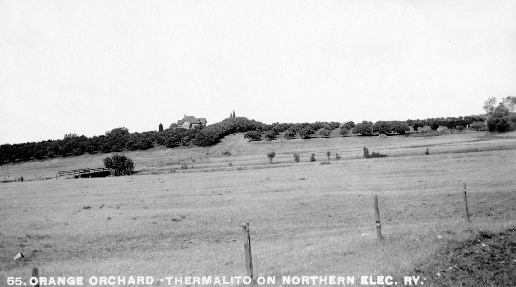
To reach Oroville to the east, the branch line had to first traverse Thermalito, a primarily agricultural area. Not to be confused, the building in the distance is not the Bella Vista Hotel, which had been taken over by the Grand Lodge of Odd Fellows as a home for their aged members in 1898. East view, circa 1910.
L146-70-NE Photo, Courtesy BAERA, Western Railway Museum Archives, 108868sn, (Image 15 of 32)
This is a rare west view of the NE right-of-way from the Thermalito Station showing the combination of third rail and overhead wire used at this location. This image is undated, but the autos along Feather Ave. suggest circa 1920.
L146-75-Morris E Phares Studio of Oroville, Courtesy BAERA, Western Railway Museum Archives, 108851s, (Image 16 of 32)
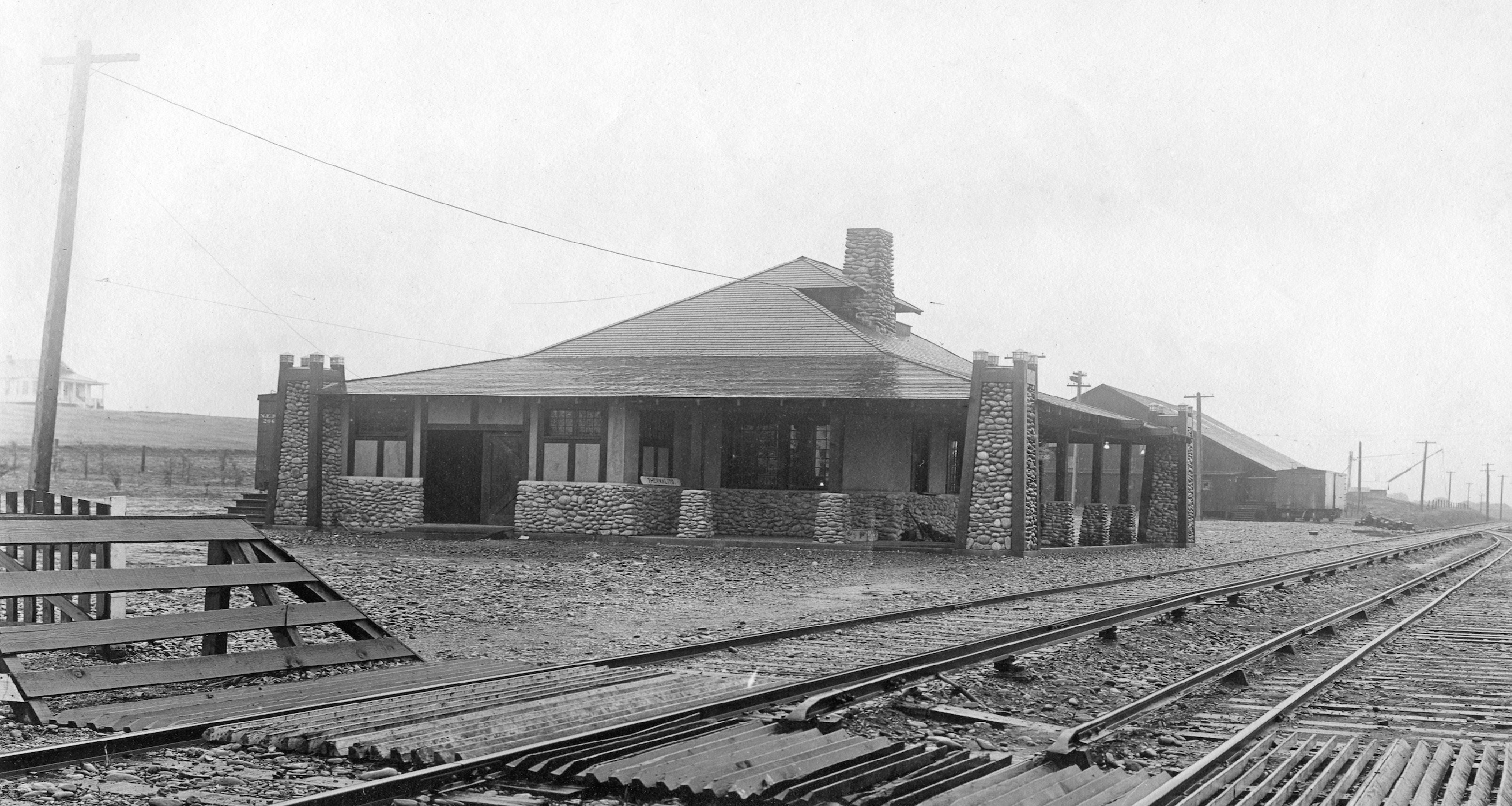
This undated northeast view shows the new Thermalito Station, the station sign still unattached, and the freight shed to the east. This was one of four craftsman-style stations built by the NE attributed to its general manager AD Schindler, who used a designs based on the Pacific Electric Railway's Glendale, CA station. See Garth Groff’s excellent presentation of this topic at http://www.wplives.org/sn/stations.html.
L146-80-NE Photo, Courtesy BAERA, Western Railway Museum Archives, 108861sn, (Image 17 of 32)
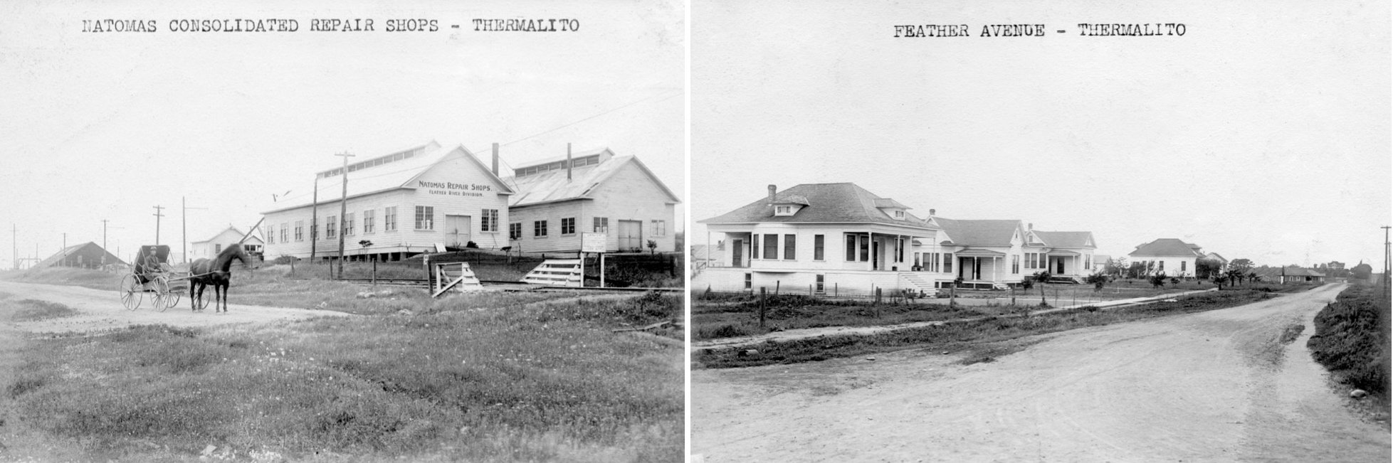
The center of early 20th century Thermalito formed around Feather Ave. The Natomas Consolidated Company was formed in 1909 as part of merging several dredging companies near Folsom that expanded to the Oroville area. The NE moved the tailings to a rock crusher to be discussed in a later update. de Sabla was its President, and Hammon and Sloss were Vice-Presidents. The west view on the left show its repair shops in Thermalito just east of the NE freight shed.
L146-85-Courtesy BAERA, Western Railway Museum Archives, 108570sn, 08572sn, (Image 18 of 32)
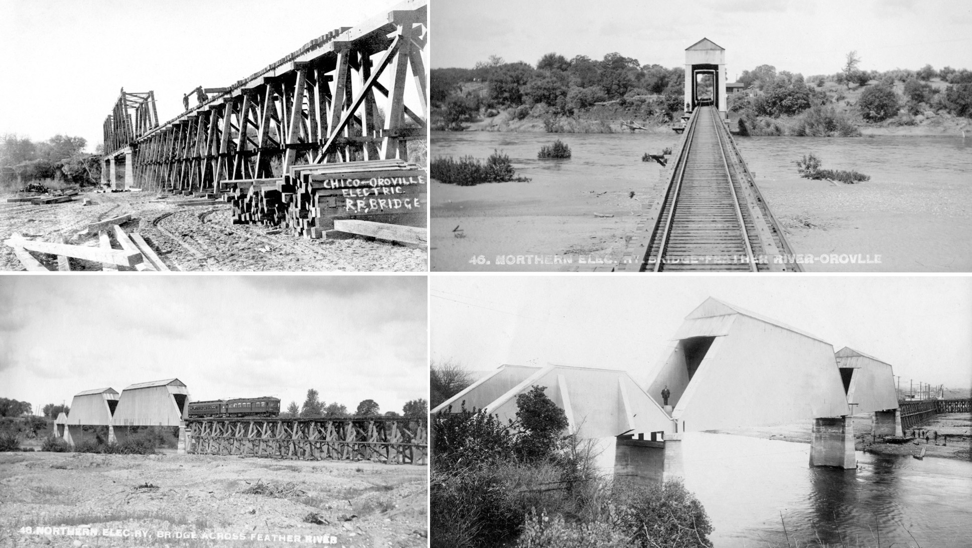
Construction of the Chico-Oroville route’s big challenge was crossing the Feather River, and maintaining a trestle over land that was subject to flooding and the intensive gold dredging efforts of the Natomas Cons. Co. Upper left, west view of bridge construction, Jan. 29, 1906; upper right, west view from trestle of right-of-way, circa 1910; Lower left, final structure, northwest view, circa 1910; lower right, final structure, southeast view, showing overhead catenary and dredge alongside trestle, circa 1910.
L146-90-Courtesy BAERA, Western Railway Museum Archives, 108538sn, 108555sn, 108553sn, 108577sn , (Image 19 of 32)
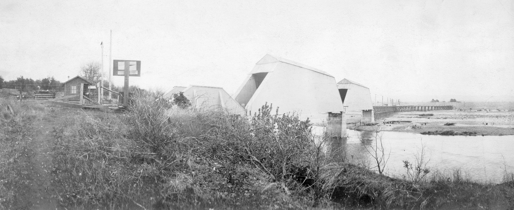
Another expansive circa 1910 northeast view of the Feather River crossing, the length of which today would encompass both Riverbend Park and Highway 70.
L146-95-Courtesy BAERA, Western Railway Museum Archives, 108539sn, (Image 20 of 32)
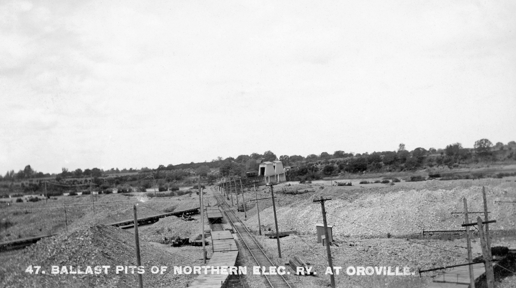
Next the main ballast pit east of the river that the NE serviced for Natomas Con. Co. in a west view circa 1910. The track alignment of the NE in this area has not been deciphered, and it would appear it was changing with the dredging operation. Note the water-filled channel to the right or north of the track as it comes into play in the next image ...
L146-100-NE Photo, Courtesy BAERA, Western Railway Museum Archives, 108548sn, (Image 21 of 32)
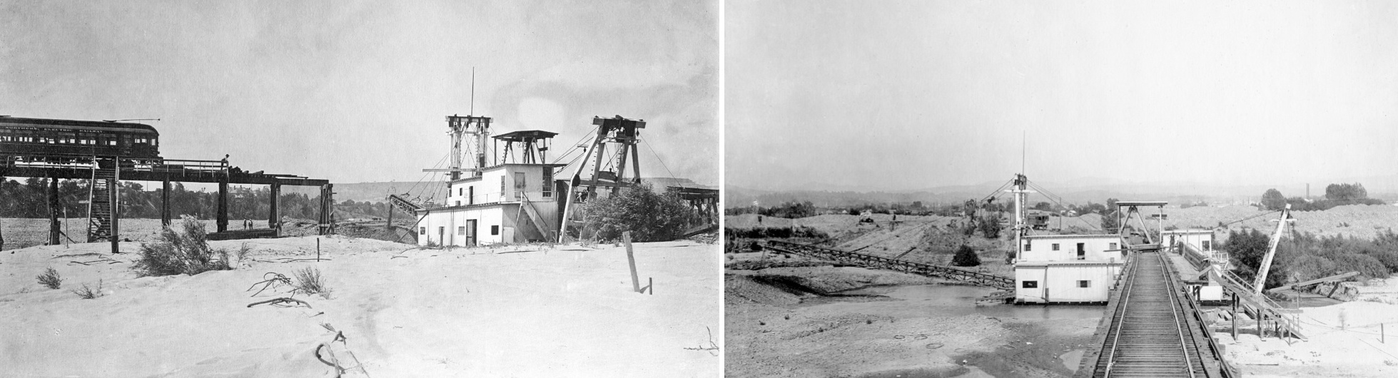
Visual proof of the importance of dredging in Oroville well into the 20th century is shown here to document the temporary severing of the NE trestle on occasion to permit passage of these vessels, leaving passengers to descend and ascend wooden stairs and temporary walkways to board a train on the other side of the cut end. Left, northeast view; right, east view; both June 22, 1911.
L146-105-Courtesy BAERA, Western Railway Museum Archives, 108859sn, 108868sn, (Image 22 of 32)
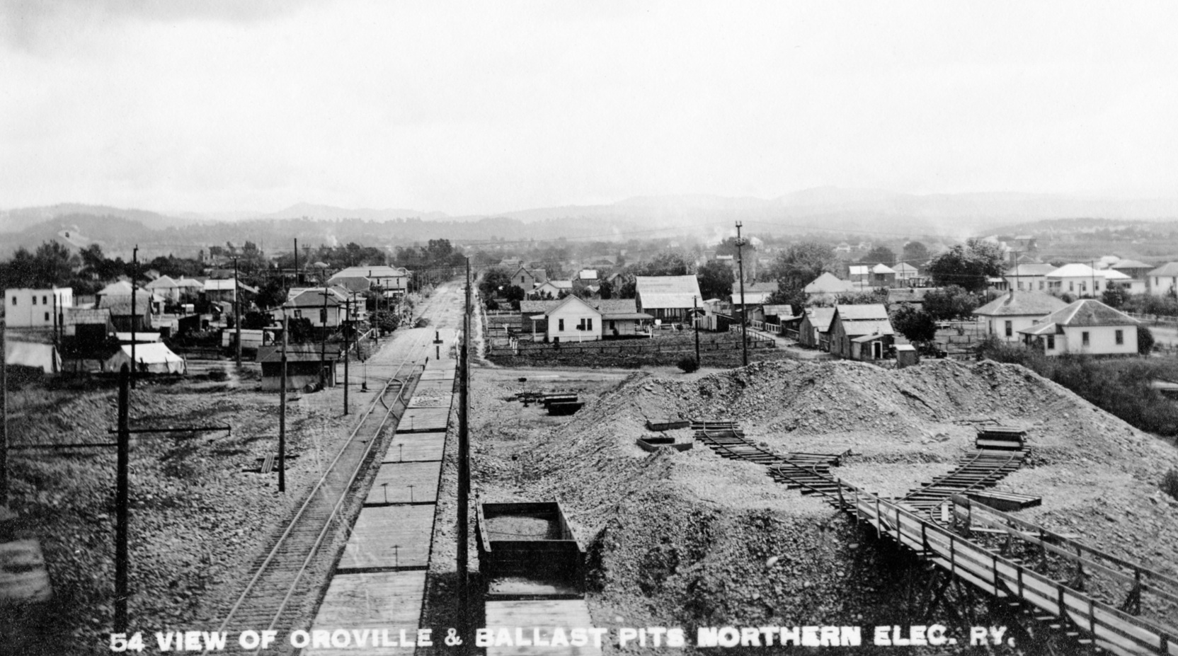
In this circa 1910 east image, the proximity of the ballast pit to the Marysville Rd., today Feather River Blvd., is seen, as is a track on that road coming off the main line to the north, or left, as the latter continues east to High St.
L146-110-NE Photo, Courtesy BAERA, Western Railway Museum Archives, 108867sn, (Image 23 of 32)
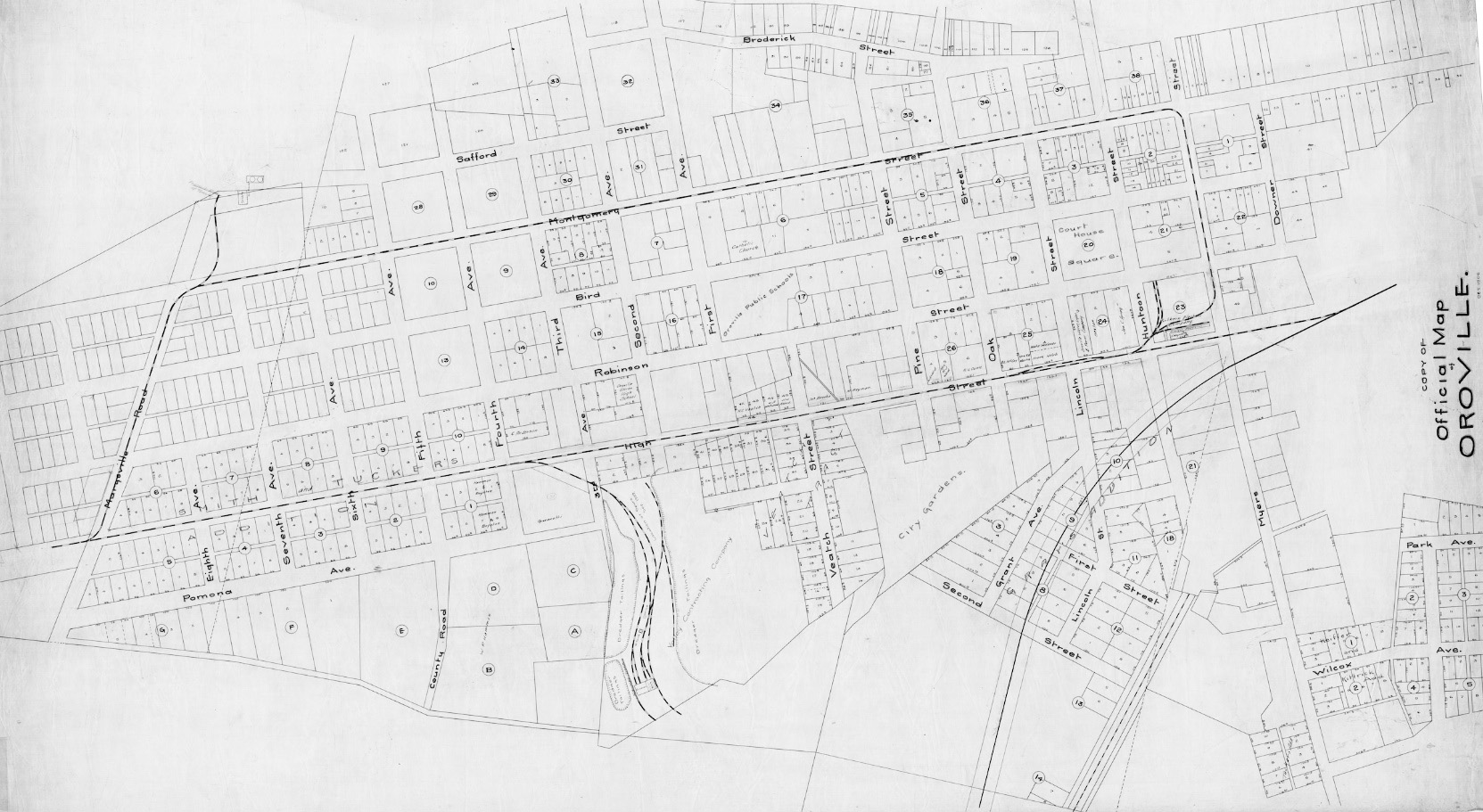
Reaching the Marysville Rd., the rectangular, closed-loop path of the NE through Oroville proper can be followed on this 1906 map. With the exception of Marysville Rd., the labelled roads should be familiar to Oroville residents. See an annotated version next ...
L146-115-Courtesy BAERA, Western Railway Museum Archives, 58356sn, (Image 24 of 32)
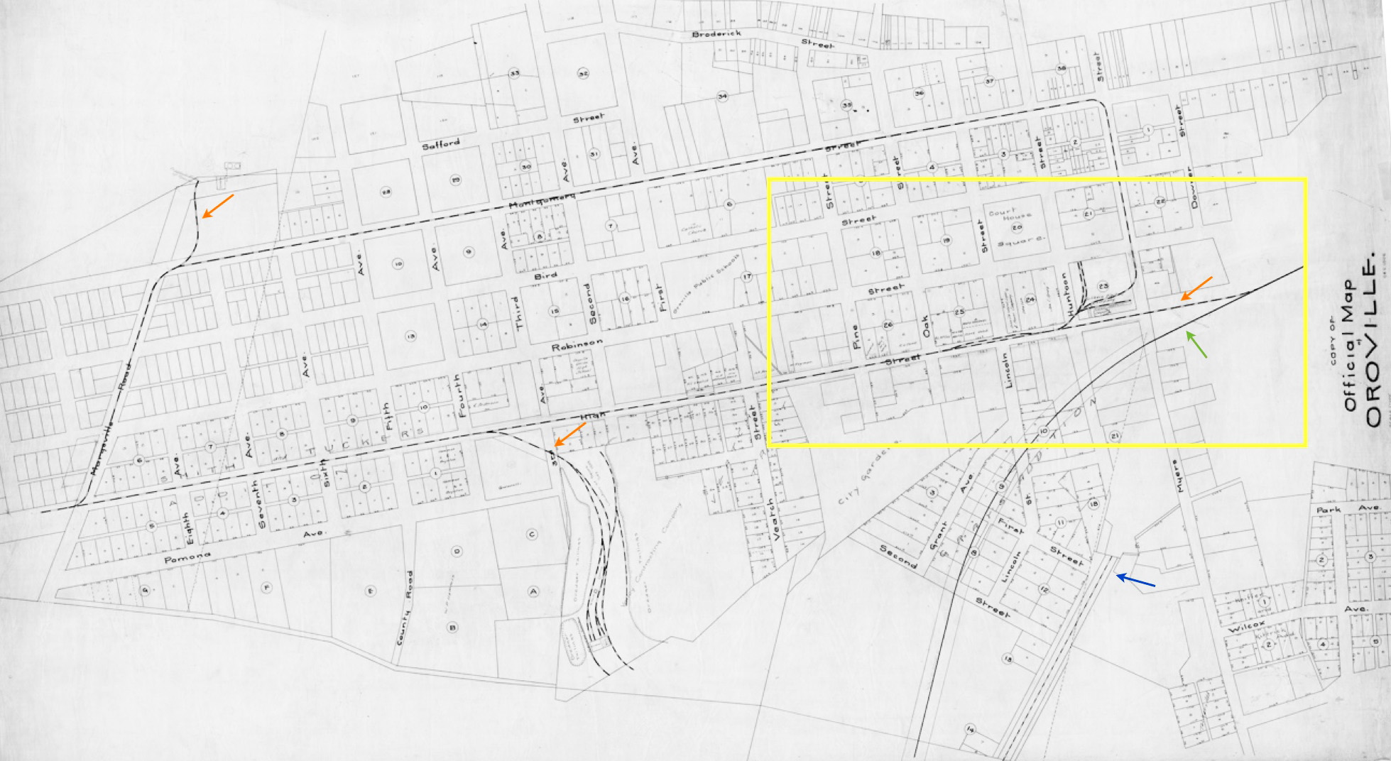
On this map from 1906, the three orange arrows point to spurs that will be addressed in a later update. The blue arrow marks the terminus of the Southern Pacific branch from Marysville, the green arrow the just initiated construction of the route of the Western Pacific Railroad. The next image will be a detail of the depot area and surrounding streets, here enclosed by the yellow box.
L146-120-Courtesy BAERA, Western Railway Museum Archives, 58356sn, (Image 25 of 32)
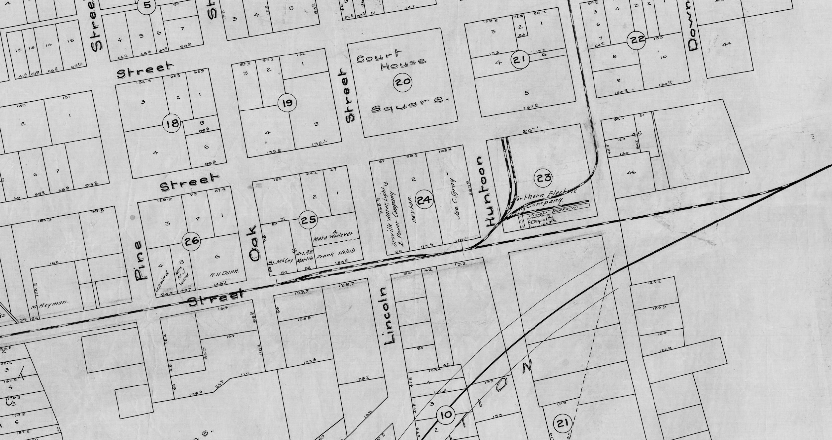
The square block for the terminus, freight and passenger depots was located between Huntoon and Myers Sts., west to east, and High and Robinson Sts., south to north, indicated as number 23 on the map. No single picture has been found that confirms all the details of the track alignment of the railway in this location.
L146-125-Courtesy BAERA, Western Railway Museum Archives, 58356sn, (Image 26 of 32)
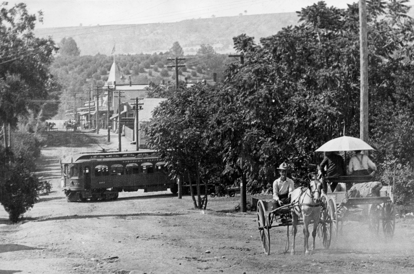
A circa 1910 north view down Huntoon St. shows NE 101 heading east on High St. approaching the passenger depot. The location is unmistakable based on the slight angle of the train to the street, the presence of the Green Block building with cupola on the corner of Huntoon and Bird Sts., and Table Mountain filling the background. The NE trains traveled counterclockwise around the town, more on that in the next update.
L146-130-Harre Demoro Collection, Courtesy BAERA, Western Railway Museum Archives, 108848sn, (Image 27 of 32)
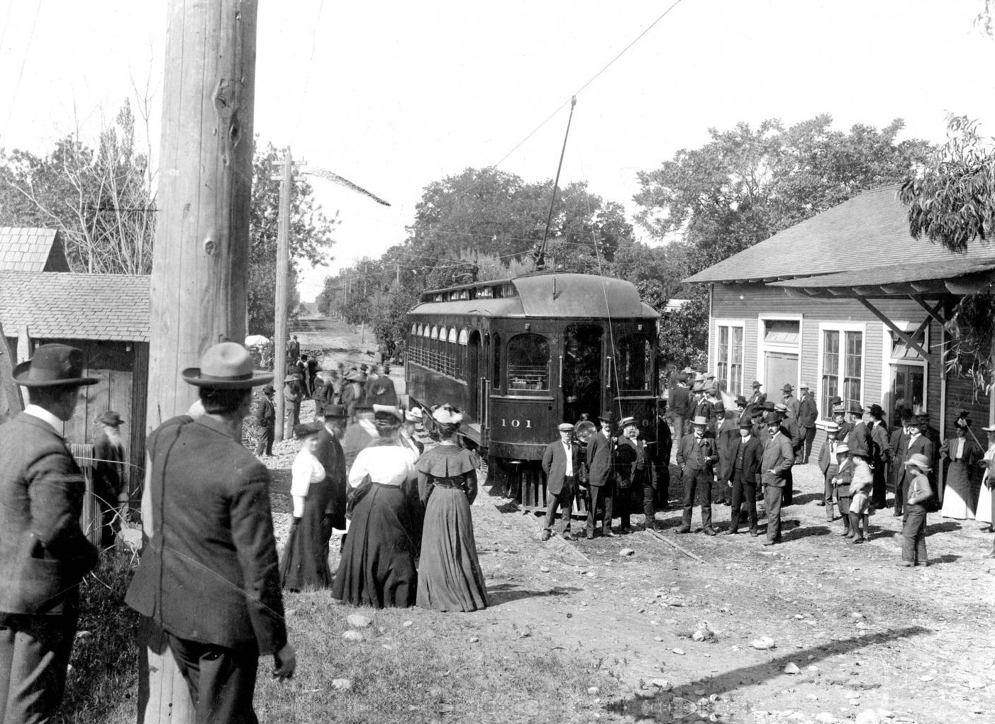
Northern Electric 101 sits along the depot on High Street in this circa 1906 west view. This train is set to return to the mainline via High St. In the unspecified near future, trains heading west would complete the loop using Myers St. by navigating the track to the north of this building as will be shown next. Ref: sc20409
L146-135-Morris E Phares Photo, Courtesy the Meriam Library, California State University, Chico, (Image 28 of 32)
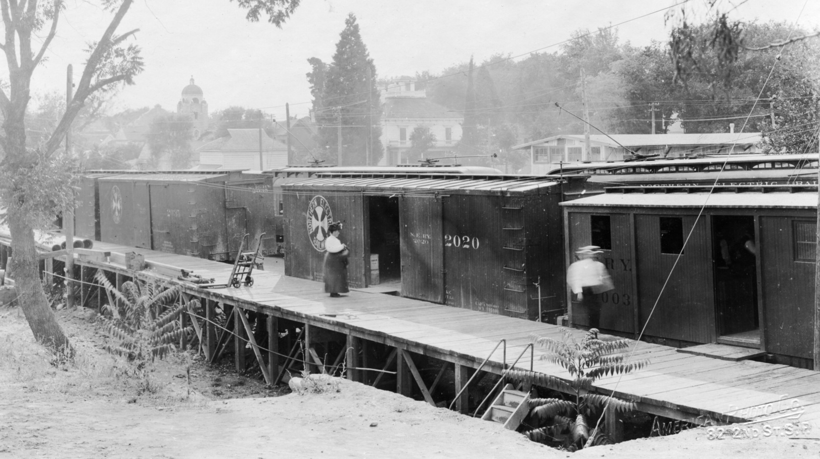
A two-car NE train has just pulled along the combination passenger-freight depot in this circa 1910 east view. At least one, possibly two of these structures was said to have burned down, but pictorial evidence is lacking. Note the car on the High St. spur is labelled, “Northern Electric Railway”, the name given to the NE after Sept. 19, 1907 to encompass the co-joining of the original NE and the Shasta Southern Railway Co.
L146-140-NE Photo, Courtesy BAERA, Western Railway Museum Archives, 108541sn, (Image 29 of 32)
This undated northwest view from High St. shows the freight platform present in the map in 146-125. The Second Methodist Church bell tower at Robinson and Lincoln Sts. can be see in the background left, while the low structure behind the line of freight and passenger cars is a newer structure not shown on the map in 146-125 to be presented next ...
L146-145-American Photo Co. of SF, Courtesy BAERA, Western Railway Museum Archives, 108547sn, (Image 30 of 32)
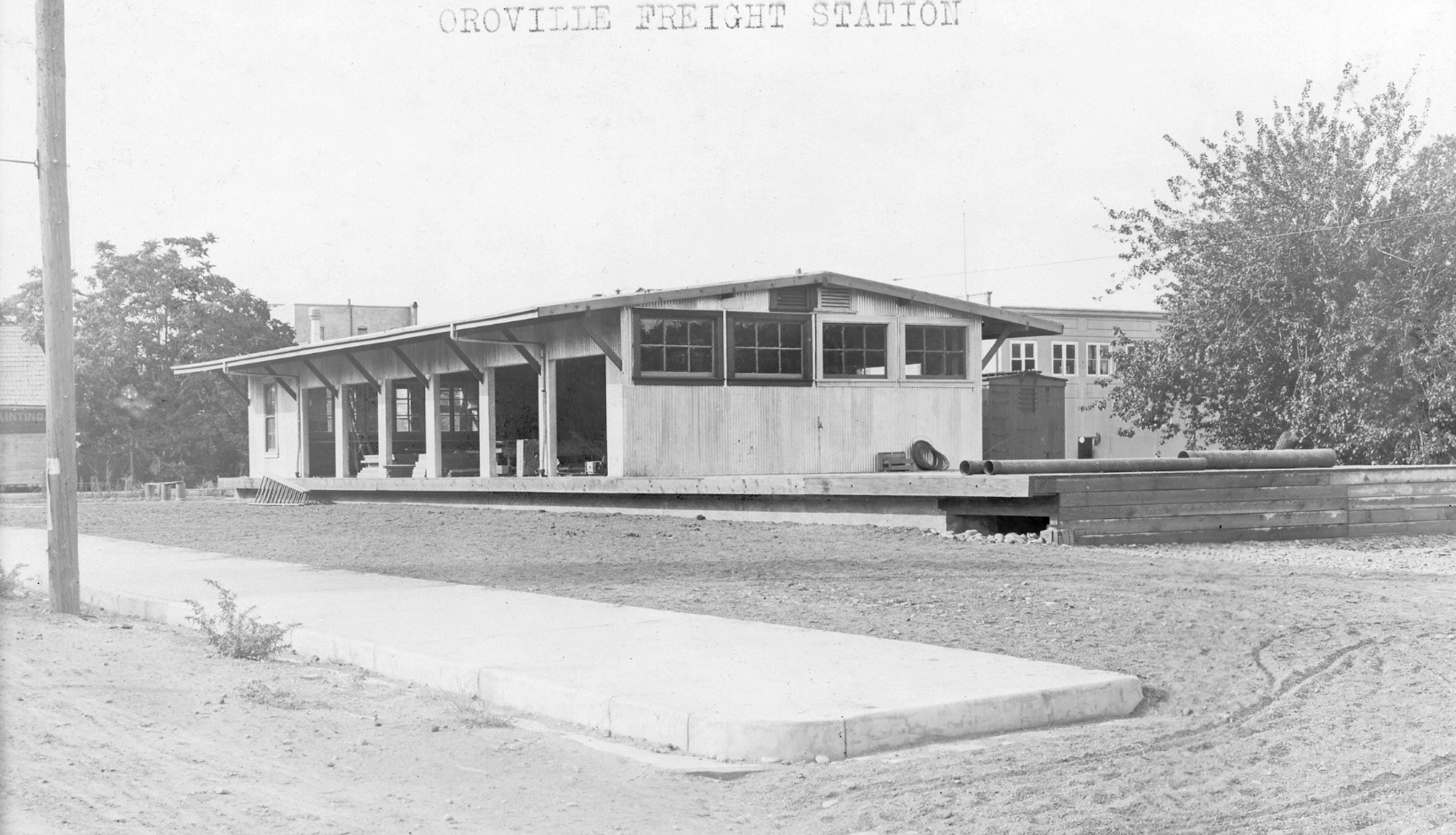
The freight depot was added after the original combination depot, being set to the west of the two freight tracks heading north in the terminal square block in 146-125. To the right of the freight station in the background is the Robinson St.-side of the building occupied by the City of Paris department store. Next time, celebration and growing pains alters the NE and the town of Oroville.
L146-150-Courtesy BAERA, Western Railway Museum Archives, 108543sn, (Image 31 of 32)
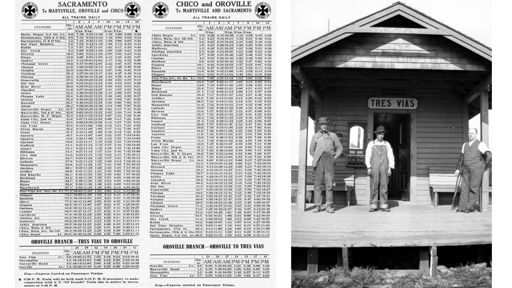
Time to check the schedule, shown here from Sept. 18, 1910, and head over to the station for the next trip to Oroville, shown here from 1918.
L146-155-Sappers Collection, Courtesy BAERA, Western Railway Museum Archives, 106484sn, (Image 32 of 32)