North Coast
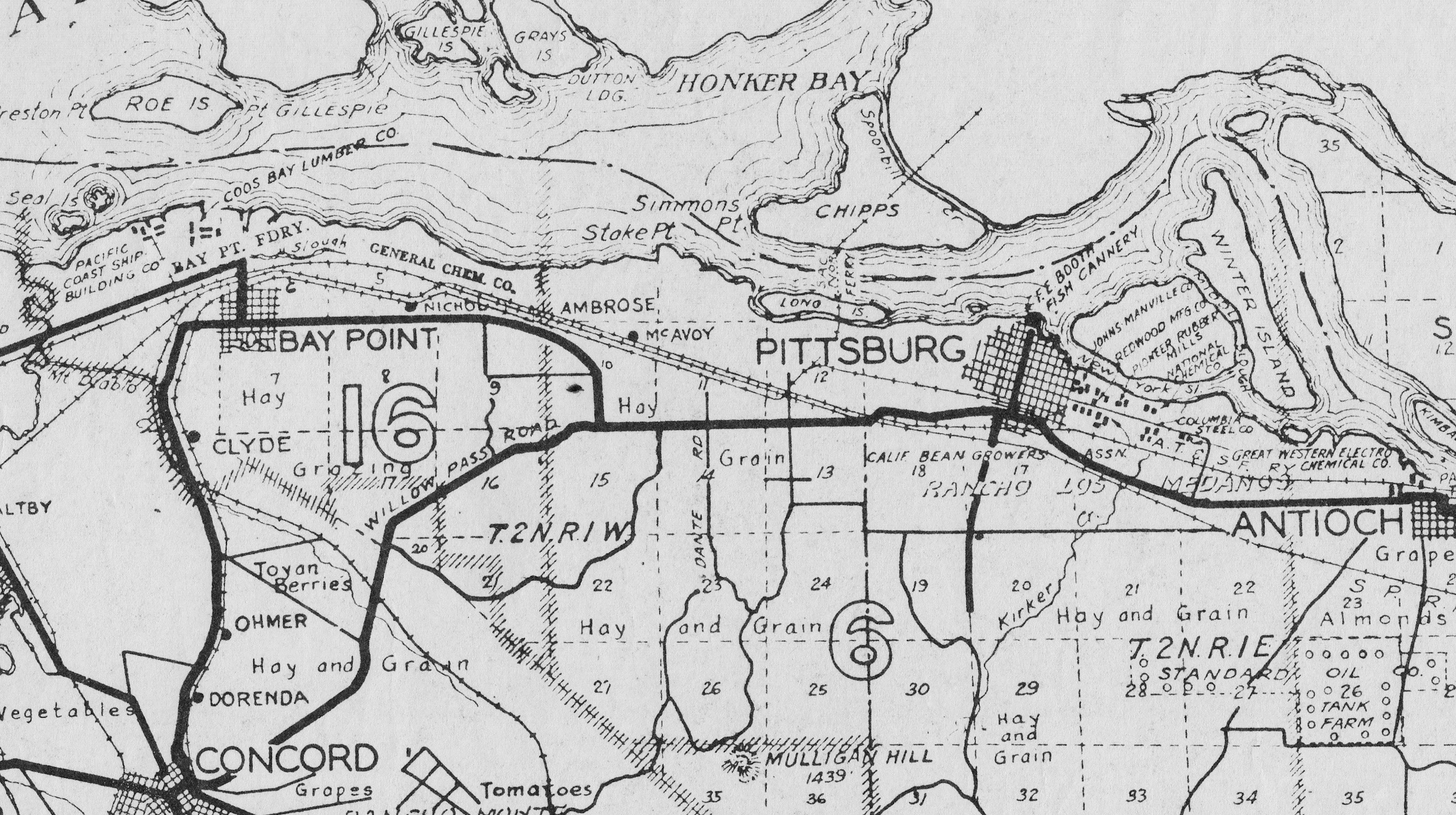
This 1939 agricultural-based map of the North Coast may be viewed as an anachronism based on temporal accuracy, but it shows the key towns, shipping access, industries and the four railroads that helped the four entrepreneurs and industrialists of the early 20th century shape the region. Who were these individuals and how did the SN serve their very different interests? Ref: G4363.C6J1 1939.C6
L5-Courtesy Earth Sciences and Map Library, University of California, Berkeley , (Image 1 of 16)

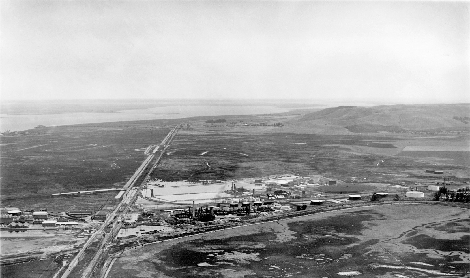
High above Avon, this northeast oblique by George Russell circa late 1920s shows the industries and towns built by the three key individuals and the four railroads that supplied the eastern edge of this region. See the next panel for an annotated version. Ref: 556 API 563_7_BOX 59
L10-George Russell Photo, Courtesy California State Lands Commission , (Image 2 of 16)
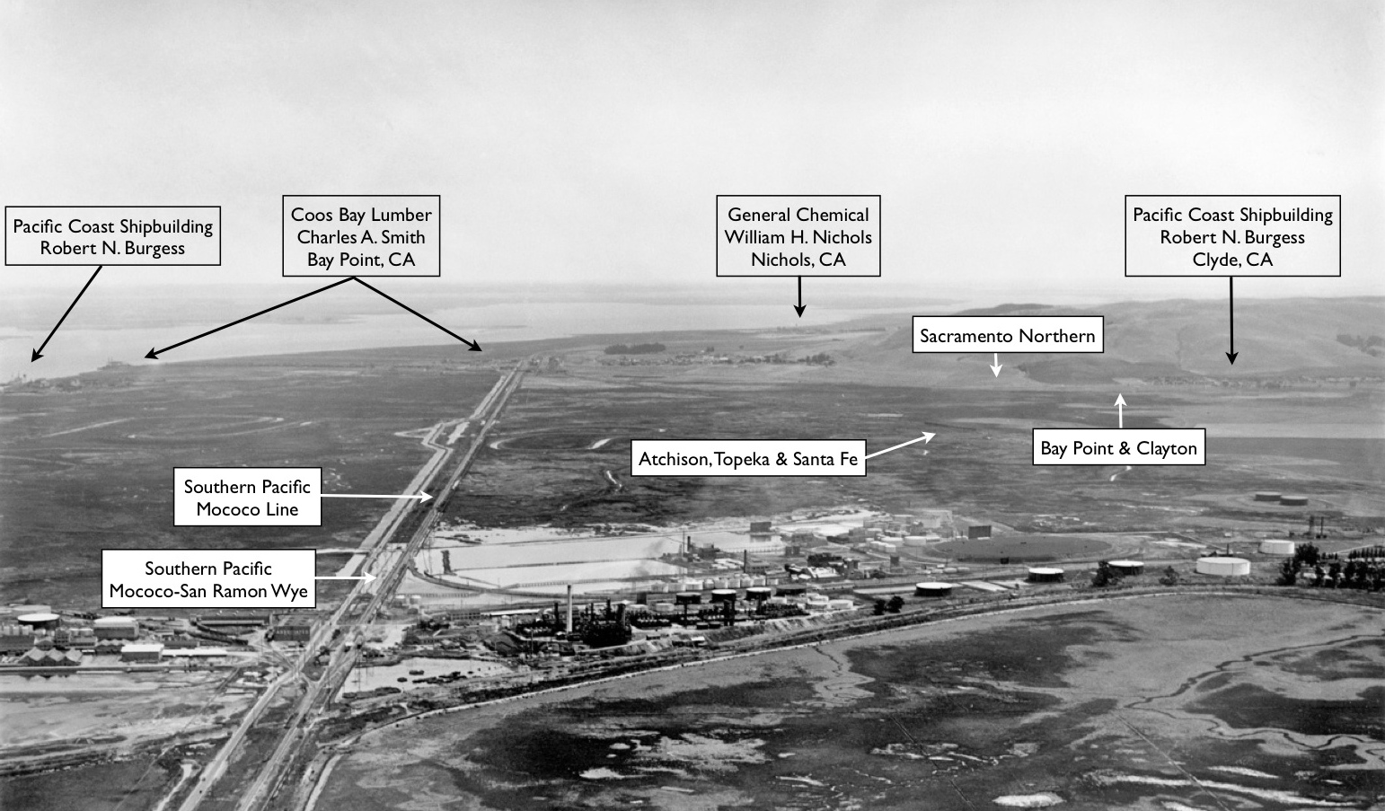
Annotated version of L10 showing major industries, industrial leaders and places, black arrows, and the four railroads serving the area, white arrows. Northeast oblique, circa late 1920s. Appreciate that the homes in Clyde were built by the Clyde Co., however, the government-based financing for this construction was based on the formation of the Pacific Shipbuilding Co. Ref: 556 API 563_7_BOX 59
L11-George Russell Photo, Courtesy California State Lands Commission, (Image 3 of 16)
Starting at Clyde, this detail from a northwest aerial view from the late 1920s shows the town relative to the shipyards it was intended to serve. The key landmarks seen in this image will be presented in full in an upcoming Landmark. Ref: 165 API 563_5_BOX 59
L15-George Russell Photo, Courtesy California State Lands Commission, Detail, (Image 4 of 16)
A southeast view down the SN right-of-way with a Mt. Diablo backdrop in this undated image provides one obvious reason for the enthusiasm of Robert N. Burgess for the then Oakland, Antioch and Eastern Railway. A whole Special Topic in the History section to be presented in the future will reveal additional details.
L20-Courtesy BAERA, Western Railway Museum Archives, 97697sn, (Image 5 of 16)
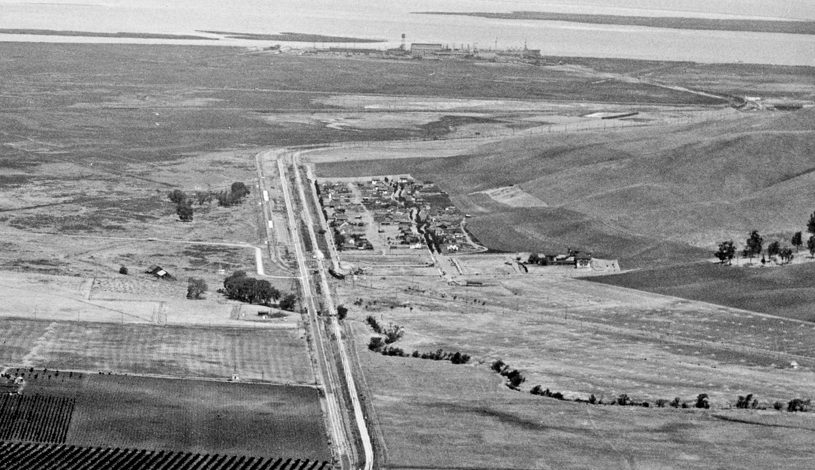
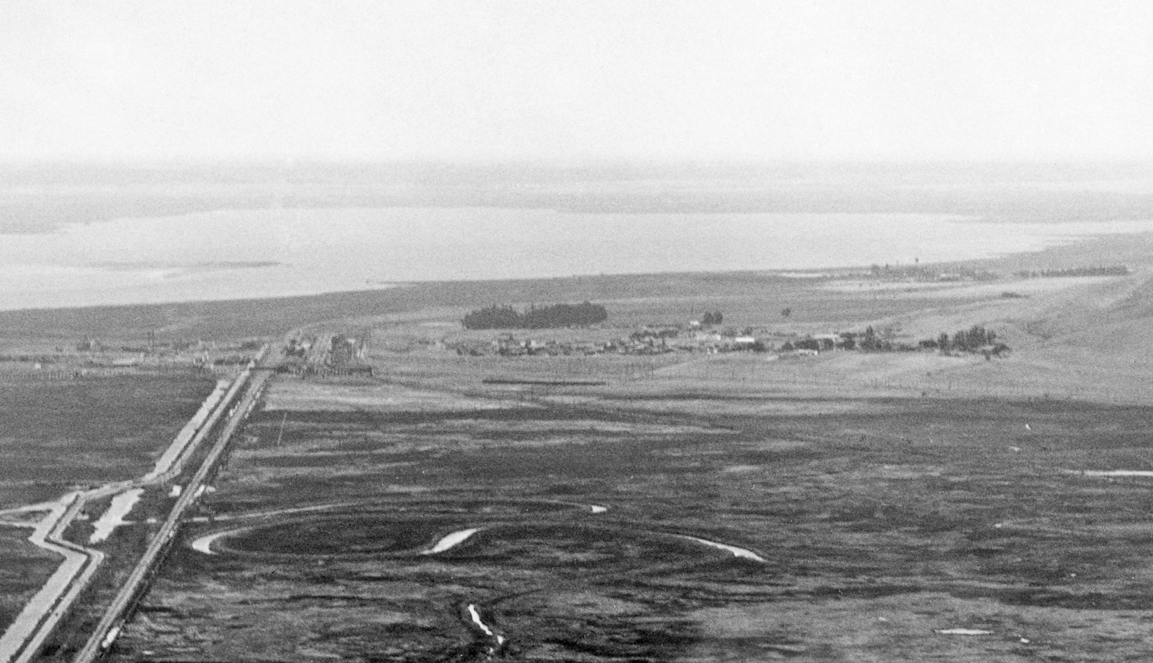
A detail from L10, a northeast oblique from the late 1920s, sets Bay Point in the center of the image as the next destination, to be followed by Nichols, upper right. Ref: 330 API 563_7_BOX 59
L25-George Russell Photo, Courtesy California State Lands Commission, Detail, (Image 6 of 16)
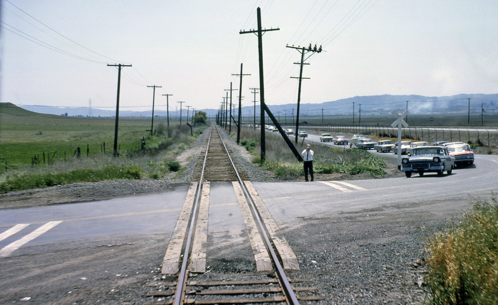
The southeast view of the right-of-way from the rear of the End-of-an-Era excursion train from Apr. 12, 1964 shows the grade crossing of the Port Chicago Highway, the point at which the SN started to angle toward Port Chicago. This section of road, north of Clyde to Nichols Rd., has been closed to car traffic since 1995.
L30-Ted Wurm Photo, Courtesy BAERA, Western Railway Museum Archives, 95963sn , (Image 7 of 16)
Four railroads are seen converging on Port Chicago just after the July 17, 1944 explosion in this southwest view. The SN, along the left border, is seen from the Port Chicago grade crossing until it sets a parallel path with the Santa Fe, Bay Point and Clayton and Southern Pacific Railroads. The last remains of Burgess’ bridge to the shipyard can also be seen, but stay tuned for much more. Ref: RG 181 NN373-91, Vol 5 A 17-25
L35-Courtesy The National Archives at San Francisco, Detail , (Image 8 of 16)
Port Chicago in 1961, northwest view, in the midst of a contentious battle with the Navy to survive as an entity.
L40-Courtesy Contra Costa County Historical Society, 5469, (Image 9 of 16)
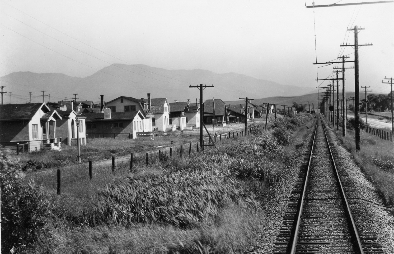
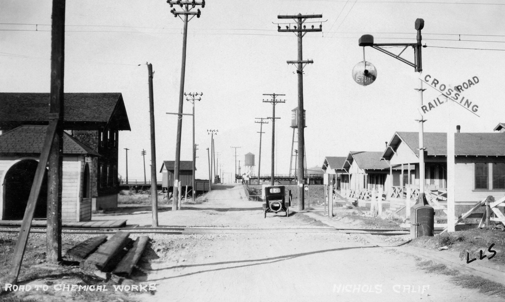
William H. Nichols brought General Chemical to create the town of his namesake in about 1910, and built housing and other amenities around it as seen in this north view circa 1913. Note the SN shelter in the foreground and the Santa Fe shelter in the center. The SP shelter - a topic to arrive soon.
L45-Louis L Stein Collection, Courtesy BAERA, Western Railway Museum Archives, 97702sn, (Image 10 of 16)
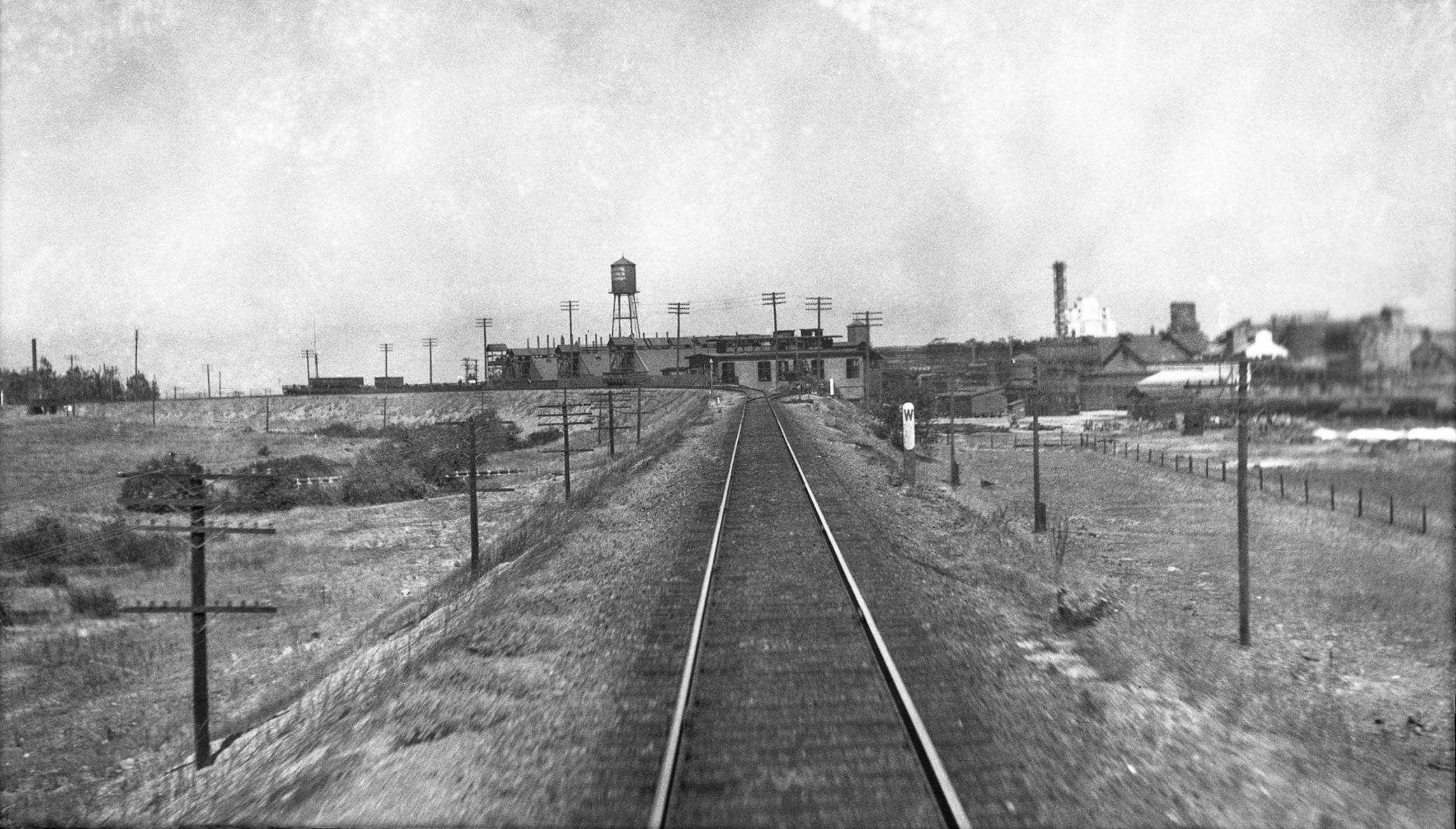
A sweeping west view of the General Chemical facility is optimal from the Santa Fe tracks and not the SN as seen in this undated, post-1931 west view taken by John W. Barriger III. The next stop will be McAvoy. Ref: ATSF 485
L50-John W. Barriger III Photo, John W. Barriger III National Railroad Library at UMSL, (Image 11 of 16)
RL Copeland took this east view of McAvoy and points east on Jan. 20, 1951. McAvoy, the namesake for farmer Oliver McAvoy, provides a contrast from the surrounding industry with its yacht clubs and agricultural setting. The Shell Chemical Company, center, on the site of the Ambrose ranch, however, has already been in business for two decades. Shore Acres? Stay tuned as the view of Pittsburg can be seen along the top left.
L55-RL Copeland Photo, Courtesy Contra Costa County Historical Society, 7275, (Image 12 of 16)
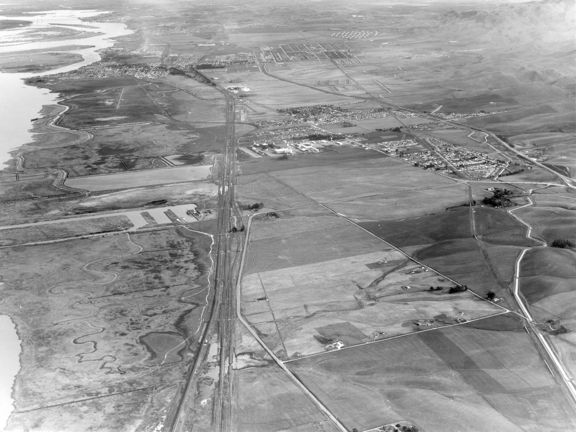
First to the current border between Pittsburg and the new Bay Point, the latter having been called West Pittsburg from the 1960s until its renaming in 1993. This circa late 1920s southwest image shows the SN subway under the Santa Fe and Southern Pacific, right margin, and the West Pittsburg “Wye”. Confused by the name? Patience, it will all be explained. Ref: API 578_13_BOX 71 thru 74
L60-George Russell Photo, Courtesy California State Lands Commission, Detail , (Image 13 of 16)
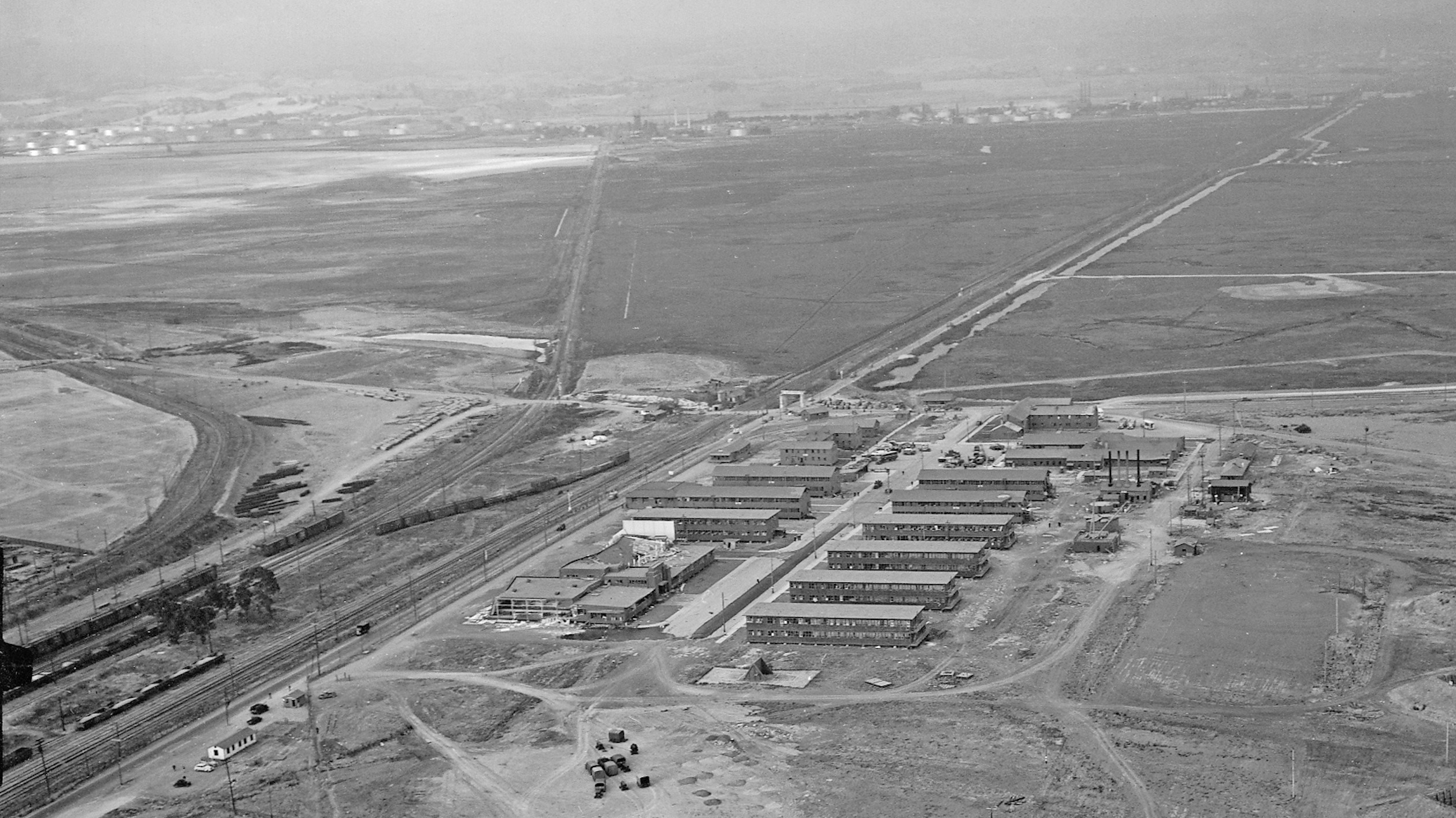
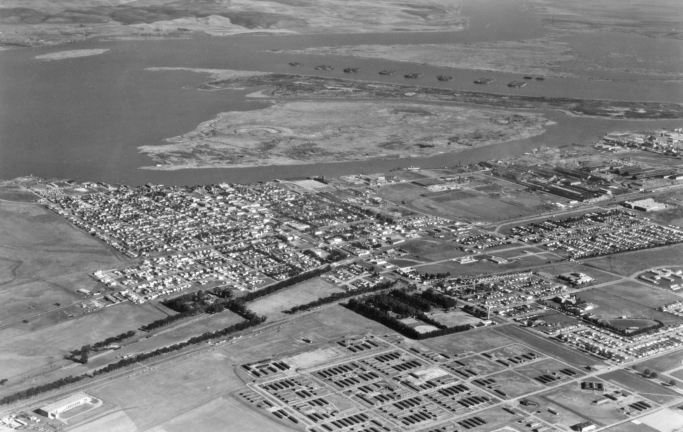
You can’t talk about Pittsburg without acknowledging the impact of Camp Stoneman, an active base from 1942 until 1954. Northeast aerial from Jan. 2, 1947.
L65-RL Copeland Photo, Courtesy Contra Costa County Historical Society, 7273, (Image 14 of 16)
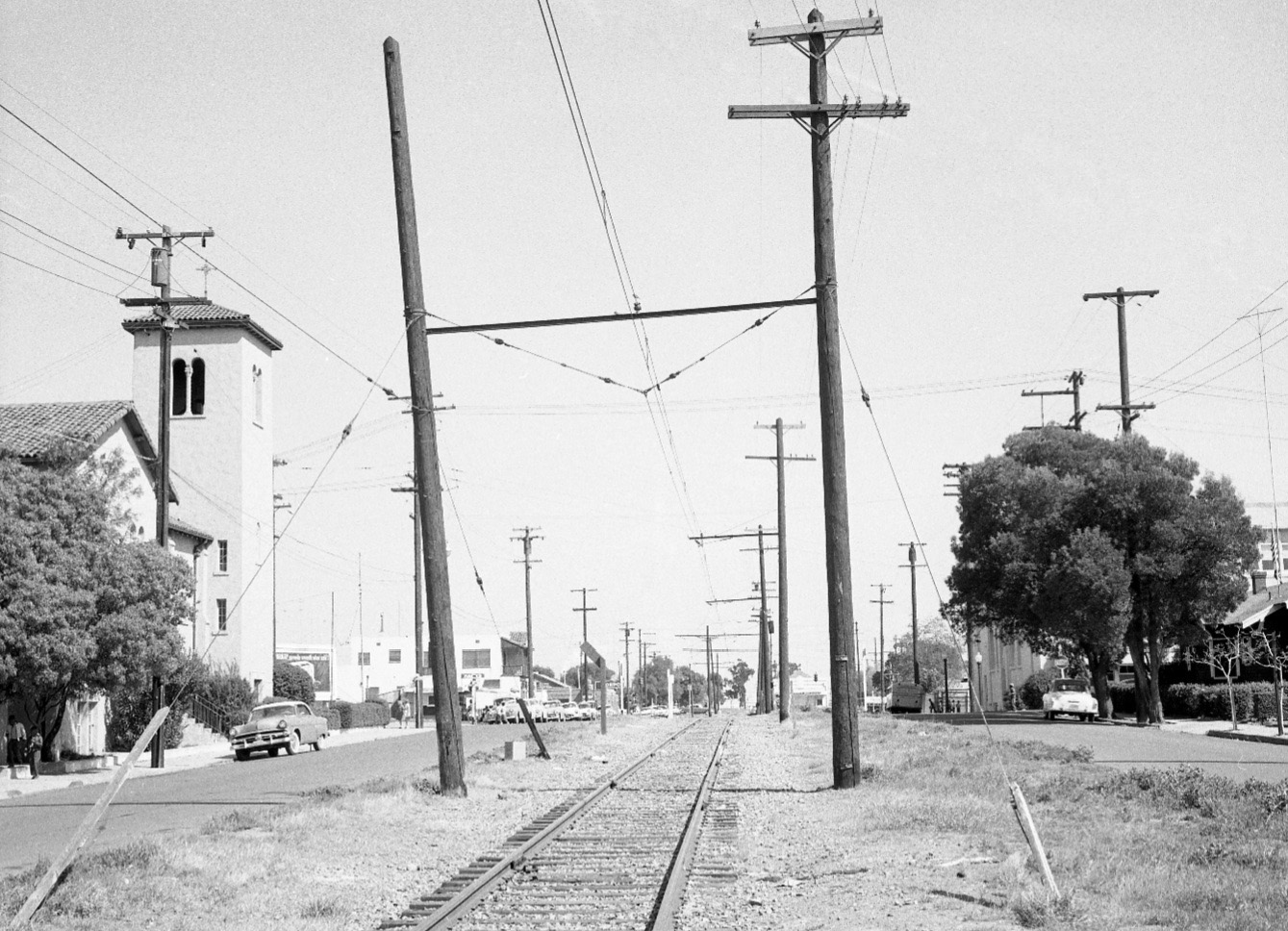
Taking a walk along the SN in mid-1957 toward the depot, this east view shows St. Peter Martyr Church to the left at the Black Diamond St.-8th St. intersection. A parish dating back over 100 years, the church at 740 Black Diamond was built in 1931 and serves as an important historical marker for images of the area.
L70-EK Muller Photo, Courtesy BAERA, Western Railway Museum Archives, 96934sn, (Image 15 of 16)
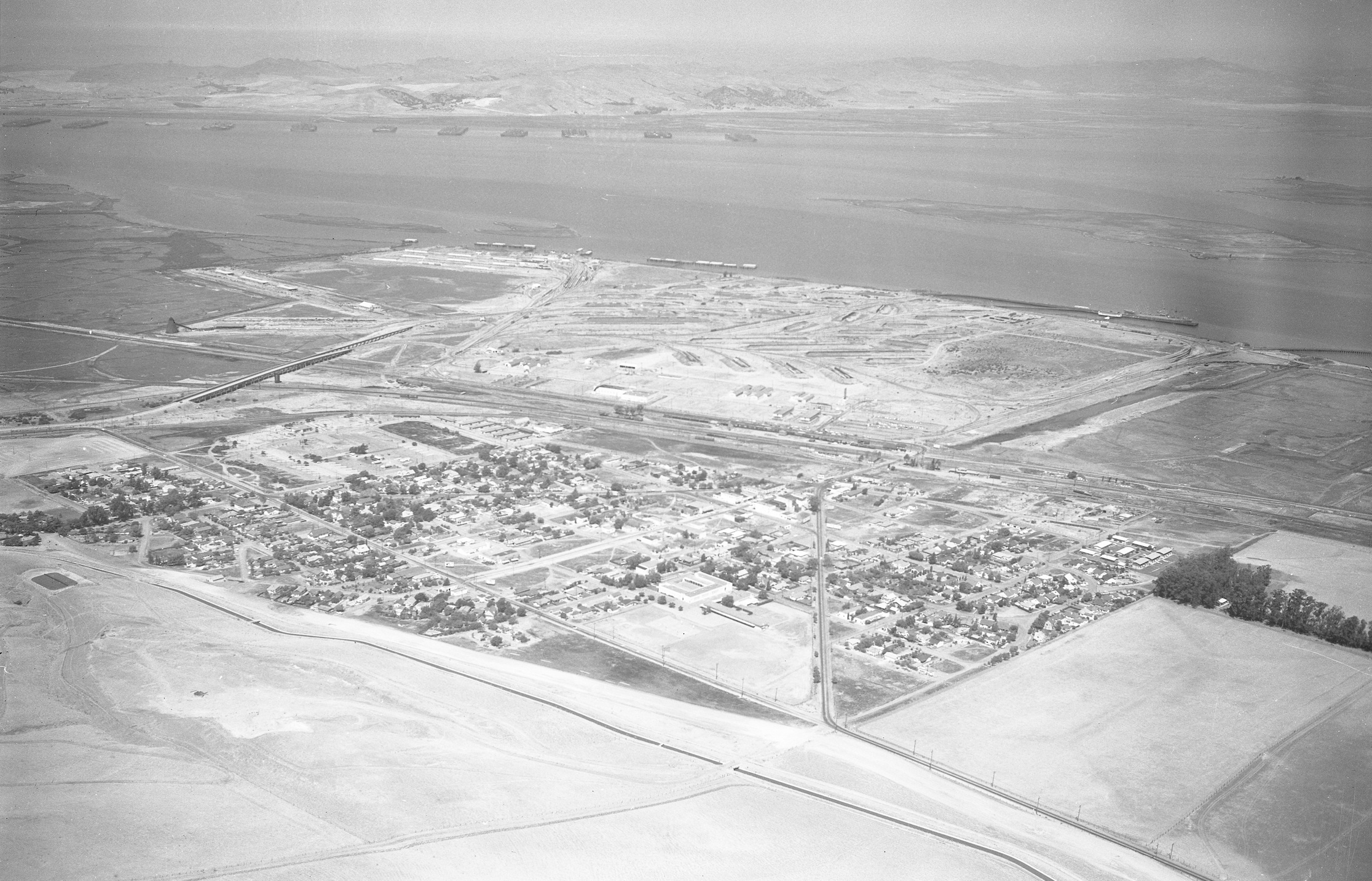
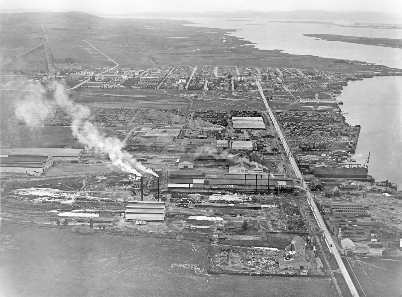
Finally, a west view from George Russell of the entire profile of Pittsburg in the late 1920s. Industrialist Charles A. Hooper and his many holdings, the Columbia-Geneva-USS Steel Plant, and much more of the industrial heritage of this area in the 20th century to come. Ref: API 578_41_BOX 71 thru 74. Appreciation to Matt Fossum, Janet Stapleton, Evan Werkema, and Bill Greene for their significant contributions to this presentation.
L75-George Russell Photo, Courtesy California State Lands Commission, (Image 16 of 16)