Montclair
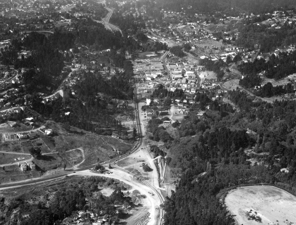
North view from Montclair Playground, right foreground, from Feb. 1, 1956 captures the construction of Mountain Boulevard Freeway Unit Two in the foreground back to Moraga Avenue, with completed Unit One back to Tunnel Road in the background.
D5-Copyright California Department of Transportation, 4809-2, (Image 1 of 15)

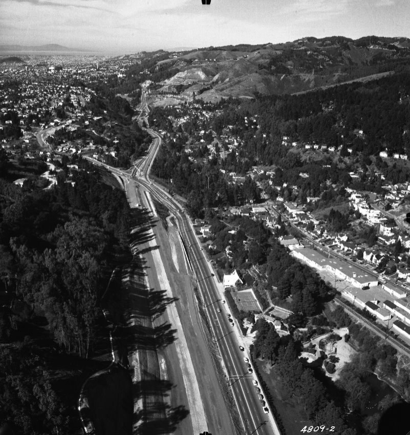
Detail of the north view from D5 of construction of Unit Two freeway from Feb. 1, 1956. Note Julia Morgan’s Hansel and Gretel-style Montclair Fire Station from 1927 along Moraga Avenue, center, and the Montclair Elementary School to the east or right.
D10-Copyright California Department of Transportation, Detail 4809-2 , (Image 2 of 15)
South view from the Moraga Avenue and Thornhill Drive intersection of the construction of Unit Two freeway with Montclair Village coming into view, Feb. 1, 1956. Unit Two was was completed that October, extending Unit One 1.28 miles to Ascot Drive.
D15-Copyright California Department of Transportation, 4809-5, (Image 3 of 15)
A final south view of the construction of Unit Two adjacent to Montclair Village showing the construction of the bridge at La Salle Avenue, and the Park Boulevard Interchange, Feb., 1, 1956.
D20-Copyright California Department of Transportation, 4809-4 , (Image 4 of 15)
Three year earlier, Montclair Village and the SN trestle over Mountain Boulevard are seen in this southeast view, Sept. 23, 1953. No sign of Unit Two roadwork, but reconfiguration of the Mountain Blvd. and Park Blvd. intersection is in progress.
D25-Public Works Photo, Oakland Cultural Heritage Survey, Oakland City Planning Department , (Image 5 of 15)
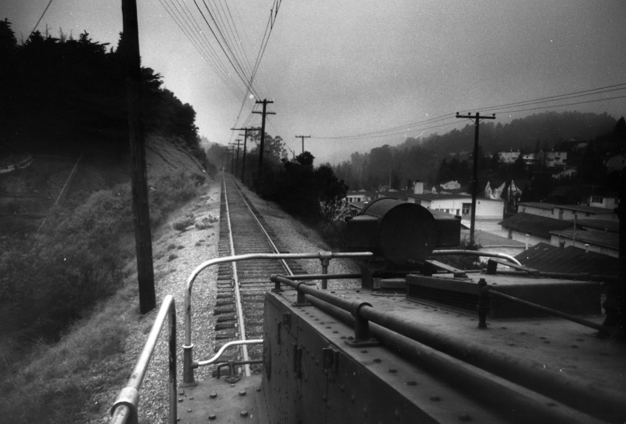
This is the first of two north views from circa 1952, taken within seconds by Reg McGovern riding the rails at the Montclair berm. See the next image ...
D30-Reginald McGovern Photo, Courtesy Reginald McGovern, (Image 6 of 15)
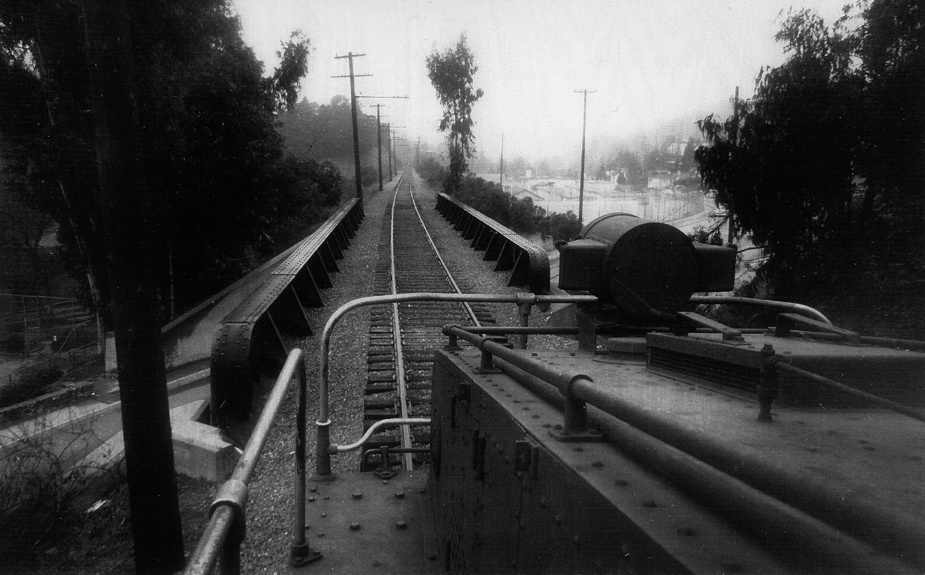
Now the Mountain Blvd. trestle is in view, and the identification of the Montclair Elementary School to the east, or right, is straightforward. North view, circa 1952.
D35-Reginald McGovern Photo, Courtesy Reginald McGovern , (Image 7 of 15)
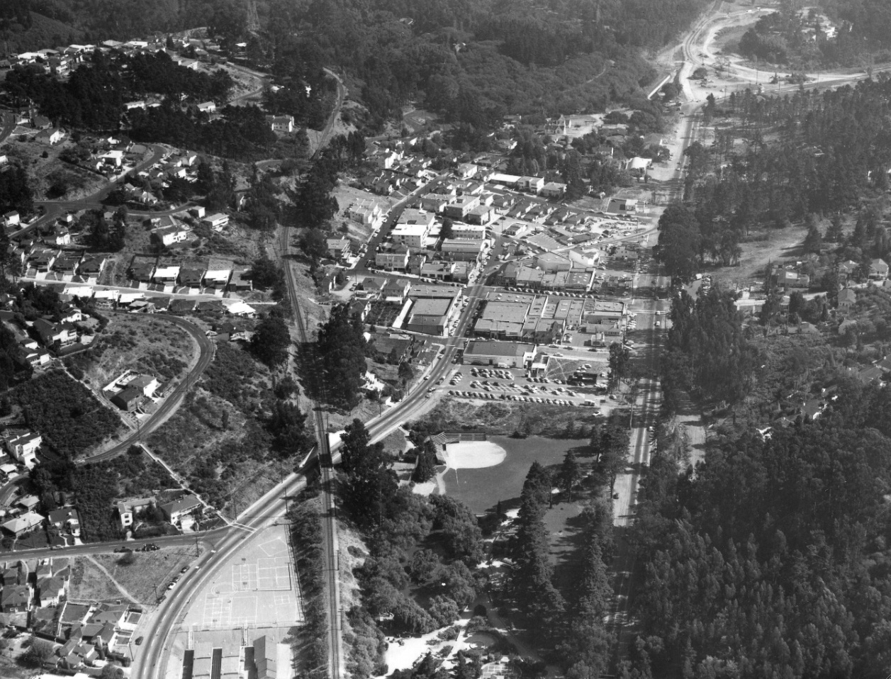
This north view from Sept. 23, 1953 shows central Montclair Village, the SN trestles at Mountain Boulevard and Snake Road, and the path of the future freeway section, Unit Two, to the left, or west, of Moraga Avenue. The terminus of Unit One can be seen in the background.
D40-Public Works Photo, Oakland Cultural Heritage Survey, Oakland City Planning Department , (Image 8 of 15)
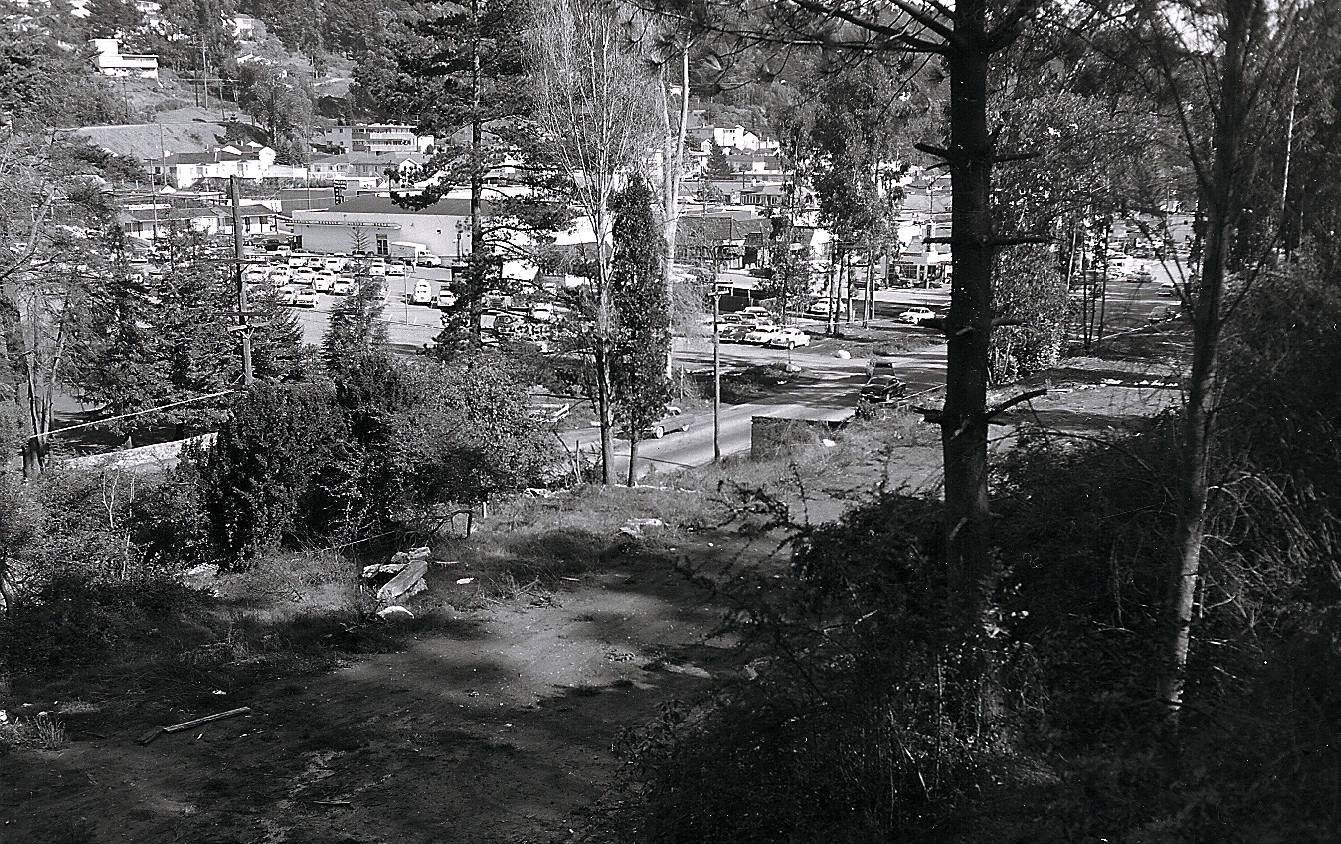
This southeast view of Montclair Village from Mar. 9, 1954 shows a landmark, Pay Less Grocery Market and its parking lot at Moraga Avenue, just north of Medau Place.
D45-Public Works Photo, Oakland Cultural Heritage Survey, Oakland City Planning Department , (Image 9 of 15)
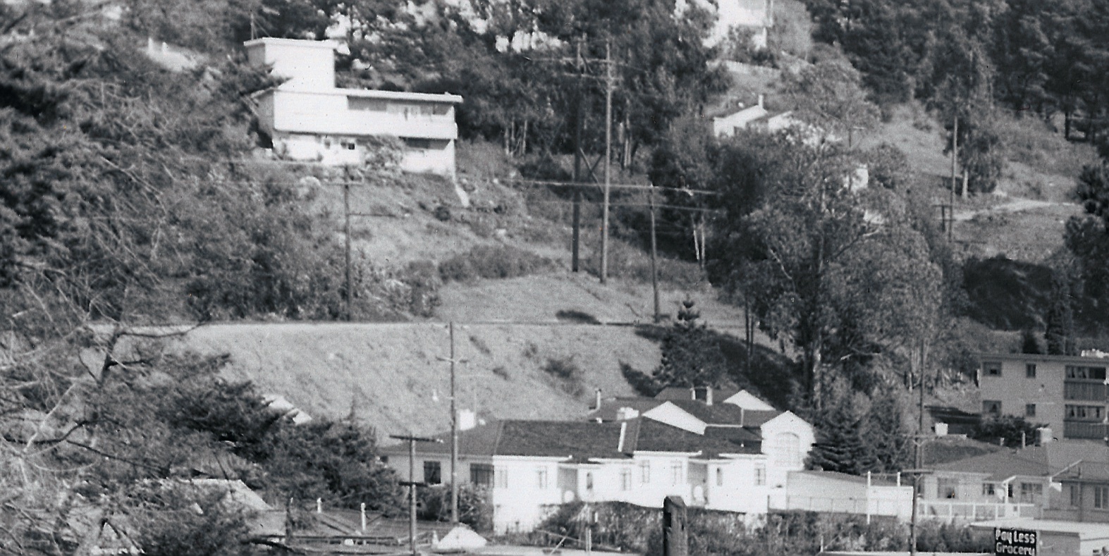
A detail of D45 captures the grocery sign against the backdrop of the SN right-of-way, southeast view, Mar. 9, 1954.
D50-Public Works Photo, Oakland Cultural Heritage Survey, Oakland City Planning Department , (Image 10 of 15)
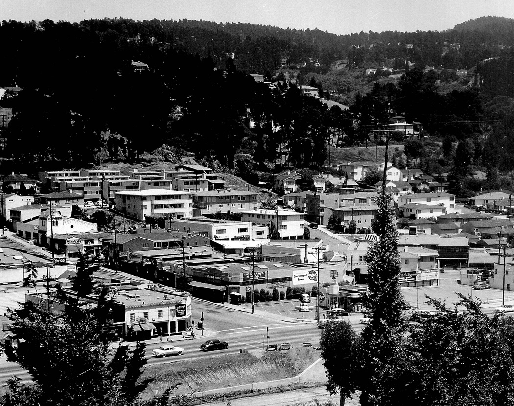
A little further south relative to D45, this southeast view of Montclair Village shows the intersection of La Salle and Moraga Aves. It is now 1955 and construction of Unit Two has commenced.
D55-Courtesy Oakland History Room, Oakland Public Library, F-574, (Image 11 of 15)
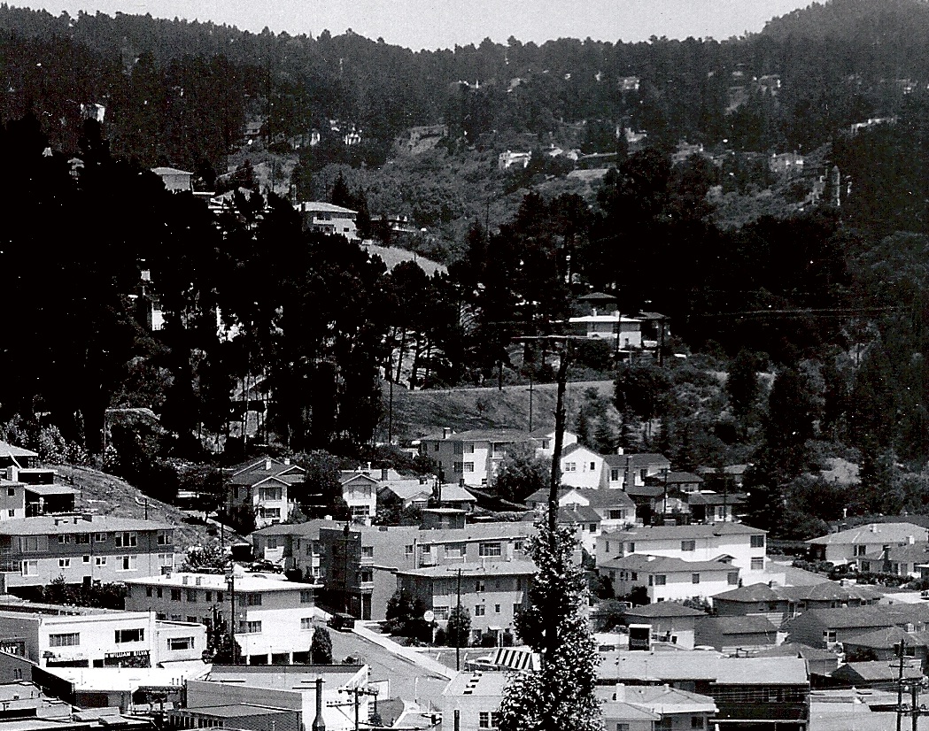
A detail of D55 shows the close proximity of the SN right-of-way to the central business area of Montclair. Southeast view, circa 1955.
D60-Courtesy Oakland History Room, Oakland Public Library, Detail F-574, (Image 12 of 15)
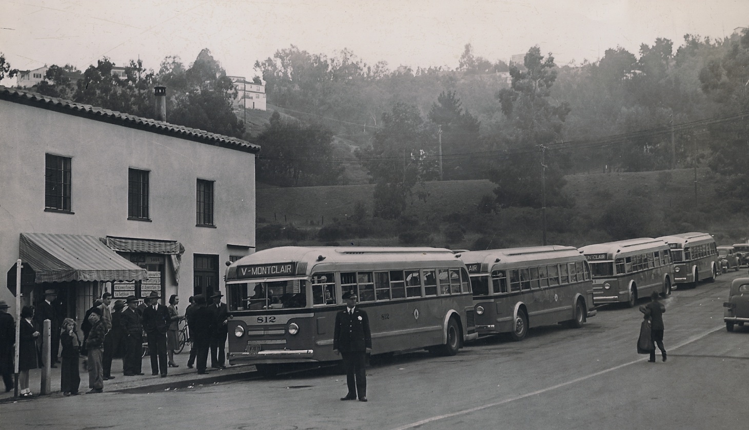
Its opening day for the Montclair V Line at La Salle and Moraga Avenues, Feb. 25, 1940. The camera lens brings the SN a little closer than the human eye would appreciate from this northeast view.
D65-Brian Thompson Photo, Courtesy Brian Thompson , (Image 13 of 15)
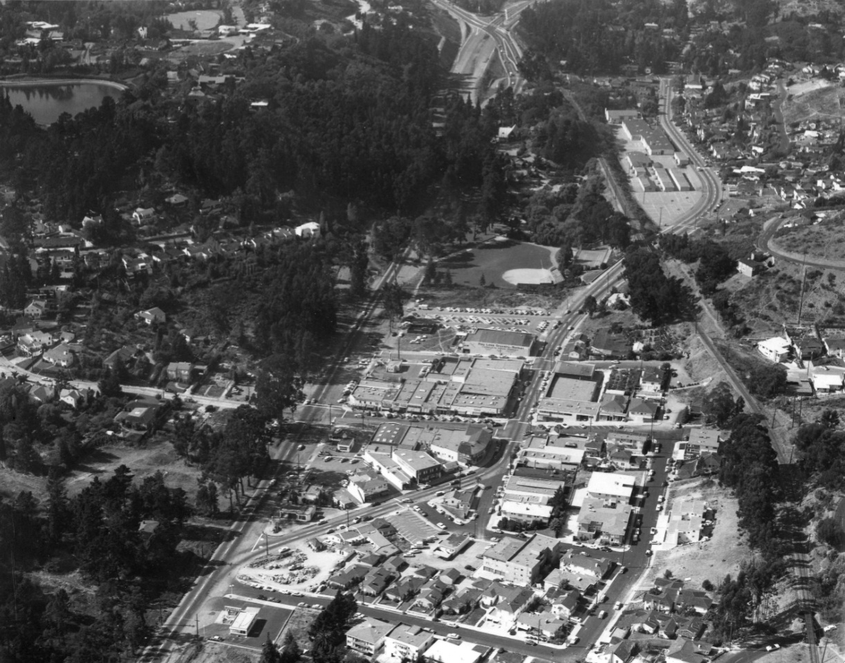
Further south, this panorama of Montclair shows a north view from the level of Park Blvd. of the construction at the intersection with Mountain Blvd. on Sept. 23, 1953. The SN right-of-way is about to enter Shepherd Canyon.
D70-Public Works Photo, Oakland Cultural Heritage Survey, Oakland City Planning Department , (Image 14 of 15)