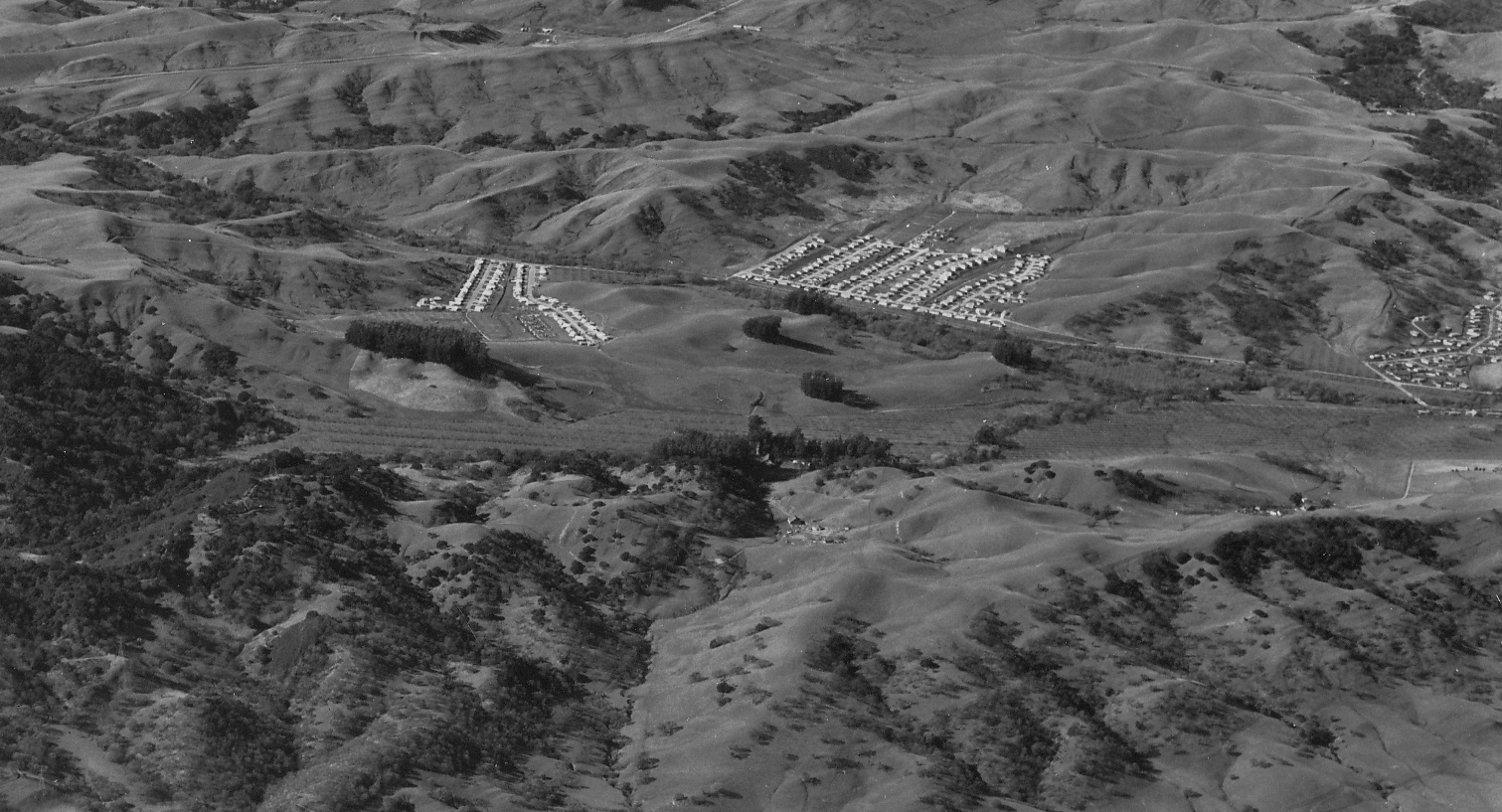
Lafayette
West view of the Burton Valley from Jan. 22, 1953 in which St. Mary's Road may be traced from central Moraga, far left, past the College, splitting the new housing developments, and finally crossing Glenside Drive at the far right.
H5-RL Copeland Photo, from the collection of the Moraga Historical Society, Moraga, CA, 11, (Image 1 of 15)

Detail of H5, west view from Jan. 22, 1953. Difficult to discern the SN in this image, but the SN right-of-way is today coincident with the Lafayette-Moraga Regional Trail, and Las Trampas Creek is always to the east of the right-of-way in this section.
H10-RL Copeland Photo, from the collection of the Moraga Historical Society, Moraga, CA, 11, (Image 2 of 15)
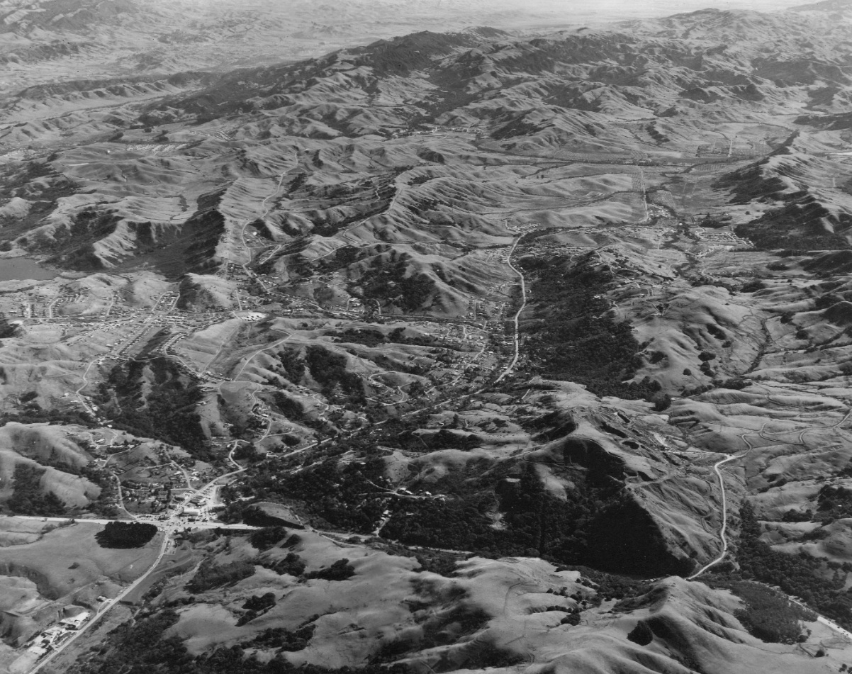
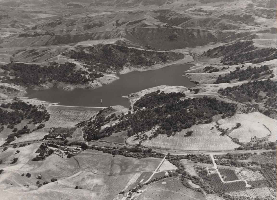
An east view of Lafayette Reservoir and south Lafayette from the Orinda Crossroads, Jan. 22, 1953.
H15-RL Copeland Photo, from the collection of the Moraga Historical Society, Moraga, CA, 10 , (Image 3 of 15)
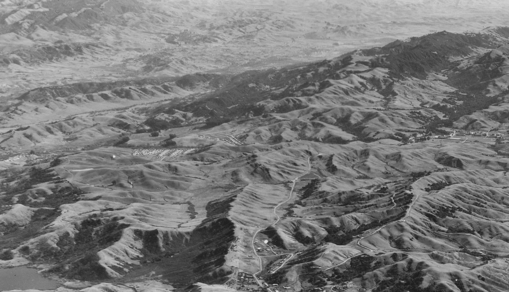
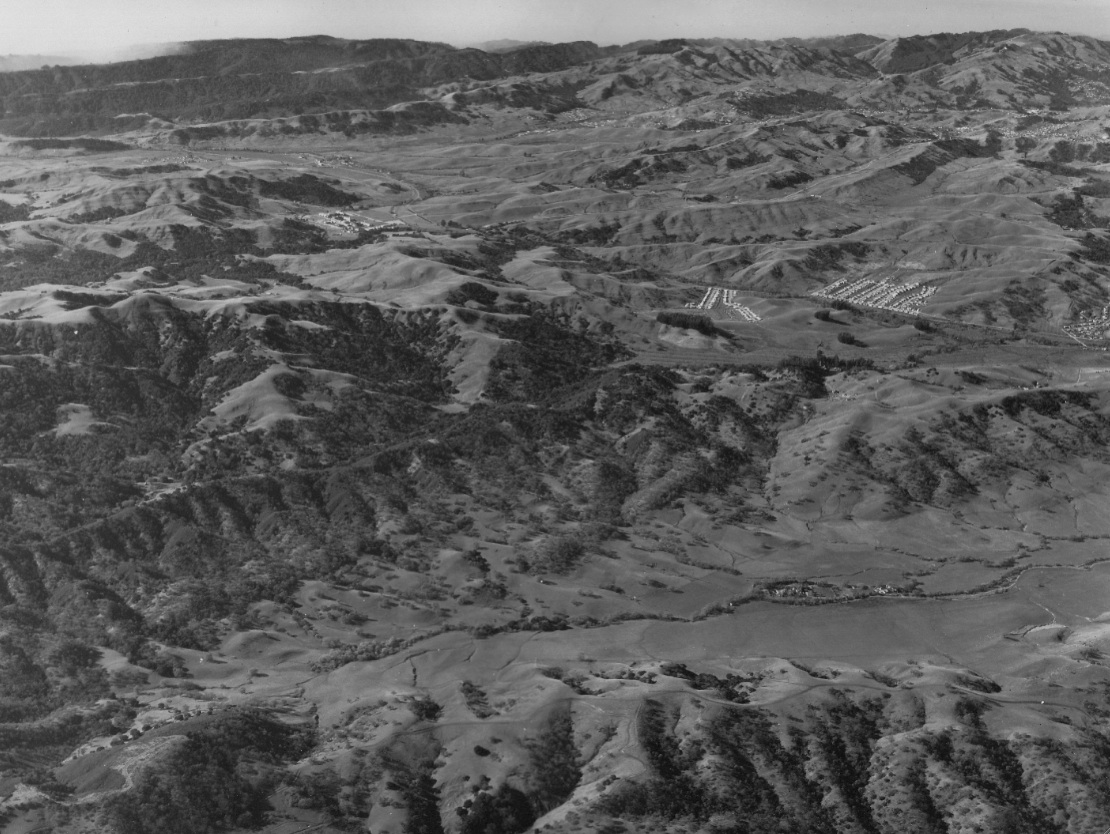
Detail from H15, east view Jan. 22, 1953, showing horizontally across the image, St. Mary's College, far right, and the Burton Valley to Glenside, center and left, respectively.
H20- RL Copeland Photo, from the collection of the Moraga Historical Society, Moraga, CA, 10 , (Image 4 of 15)
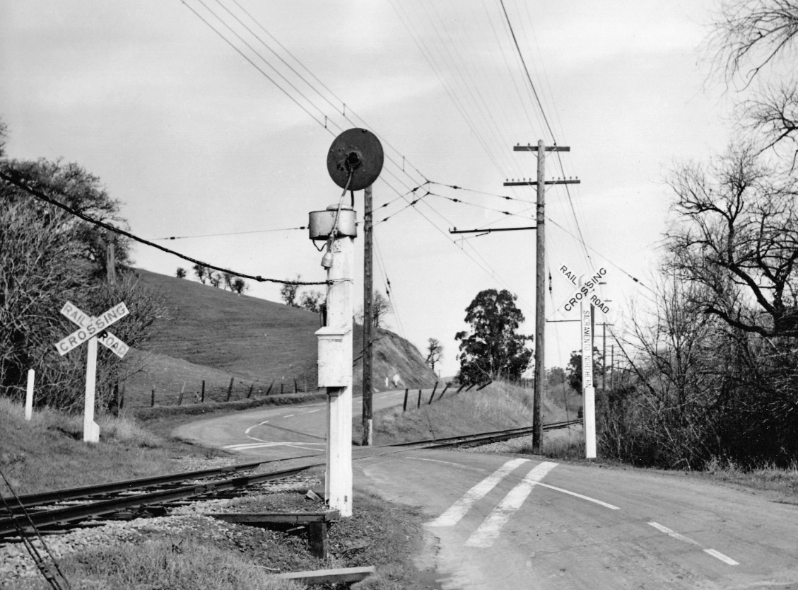
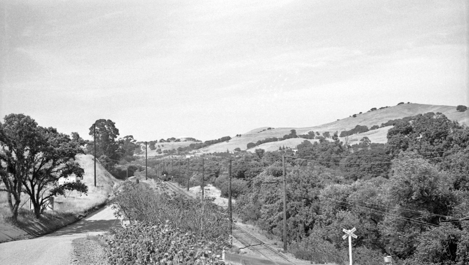
This northwest view captures the SN grade crossing of St. Mary’s Road in Burton. The heavy brush to right marks Las Trampas Creek, which the road had already crossed a half mile to the south at the southern edge of present day Lafayette Community Park.
H25-Courtesy Bay Area Electric Railroad Association, Western Railway Museum Archives, 52073sn, (Image 5 of 15)
Another view of the grade crossing shows the origin of Florence Drive, far left corner, built to provide access to the new housing development. The ridge profile to the northeast remains a thumbprint for the interval between Burton and Glenside Drive along St. Mary’s Road.
H31-Courtesy the California State Railroad Museum, CSRM 33353, (Image 6 of 15)
The SN crossed Glenside Drive twice, and in between these crossings the road brushed up to the right-of-way as seen in this southwest view from 1952. This image captures the decade of the 1950s and the transformation from a rural to a suburban setting. Now part of the Lafayette-Moraga Trail.
H32-Reginald McGovern Photo, Courtesy Reginald McGovern , (Image 7 of 15)
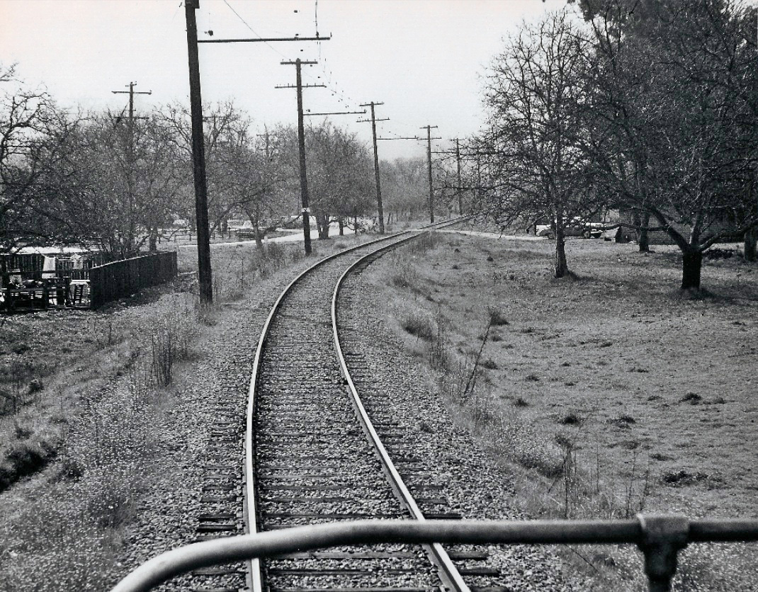
An undated northwest view along the right-of-way toward the West Lafayette station area, today part of the Lafayette-Moraga Trail.
H34-Courtesy BAERA, Western Railway Museum Archives, 70094sn, (Image 8 of 15)
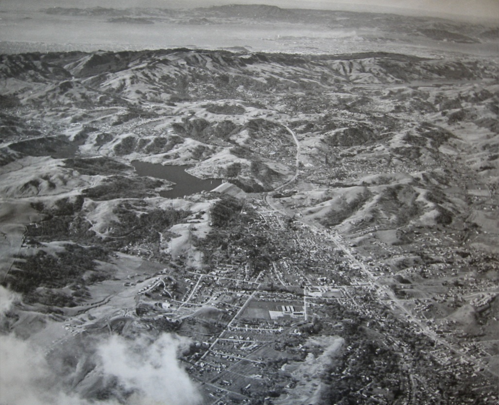
From a plane at 6-7,000 feet just west of Mount Diablo, this west view of central Lafayette highlights Lafayette Reservoir, and Mount Diablo Boulevard winding through the center of the image. Ref. Oakland Tribune, Sunday, Jan. 7, 1955, page 67.
H35-Les Sipes Photo, the Oakland Tribune, Courtesy of East Bay Municipal Utility District, (Image 9 of 15)
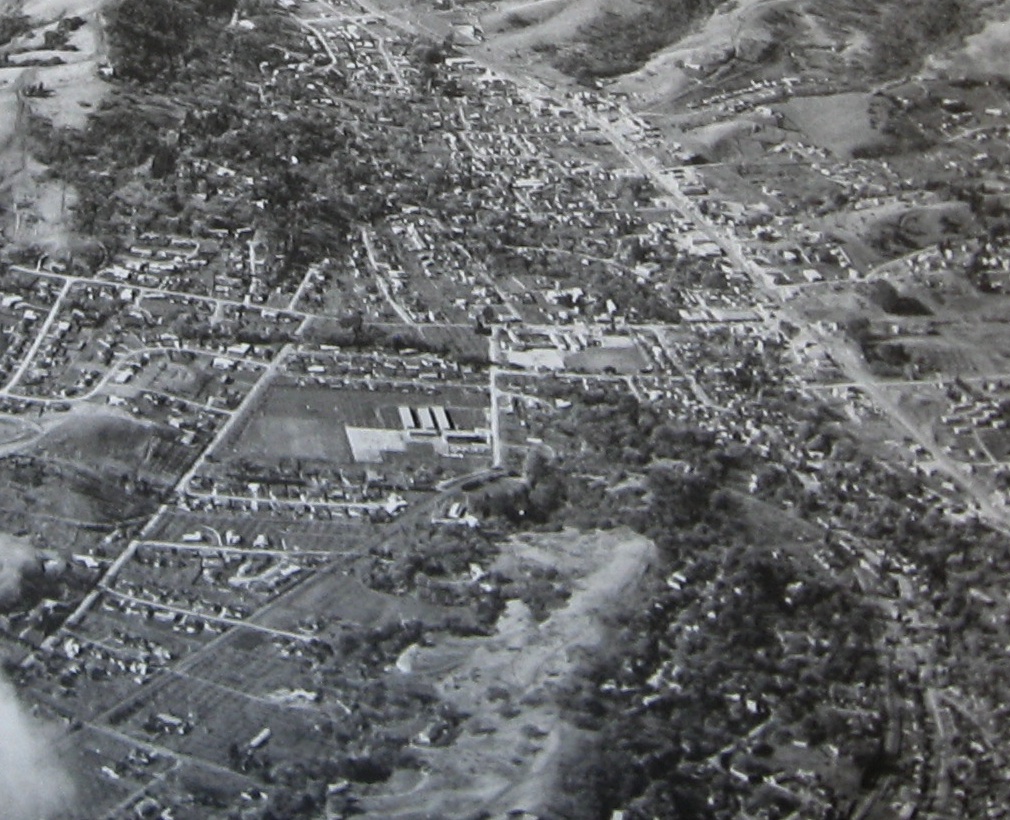
This detail from H35, west view, Jan. 7, 1955, shows the Lafayette "Loop" formed by the right-of-way of the SN Railroad. Note Stanley Middle School denoted by the three rectangular structures, with School Street to the north, and St. Mary's Road to the south, both seen originating off Moraga Road.
H40-Les Sipes Photo, the Oakland Tribune, Courtesy of East Bay Municipal Utility District, (Image 10 of 15)
This crisp image of a west view of central Lafayette Apr. 9, 1953 shows Mt. Diablo Blvd down the center, with an accentuated Golden Gate Way separating itself to the north of the loop. Clock in bottom right corner suggests Clyde Sunderland photo.
H45-Copyright California Department of Transportation, 3299-4, (Image 11 of 15)
This detail from H45, west view, Apr. 9, 1953, shows Moraga Boulevard conforming to the north side of the “Loop”. Foye Drive crosses the tracks in much the same way it crosses the Lafayette-Moraga Regional Trail today.
H50-Copyright California Department of Transportation, Detail 3299-4 , (Image 12 of 15)
With the completion of Highway 24 nearing, this east view from Jan 14, 1960 documents the post war growth spurt in Lafayette. More than one year after complete abandonment of the SN west of Walnut Creek, the only visible remains of the railroad is the power sub-station amongst the dense foliage located directly to the left of Stanley Middle School in the center of the image.
H55-Copyright California Department of Transportation, 7243-4 , (Image 13 of 15)
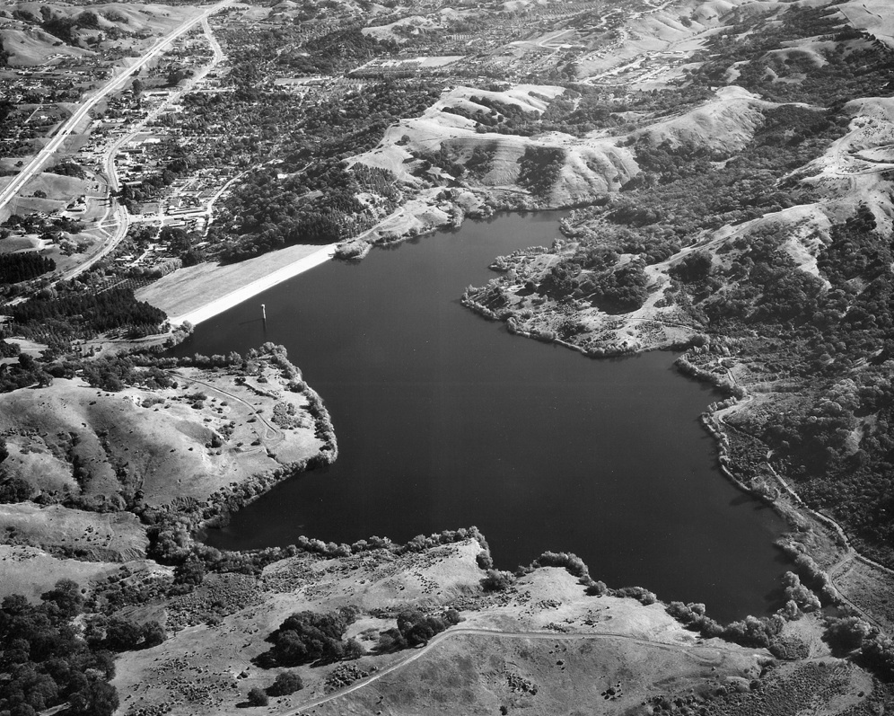
Lafayette Reservoir, seen here in a south view with Mount Diablo Boulevard from 1939, was completed in 1928 by the East Bay Municipal Utility District. The landmark now serves as a recreation area as well. Central Moraga is visible toward the upper left corner.
H60-Commercial and Photo Co. Photo, Courtesy East Bay Municipal Utility District, P-TR-716 , (Image 14 of 15)
This east view from the late 1960s with Lafayette Reservoir completes the transformation of Lafayette from a small town to an incorporated city. More on this later ....
H65-Herrington-Olsen Photo, Courtesy East Bay Municipal Utility District, P-TR-1519, (Image 15 of 15)