George Russell IX – Caterpillar, Canning and Pencils in San Leandro
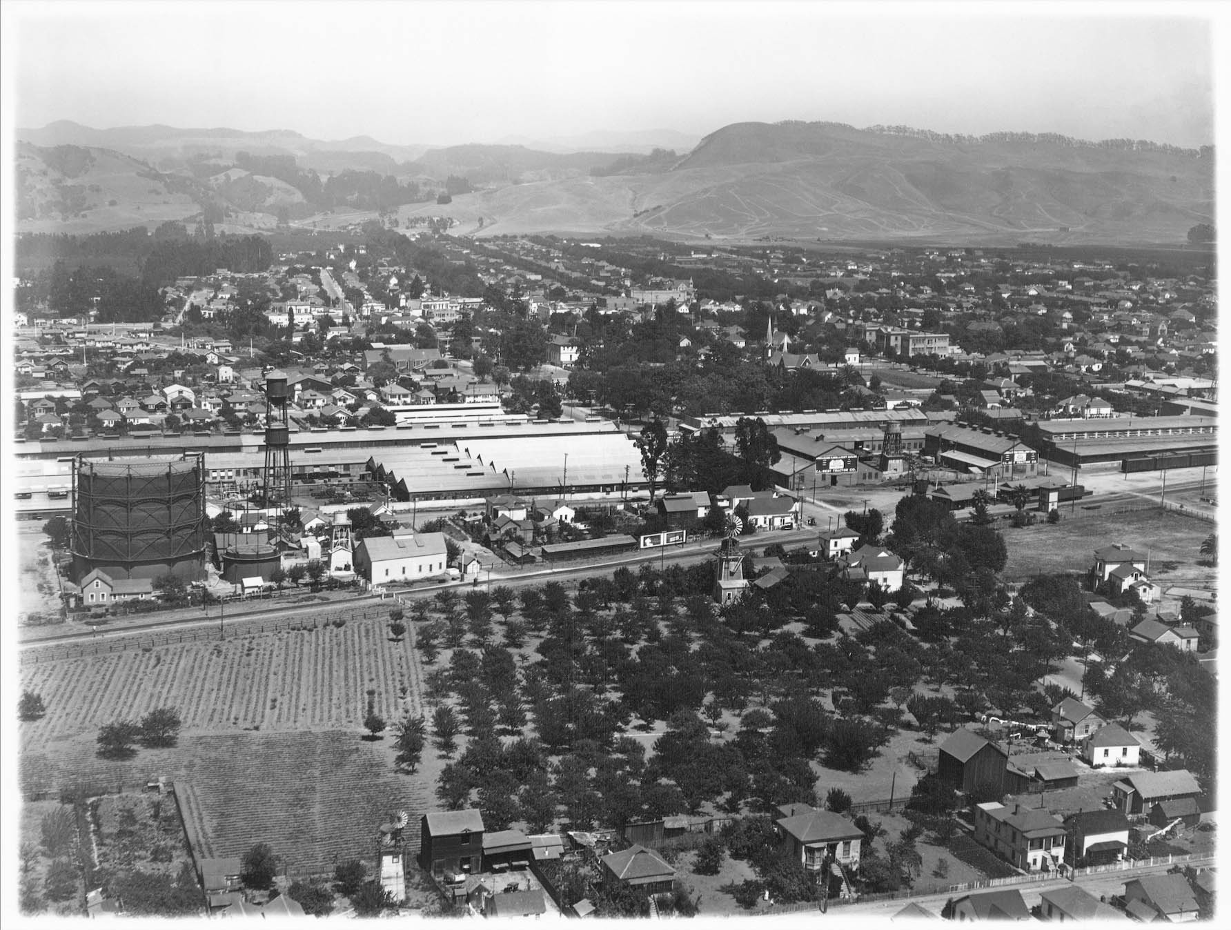
After ending at San Leandro Creek at the Oakland-San Leandro border circa 1930 in the last update, George Russell heads further southeast over San Leandro, and turn his view toward the northwest just above Thornton St., seen running across the lower margin.
L268-05-George Russell Photo, Courtesy the California State Lands Commission, API 651 64 BOX 91-95, (Image 1 of 24)

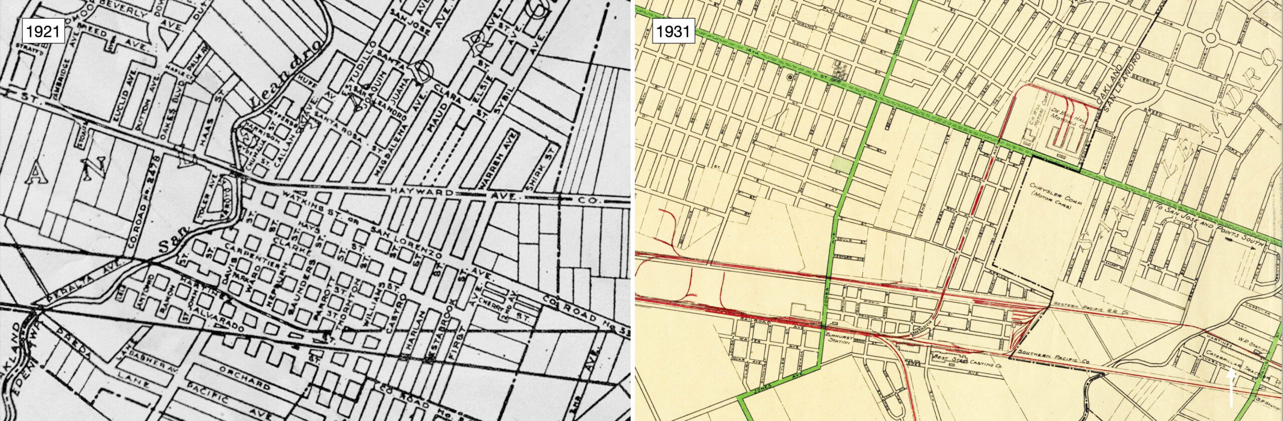
The map from 1921 provides the street names, while the edge of the 1931 map positions the huge Caterpillar Tractor Co. complex, white arrow, between the Western Pacific, WP, and Southern Pacific, SP railroads. Note the positions indicated for the SP and WP San Leandro stations relative to Davis St. in the latter map. This area is very easy to recognize in aerials as the two rail lines are converging heading south, and once past the area where the stations were located, the rail lines diverge heading south.
L268-10-Central National Bank Map, Courtesy BAERA, W. Railway Museum Arch., 83537, l, and 106539, r, (Image 2 of 24)
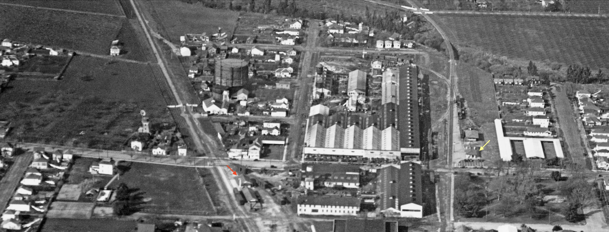
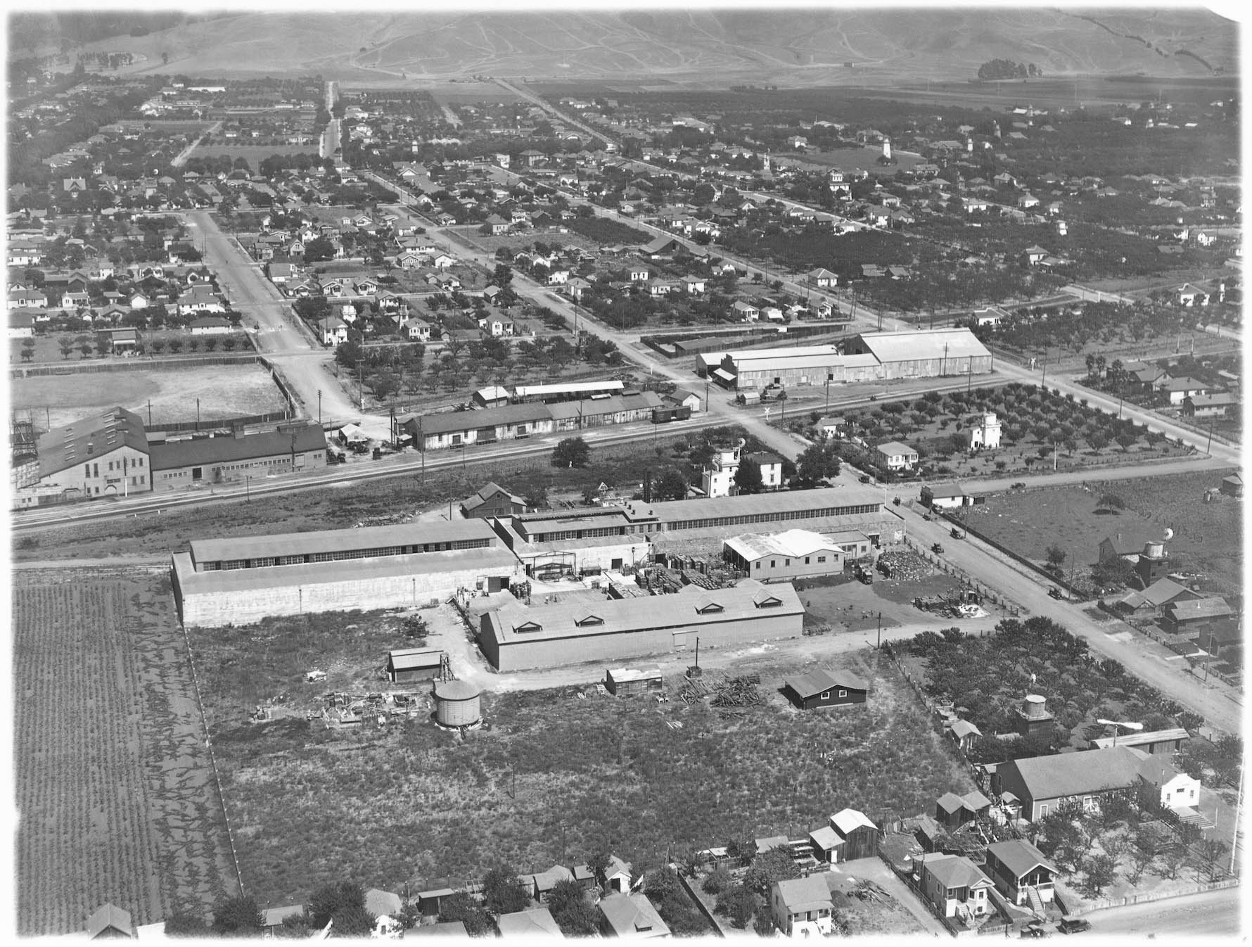
A detail from the previous northwest view circa 1930 shows Caterpillar Tractor Co. on both sides of Davis St., and the location of the SP station, orange arrow, and WP station, yellow arrow, in agreement with the previous map. Note the location of a freight depot to the south of the SP station with boxcars along the loading platform, and the WP freight depot to the north of its station, with a boxcar along side.
L268-15-George Russell Photo, Courtesy the California State Lands Commission, API 651 64 BOX 91-95, (Image 3 of 24)
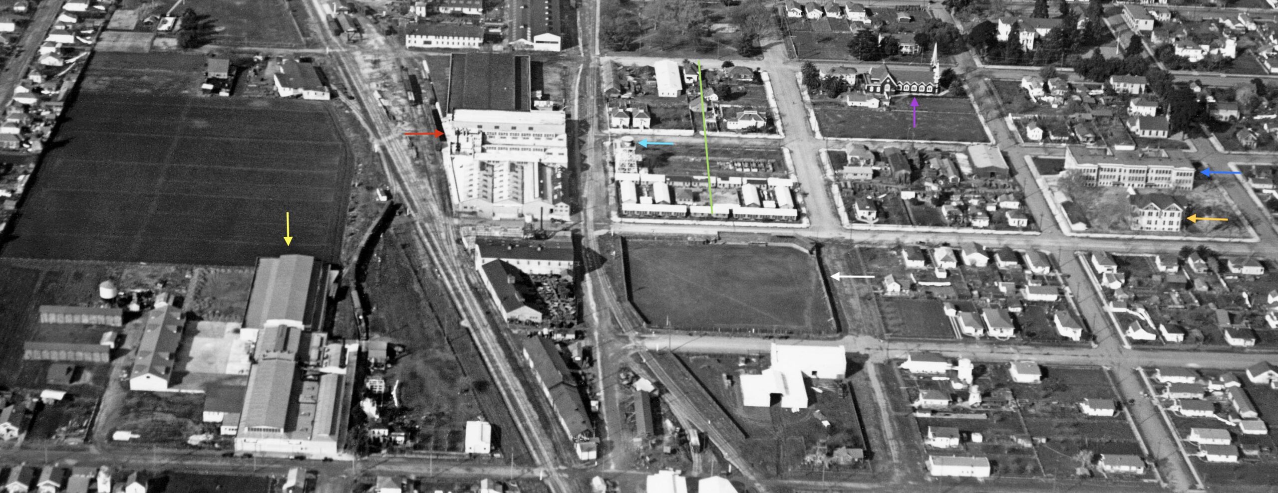
This second detail shows H. Prince and Co., Division of California Packing Corp., Cannery No. 27, 800 Thornton St., yellow arrow, and California Packing Corp. Plant No. 8, 752 Saunders St., red arrow. The latter cannery spanned over the WP and Martinez St., the water tower inscribed with “Del Monte”, turquoise arrow. The green line shows the length and position of the future San Leandro BART station. The San Leandro Baseball Club stadium, white arrow, St. Leander Catholic Church, purple arrow, the school Annex, orange arrow, and Lincoln School, blue arrow, will be discussed very shortly.
L268-20-George Russell Photo, Courtesy the California State Lands Commission, API 651 64 BOX 91-95, (Image 4 of 24)
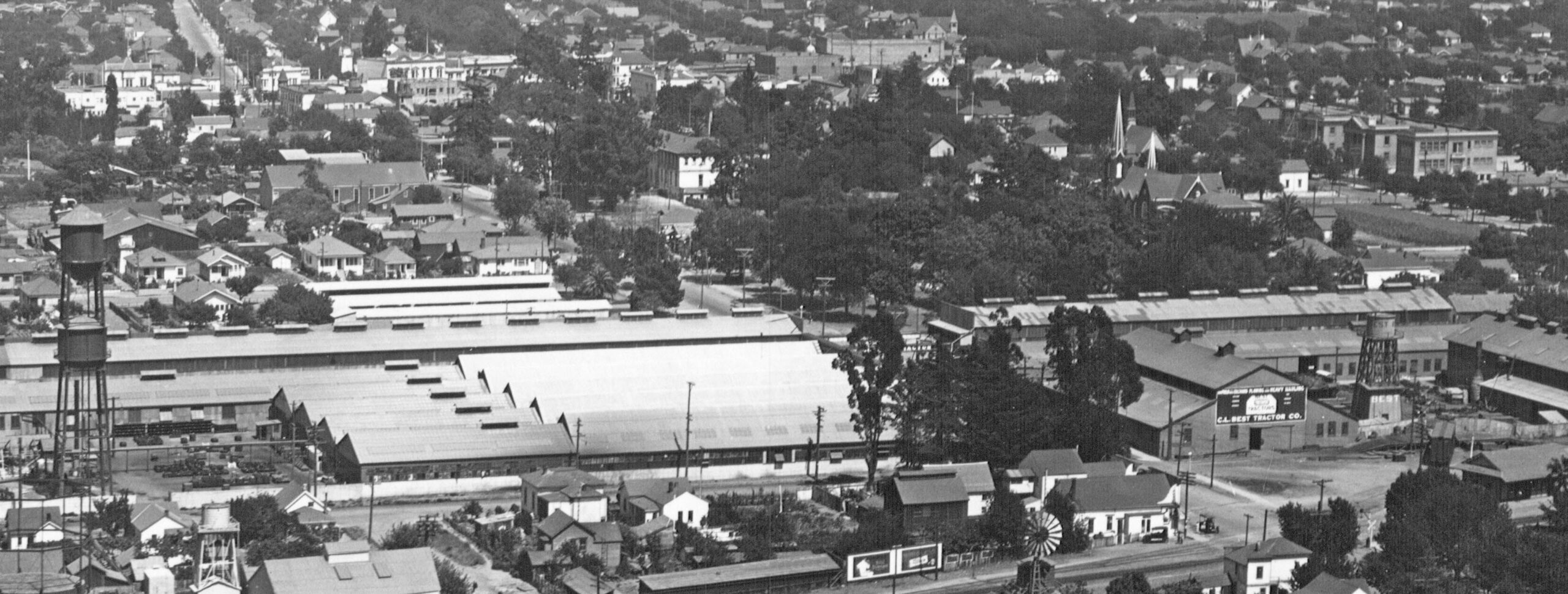
This northeast view circa 1930 allows examination of the major lettered board on the plant. A detail follows.
L268-25-George Russell Photo, Courtesy the California State Lands Commission, SLC 632 NoDate 5, (Image 5 of 24)
The sign on the south side of Davis St., center right, reads C. L. Best Tractor Co. Son of inventor Daniel Best, Clarence Leo Best followed years of failure with success, and established C. L. Best Traction Co. He purchased his dad’s former plant in 1916, and in the early 1920s, changed the name to C. L. Best Tractor Co. Best merged with the Holt Manufacturing Co. of Stockton in 1925, the latter having bought out his dad’s business in 1908. This created Caterpillar, and C.L. Best stayed on as chairman until his death in 1951.
L268-30-George Russell Photo, Courtesy the California State Lands Commission, SLC 632 NoDate 5, (Image 6 of 24)
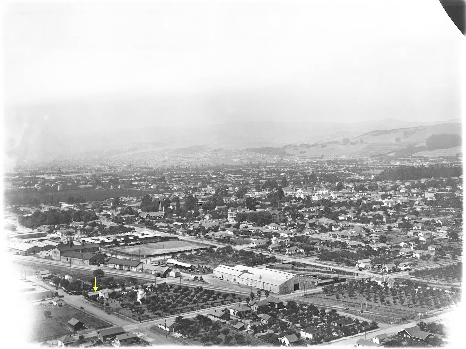
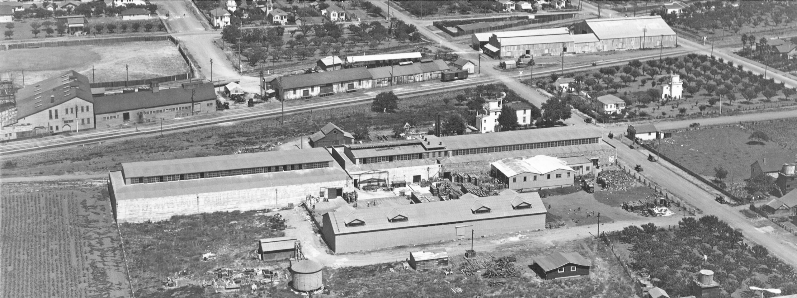
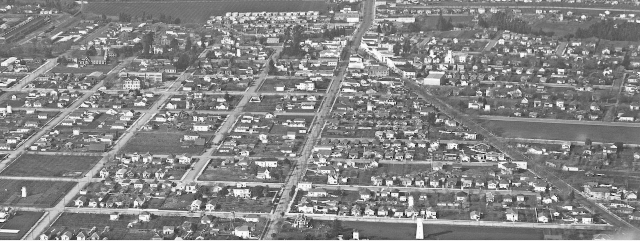
Further south, Russell provides a northwest view across San Leandro. Note where the two railroad lines are diverging, with Thornton St. marked by the yellow arrow.
L268-35-George Russell Photo, Courtesy the California State Lands Commission, API 623 2 BOX 94, (Image 7 of 24)
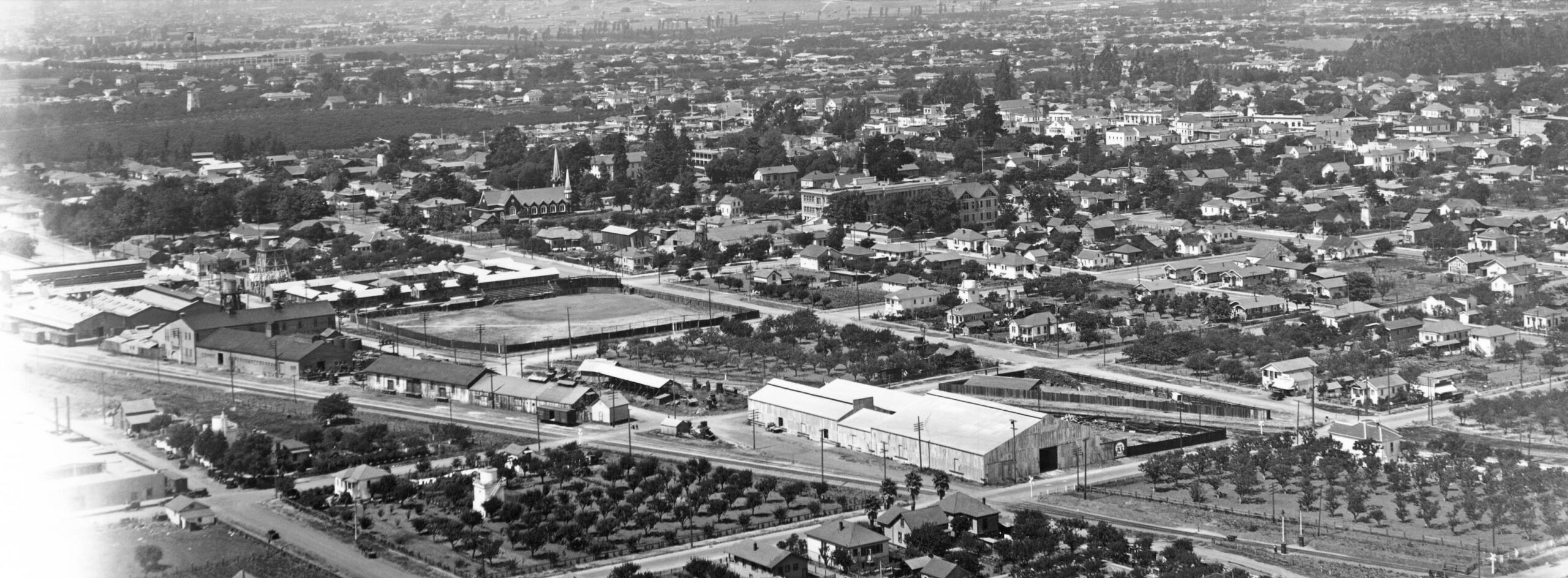
A north view further south ca. 1930 reveals the rear of a large warehouse sitting between the railroads, corresponding to the the 1938 reverse directory entry for no. 689 Thornton St., Fred Schmidt Estate warehouse. According to Cynthia Simons “San Leandro”, the baseball stadium was built in 1909. The Annex was built in 1885 to supplement the original Union School, and was all that remained from the 19th century when the Lincoln School was built in 1910.
L268-40-George Russell Photo, Courtesy the California State Lands Commission, API 623 2 BOX 94, (Image 8 of 24)
A second detail focusing on the buildings to the east of the factory shows the original gothic structure of St. Leander Catholic Church, completed in 1864. It was replaced in 1957 by the larger structure across today’s W. Estudillo Ave. The Portuguese History Museum of San Jose’s website states that “St. Leander’s is considered the third oldest parish in the East Bay, behind St. Joseph’s in Mission San José and St. Mary’s in Oakland.” See https://portuguesemuseum.org/
L268-45-George Russell Photo, Courtesy the California State Lands Commission, API 623 2 BOX 94, (Image 9 of 24)
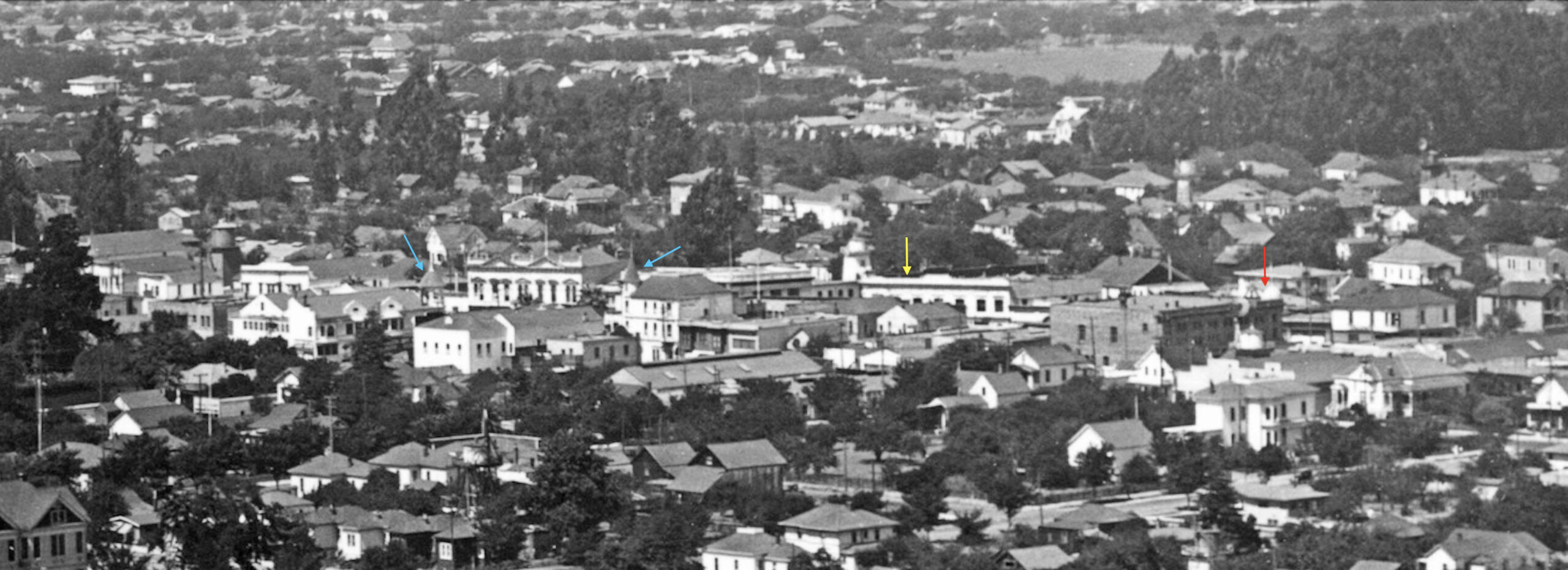
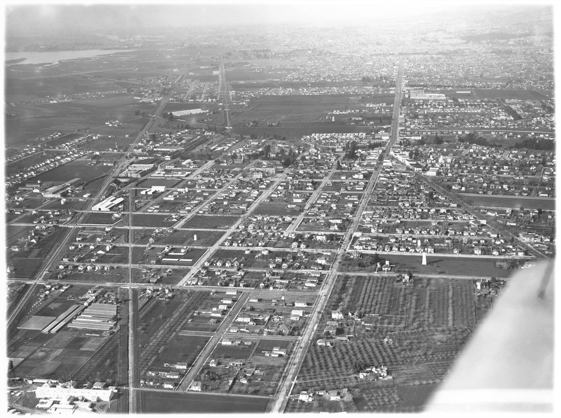
Further east, another detail showing the center of San Leandro. The yellow arrow points to the Best Building at E. 14th St. and Estudillo Ave., and the red arrow to the domed Masonic Temple at E. 14th St. and West Joaquin Ave., two structures completed in 1910 and still standing in 2022. Cynthia Simons notes that Daniel Best built the building after he retired from manufacturing where it would serve as a bank. The theater he constructed was just to the right, mostly obscured in this view. Also note the cupolas of the two buildings built by the local merchant Herrscher family in the 1890s, turquoise arrows, located on San Leandro Plaza.
L268-50-George Russell Photo, Courtesy the California State Lands Commission, API 623 2 BOX 94, (Image 10 of 24)
Russell then positioned his aircraft to the northeast to reveal two of the warehouses already discussed. See the next detail.
L268-55-George Russell Photo, Courtesy the California State Lands Commission, SLC 632 NoDate 4, (Image 11 of 24)
The southern flank of H. Prince and Co., Division of California Packing Co. California Packing Corp. Plant no. 8, sits in the foreground, with the Thornton St.-side of Fred Schmidt Estate warehouse to the northeast or right rear. The occupants of the smaller buildings north or to the left of the latter have not been identified.
L268-60-George Russell Photo, Courtesy the California State Lands Commission, SLC 632 NoDate 4 , (Image 12 of 24)
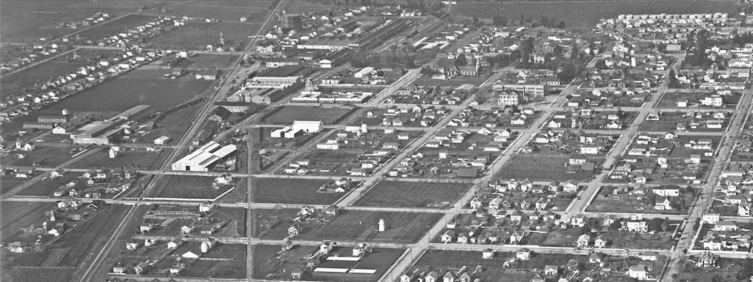
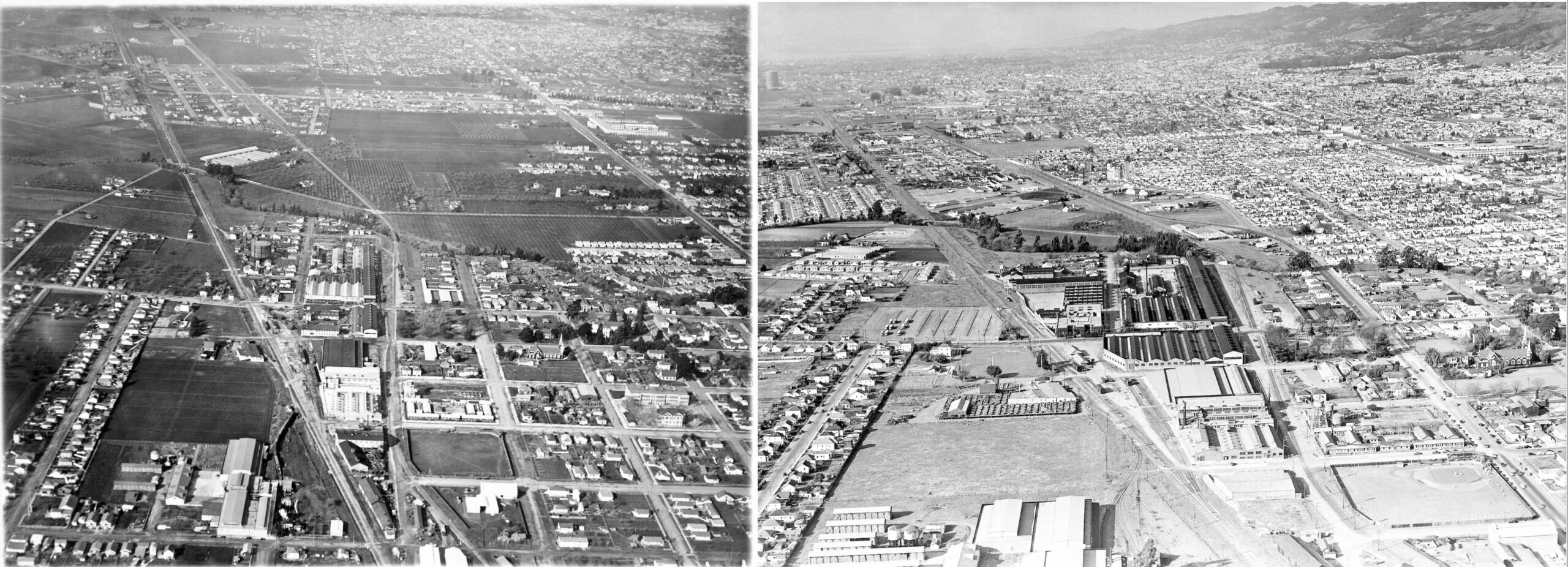
Further to the southeast, a northwest view shows the railroads further diverging on the left or west side of the image, and San Lorenzo Ave. diverging from Hayward Ave., in 2022, Washington Ave. and E. 14th St., respectively, on the right or east side. The lower edge approximates where San Leandro Blvd. crosses Washington Ave. in 2022.
L268-65-George Russell Photo, Courtesy the California State Lands Commission, API 623 3 BOX 94, (Image 13 of 24)
A detailed view from the last image focusing of the western portion of the area just reviewed …
L268-70-George Russell Photo, Courtesy the California State Lands Commission, API 623 3 BOX 94, (Image 14 of 24)
… and the eastern portion, providing a panoramic view of the city.
L268-75-George Russell Photo, Courtesy the California State Lands Commission, API 623 3 BOX 94, (Image 15 of 24)
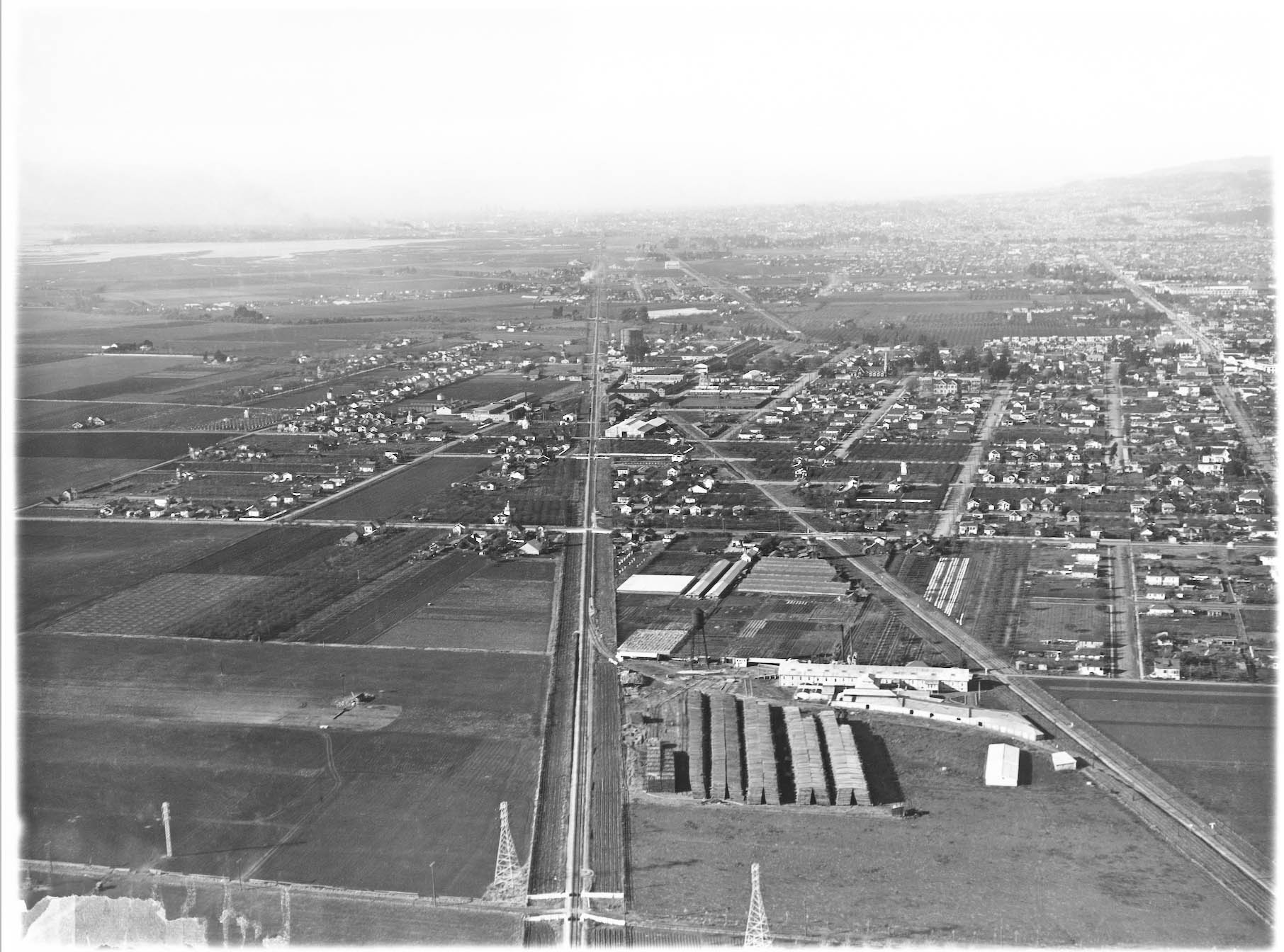
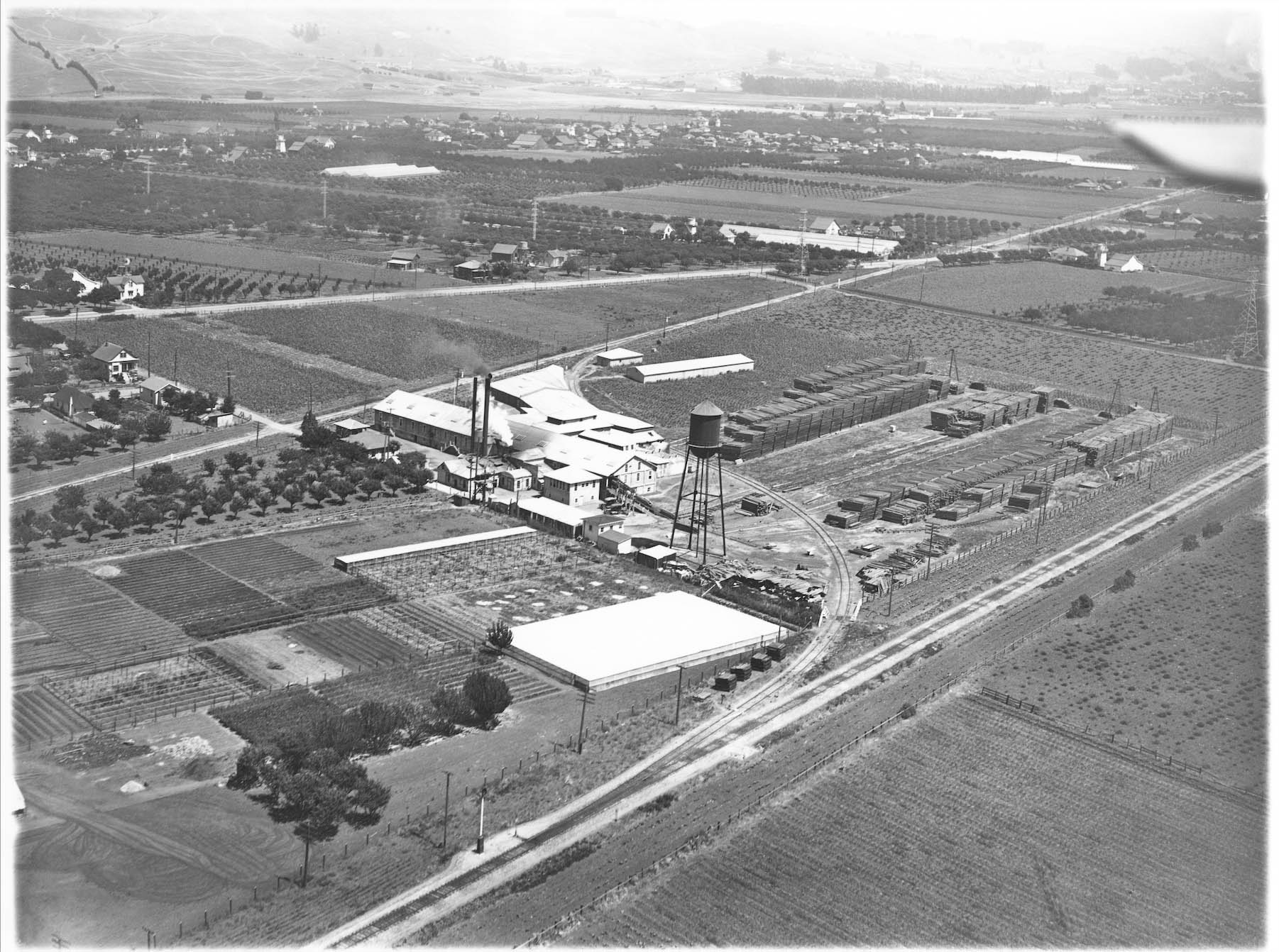
Further to the southeast, Russell set his gaze on another agricultural plot, and a large lumber mill filling the space created by the increasingly diverging railroad paths, northwest view, circa 1930.
L268-80-George Russell Photo, Courtesy the California State Lands Commission, API 623 1 BOX 94, (Image 16 of 24)
Using a previous image, this northwest view shows the Suyeyasu Nursery at 467 First Ave., or Wicks Lodge Rd., today Marina Blvd., seen running across the top edge. The identification was made using the Japanese American Nurseries Interactive Nursery Map. According to that website, the nursery operated from 1907 until after WWII, after which it was owned and operated by the Yokota family into the next century. See https://storymaps.arcgis.com/stories/895643e4706940d3b57b0efc216a26f7
L268-85-George Russell Photo, Courtesy the California State Lands Commission, API 623 3 BOX 94, (Image 17 of 24)
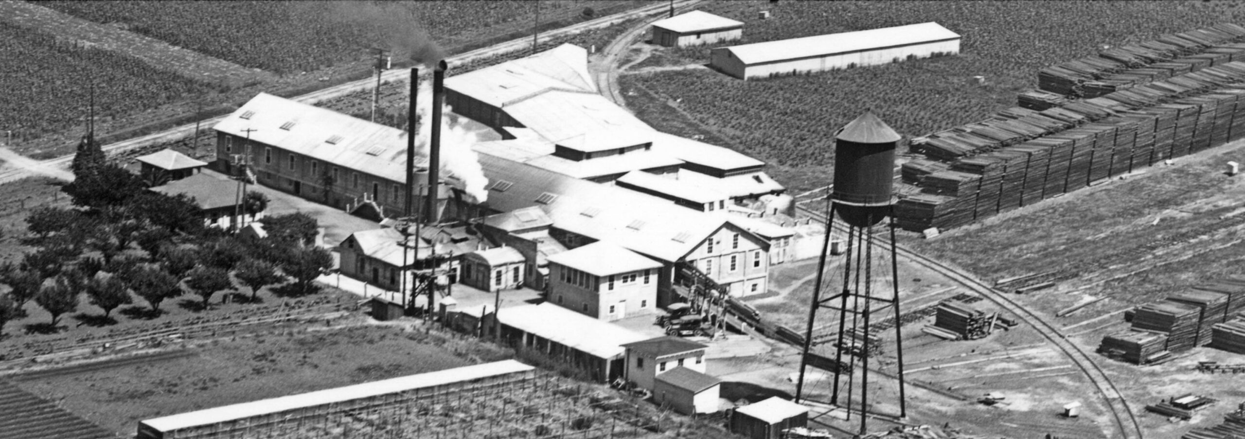
Sitting just to the east of the nursery, the slats of cedar identify this as Hudson Lumber Co., whose main product was the pencil slat, the wooden component used by pencil makers. A concise history of the growth of this industry as it ties into Hudson may be found at http://calcedar.com/company-history/
L268-90-George Russell Photo, Courtesy the California State Lands Commission, API 623 1 BOX 94, (Image 18 of 24)
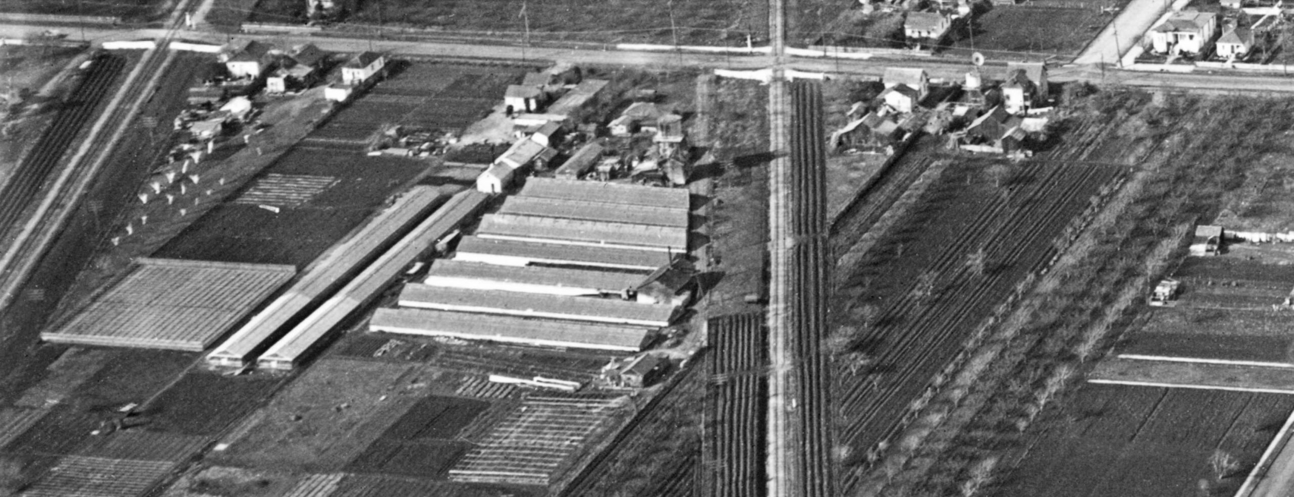
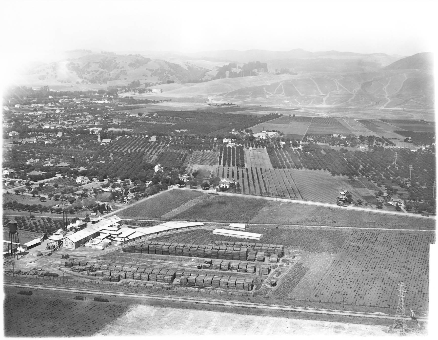
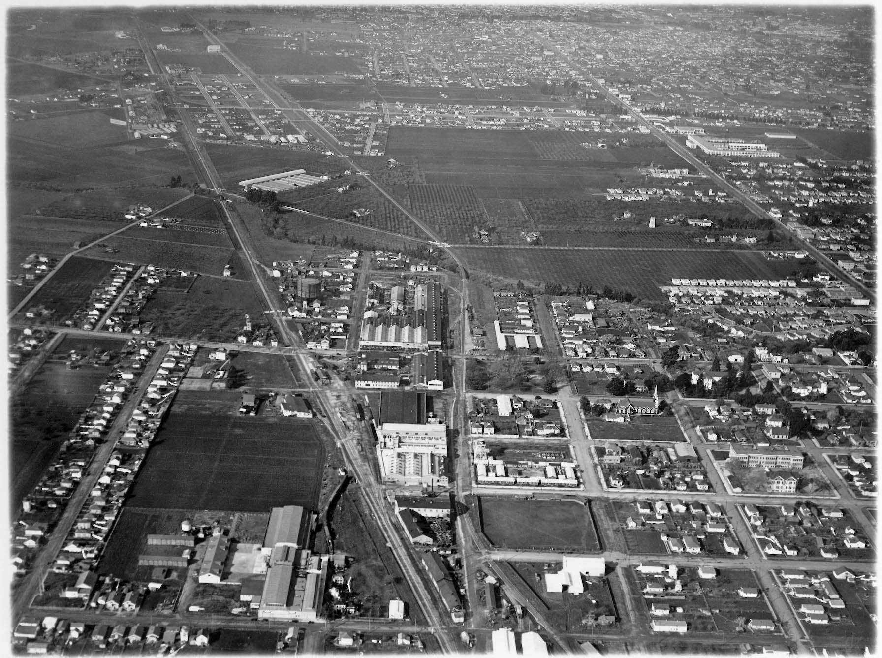
A northeast view of the same area circa 1930 is provided here, capturing the s-shaped track providing both railroads with yard access and an interconnection. Note how agricultural lands dominate the backdrop.
L268-95-George Russell Photo, Courtesy the California State Lands Commission, API 623 7 BOX 94, (Image 19 of 24)
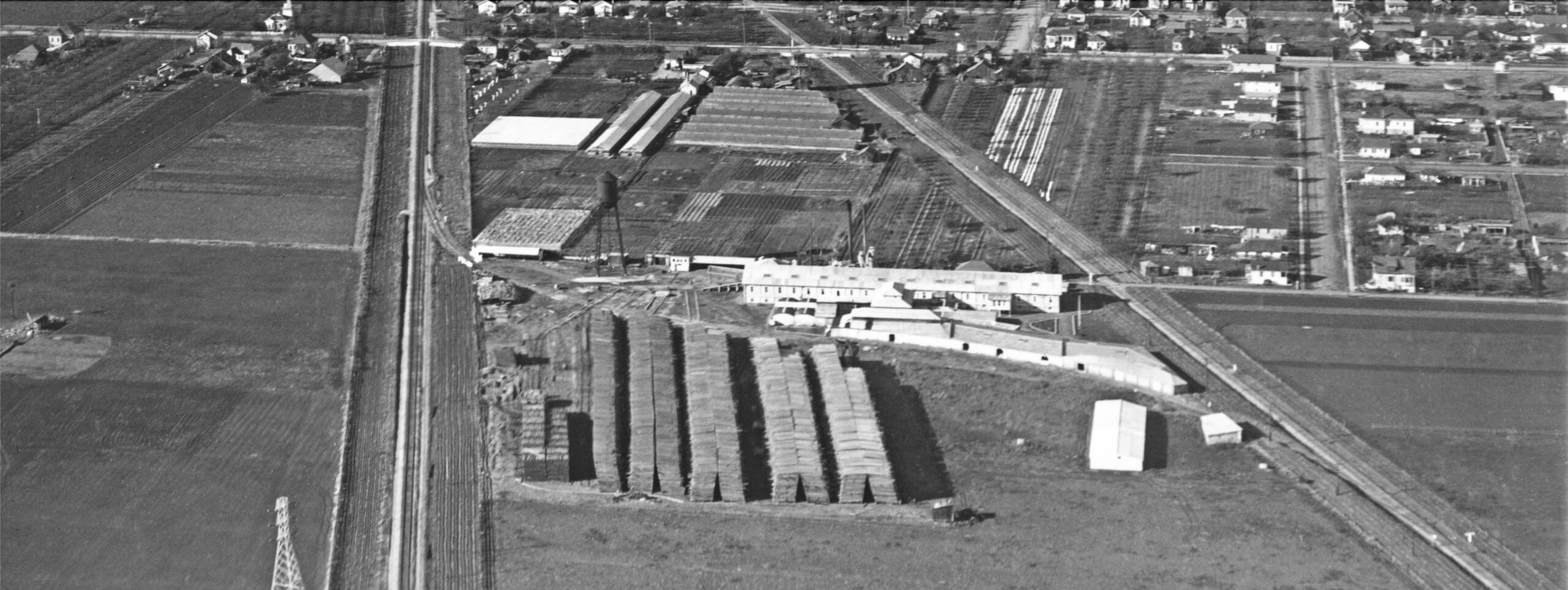
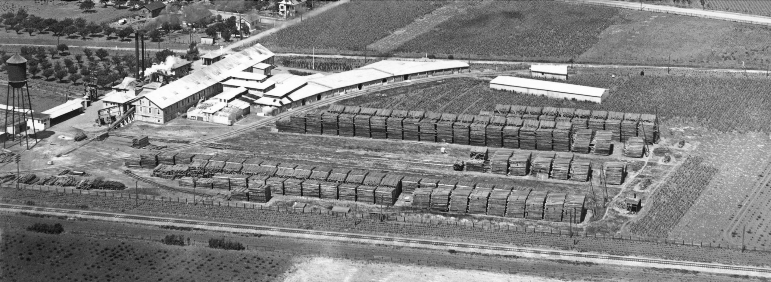
A detail from the previous image of the lumber company is shown here. Cynthia Simons wrote that Hudson was started in 1909 and lasted until 1998, when it could no longer compete with imports.
L268-100-George Russell Photo, Courtesy the California State Lands Commission, API 623 7 BOX 94, (Image 20 of 24)
One last set of views, here to the north showing the vast agricultural lands to the open East Bay hills and the area around Lake Chabot …
L268-105-George Russell Photo, Courtesy the California State Lands Commission, API 623 6 BOX 94, (Image 21 of 24)
… and more detail of the lumber mill.
L268-110-George Russell Photo, Courtesy the California State Lands Commission, API 623 6 BOX 94, (Image 22 of 24)
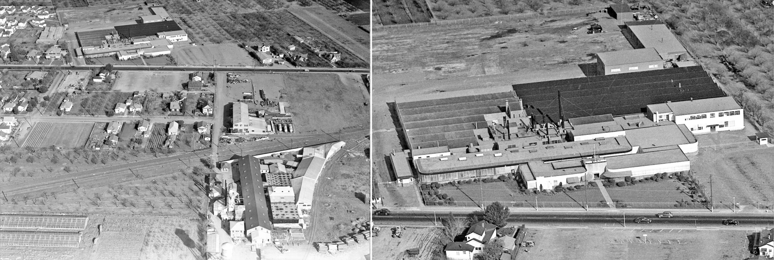
The first bonus view is a northeast view above Hudson Lumber circa 1945 showing its new neighbors. Immediately to the north of the WP tracks and siding with all the metal drums and storage tanks is Inter-Coastal Paint, mostly known for two explosions occurring there, the second blast 11 years after the first as reported in the Oakland Tribune, Sept. 13, 1962. To the north of Washington Ave. is Friden Calculators, shown in more detail on the right. Friden started the company in 1934 in Oakland, and it migrated here for larger space around 1937.
L268-115-Sappers Collection, Courtesy BAERA, Western Railway Museum Archives, 154054cv , (Image 23 of 24)
Another bonus aerial is the right northwest view from circa 1945 to compare to the one presented initially in this presentation circa 1930 on the left. And with that, George Russell’s flight review from Yerba Buena Island to San Leandro has concluded. More of Russell’s flights north of the SP Oakland Pier in the future.
L268-120-Sappers Collection, Courtesy BAERA, Western Railway Museum Archives, 154055cv , (Image 24 of 24)