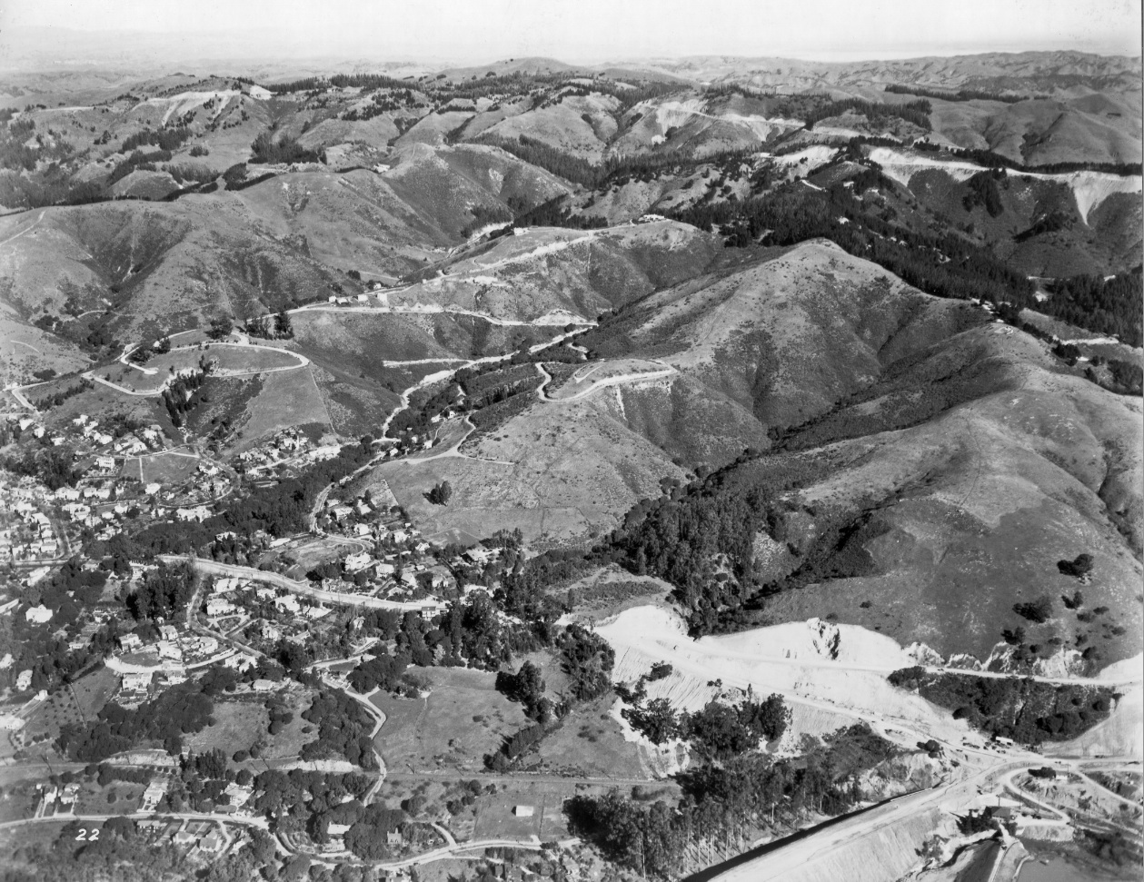
Chabot Canyon
Viewed east from the trestle at Chabot Rd. and the construction of Broadway in 1935, Chabot Canyon presented a 4.6% grade for the SN to climb to reach Lake Temescal. Detail from A5. Also courtesy Fred Booker; EBRPD Ref. USNPS-7-B
B5-HJW Geospatial Inc, Pacific Aerial Surveys, Oakland CA, Courtesy East Bay Regional Park District, (Image 1 of 14)

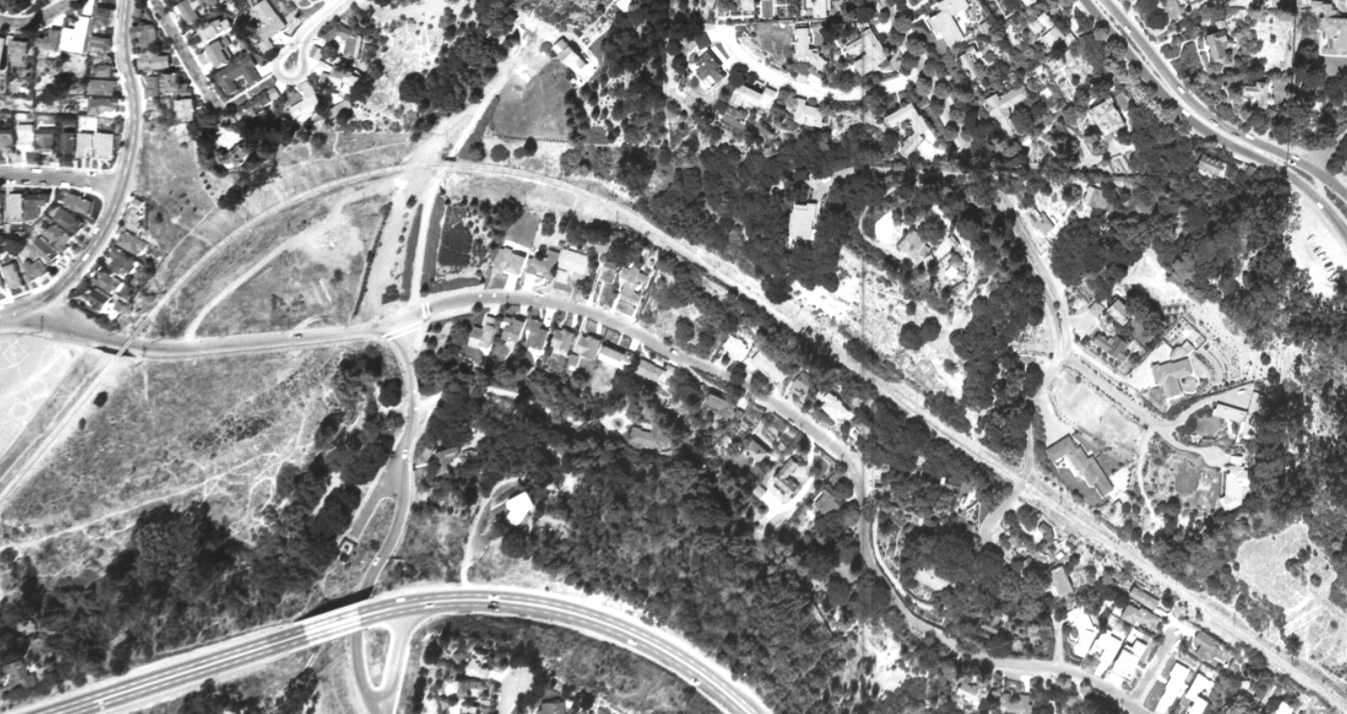
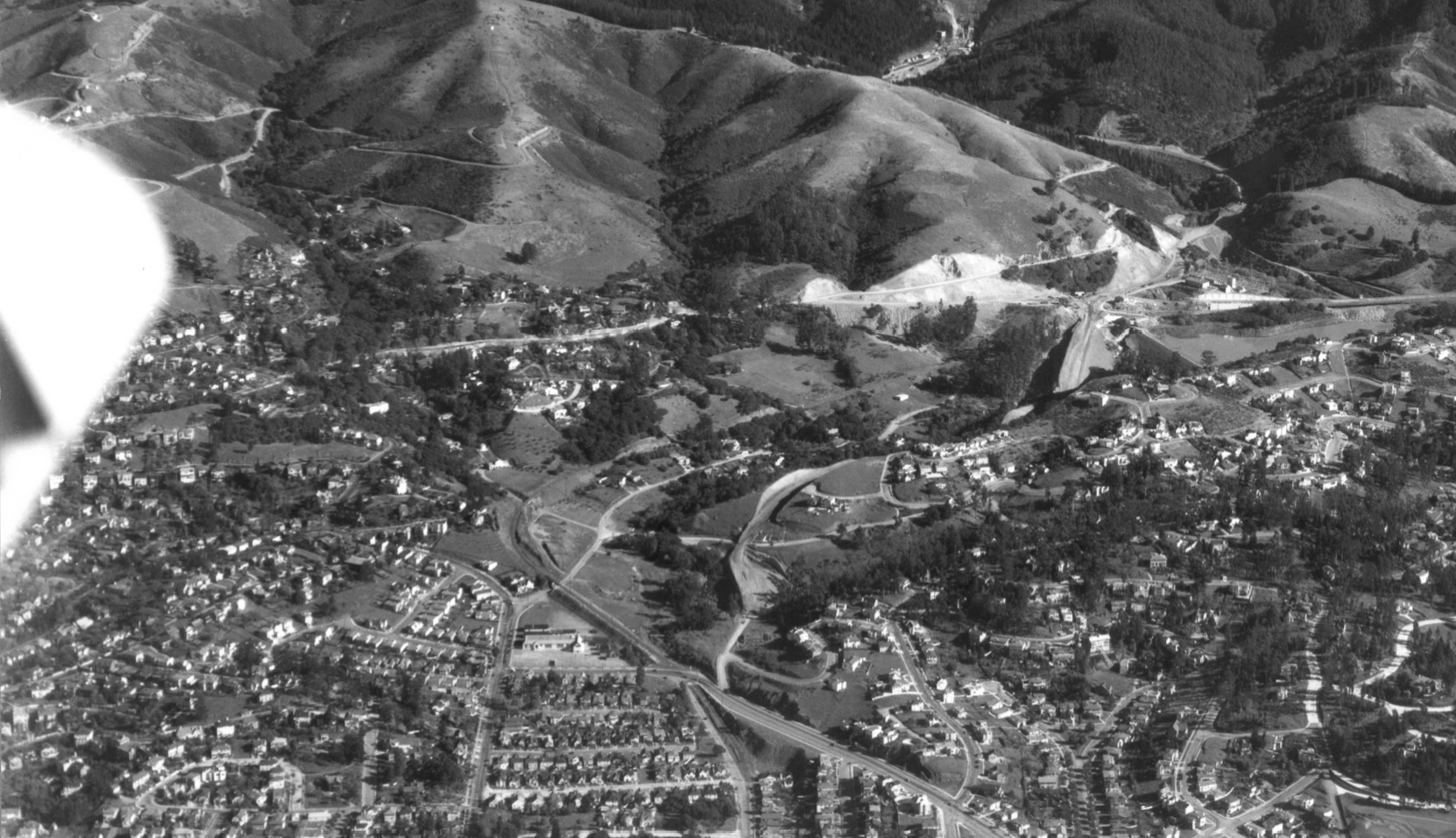
Chabot Canyon consisted of Rockridge Curve and Temescal Cut, the former name reflecting the alignment of Broadway, Chabot Rd. and the SN along the Berkeley border, the latter as a carved out path for the SN to the lake. Note Tunnel Rd. at the top right, and Roble Rd., right middle. Ref. G4364_B5_A4_1956_R6_no.117-2
B10-RM Towill Photo, Courtesy Earth Sciences and Map Library, University of California, Berkeley, (Image 2 of 14)
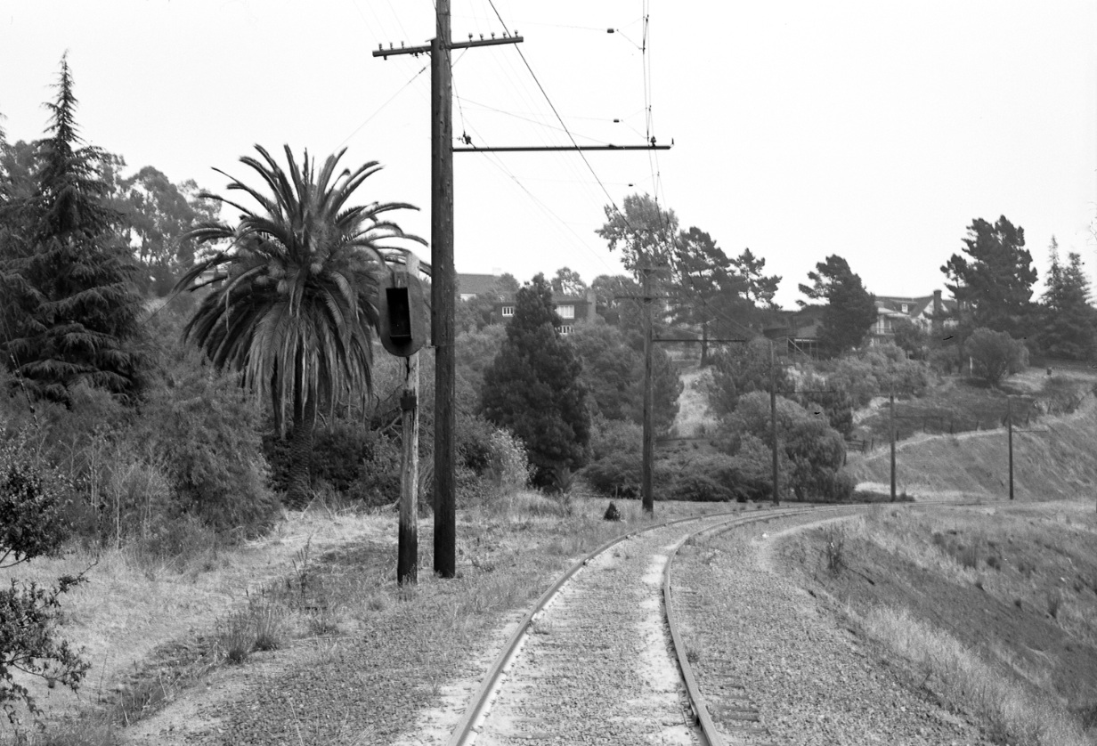
Rockridge Curve had several important landmarks, one of the most memorable was a palm tree that seemed to find its way into every image, including this east view from the 1950s.
B15-Harre Demoro Photo, Courtesy John Harder, (Image 3 of 14)
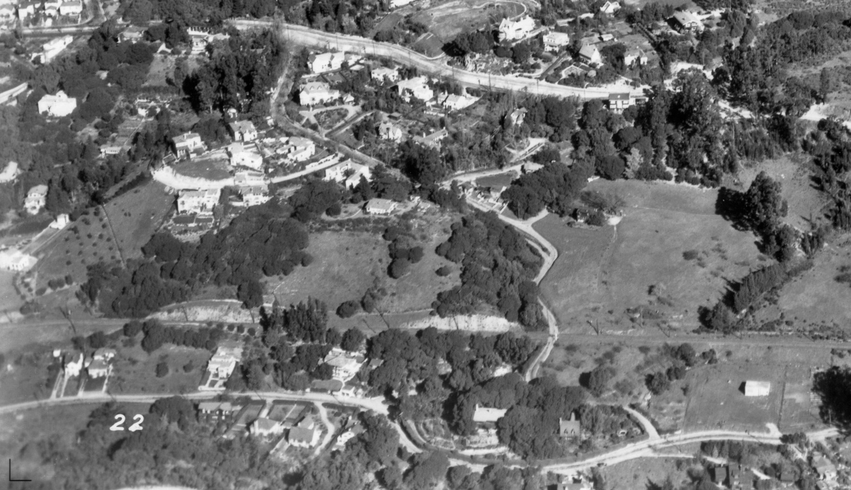
In contrast to Rockridge Curve, this 1956 east-oriented view of Temescal Cut documents the serpentine paths of Broadway, from middle left, and Chabot Rd., top left, as they converge deeper into Chabot Canyon with the SN and Landvale Rd., bottom right. Ref. G4364_B5_A4_1956_R6_no.117-2
B20-RM Towill Photo, Courtesy Earth Sciences and Map Library, University of California, Berkeley, (Image 4 of 14)
The appearance of Chabot Canyon was transformed in the 1930s as the Broadway Low Level Tunnel and associated roads were built. This June 1934 image of Chabot Canyon documents a north view of the tunnel groundbreaking ceremony.
B25-Copyright California Department of Transportation, B48, (Image 5 of 14)
A detail from B25 reveals another important landmark that was captured in most images, “The White House of Rockridge Curve”. More details about this landmark in the future.
B30-Copyright California Department of Transportation, Detail B48, (Image 6 of 14)
This 1935 view of Temescal Cut and the overlying Berkeley Hills provides documentation for the vast reconfiguration by the Joint Highway District 13 of the eastern end of the Canyon to provide new roads to the northern and eastern flanks of Lake Temescal and the new tunnel. EBRPD Ref. USNPS-7-C
B35-HJW Geospatial Inc, Pacific Aerial Surveys, Oakland CA, Courtesy East Bay Regional Park District, (Image 7 of 14)
This detail of B35 captures the idyllic setting of Temescal Cut and the Roble Rd. SN crossing west of the road construction. EBRPD Ref. USNPS-7-C
B40-HJW Geospatial Inc, Pacific Aerial Surveys, Oakland CA, Courtesy East Bay Regional Park District, (Image 8 of 14)
This Nov. 29, 1937 west view of Chabot Canyon documents the completion of the approaches to the Broadway Low Level Tunnel just weeks before its official opening. A careful search reveals the Chabot Rd. trestle in the background.
B45-Copyright California Department of Transportation, 454-5, (Image 9 of 14)
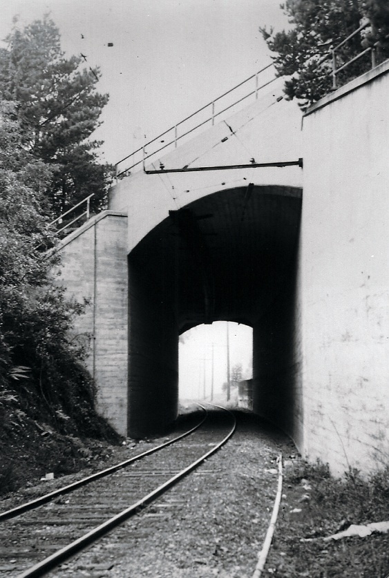
The extension of Broadway to the tunnel necessitated building an underpass for the SN to reach Lake Temescal, here in a foggy northwest view of the southeast wall.
B50-Grahame Hardy Collection, Courtesy California State Railroad Museum, CSRM 33349 , (Image 10 of 14)
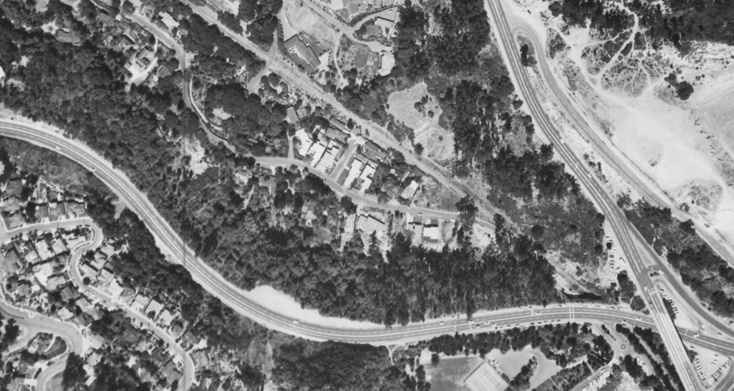
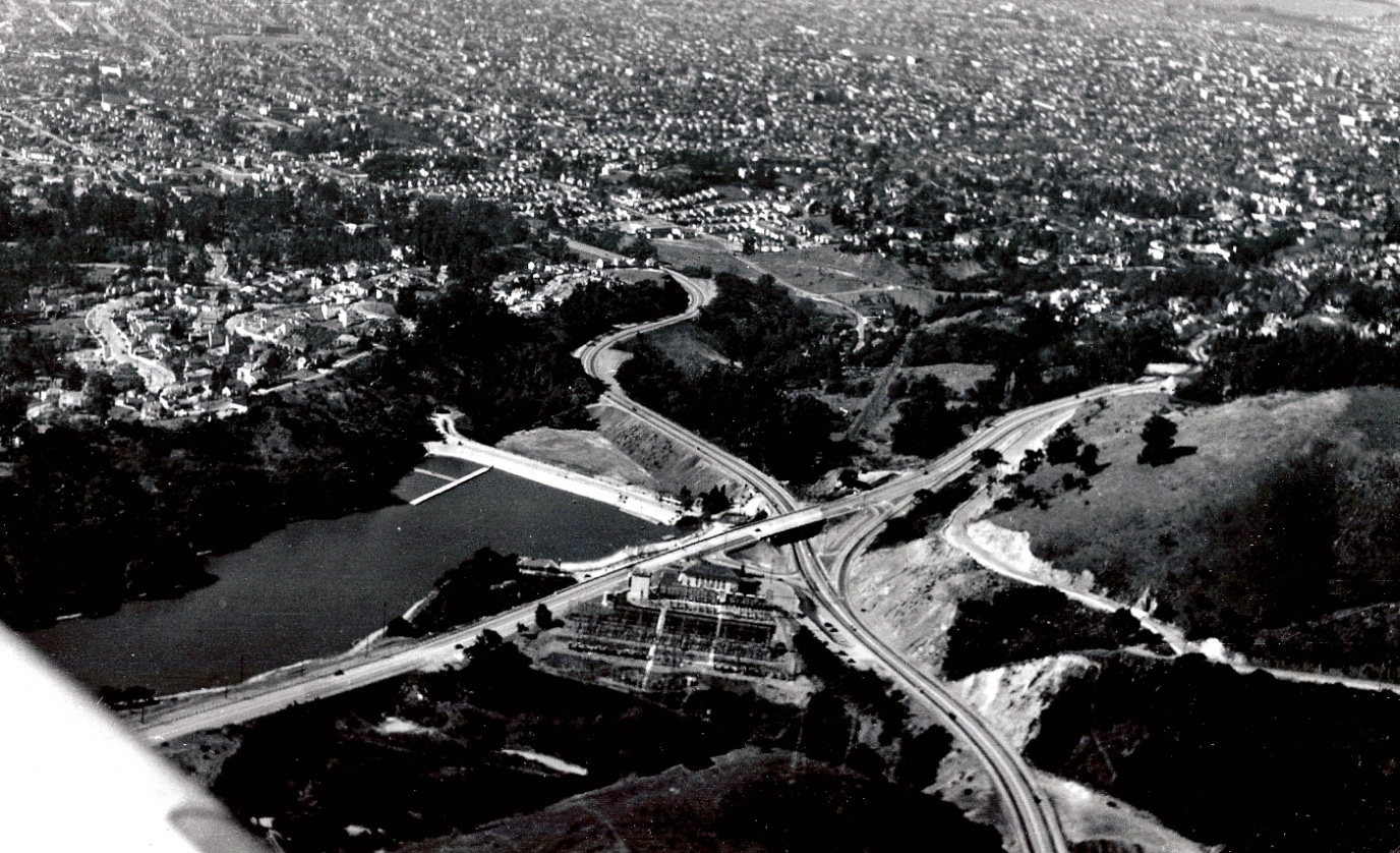
A look back toward the northwest of Chabot Canyon and Lake Temescal in 1939 captures the calm setting after the first transformation of the Canyon as a car and railroad thoroughfare; peace will prevail until the building of Highway 24 in the 1960s.
B55-Courtesy Oakland History Room, Oakland Public Library, F-268, (Image 11 of 14)
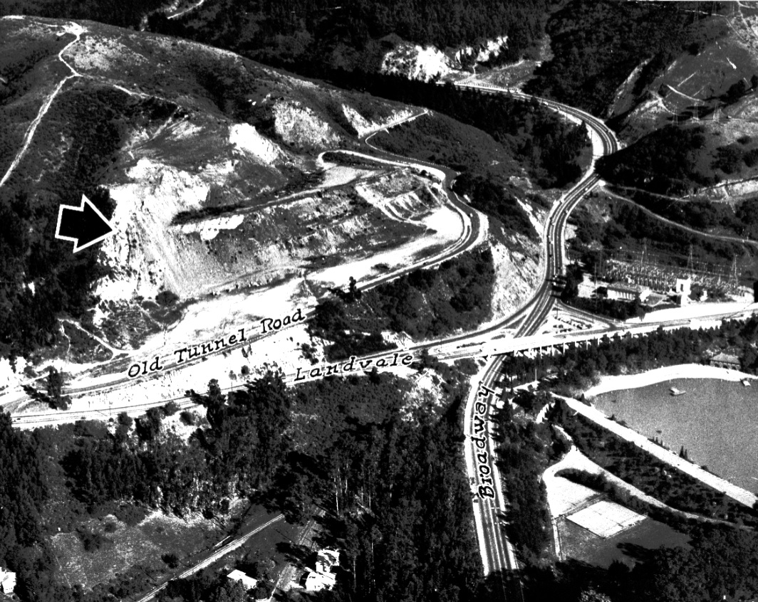
This Oct. 22, 1955 northeast view was printed by the Oakland Tribune to point to an abandoned 25 acre quarry along Tunnel Road that was slated for garden apartments and a shopping center - later to become Hiller Highlands. Also Gift of ANG Newspapers to OMC, OMC H96.1.310 6
B60-Russ Reed Photo, Courtesy Oakland Tribune Collection, the Oakland Museum of California, (Image 12 of 14)
A visual recap in the form of a northeast view from Apr. 8, 1953 of details that will be further examined in the future.
B65-Copyright California Department of Transportation, 3300-41, Detail, (Image 13 of 14)
A complementary visual recap in the form of a northwest view from Apr. 8, 1953 of details that will be further examined in the future.
B70-Copyright California Department of Transportation, 3301-19, Detail, (Image 14 of 14)