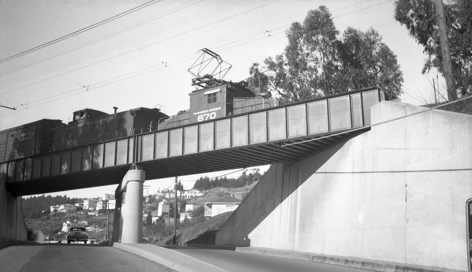
Before the Mountain Boulevard Overpass

The SN overpass over Mountain Blvd. was completed for $62,000 in 1936 based on an Oct 8, 1936 Oakland Tribune article reporting on the initiation of auto traffic below. The mystery is figuring what was there prior to this structure. North view of rear of freight with SN 670, ca. 1950.
L84-05-Tom Gray Photo, Courtesy Tom Gray, (Image 1 of 10)

Mountain Blvd. was completed in 1921, approximately 10 years after the Oakland, Antioch and Eastern Railway graded the right-of-way at this location. Documented images of this section prior to road completion have not been identified, and articles from 1920-21 do not state if a portion of the road preexisted here. Sept 23, 1953, South view.
L84-10-Public Works Photo, Oakland Cultural Heritage Survey, Oakland City Planning Department , (Image 2 of 10)

The earliest oblique view, east-facing from 1929, shows a trestle, yellow arrow, that extended beyond the road to approximate the uneven southeast hillside. Montclair Elementary School, red arrow, Montclair SN station at La Salle Ave. (then Hampton Place), blue arrow.
L84-15-Courtesy History Room, Oakland Public Library, Fairchild Aerial Surveys, Inc., F-144 , (Image 3 of 10)

Enlargements of two east-facing oblique aerials from ca. 1935 are not much more helpful, although they both show the west abutment of the trestle, yellow arrow. Montclair Elementary School, red arrow, LaSalle Ave., blue arrow.
L84-20-HJW Geospatial Inc, Pacific Aerial Surveys, Oakland CA, Courtesy East Bay Regional Park Distr, (Image 4 of 10)

The second east-facing oblique aerials from ca. 1935 also shows the west abutment of the trestle, yellow arrow. Montclair Elementary School, red arrow, LaSalle Ave., blue arrow.
L84-25-HJW Geospatial Inc, Pacific Aerial Surveys, Oakland CA, Courtesy East Bay Regional Park Distr, (Image 5 of 10)

Originally mixed in with images from Broadway Terrace, Craig Sundstrom of Montclair identified the next two images to be of the construction of the Mountain Blvd. SN overpass in 1936, this one a southwest view showing either a temporary trestle or the old trestle with the new overpass being positioned to the west.
L84-30-Public Works Photo, Oakland Cultural Heritage Survey, Oakland City Planning Department, (Image 6 of 10)

This northeast view complements L84-35, but does not reveal if the wooden trestle is a temporary structure or the original structure, and, conversely, whether the overpass abutments approximate the original right-of-way or a slight shift to the west.
L84-35-Public Works Photo, Oakland Cultural Heritage Survey, Oakland City Planning Department, (Image 7 of 10)

After the overpass was built, it became of favorite of photographers, particularly a northwest view from the south capturing both the fire station and the Montclair Park administration building, here with SN 1008 from 1940 ...
L84-40-Kenneth C Jenkins Photo, 46502, Courtesy Garth Groff, (Image 8 of 10)

... or a northwest view from the south capturing both the fire station and the south end of Montclair Park, and the block signal, here with SN 1015 and 1022 from May, 1941.
L84-45-Addison Laflin Photo, Courtesy BAERA, Western Railway Museum Archives, 18860sn, (Image 9 of 10)

Views of the entire SN overpass from a distance are particularly rare, here a southwest view of an SN motor and wrecker on assignment to service a derailed freight, April 2, 1942.
L84-50-Courtesy BAERA, Western Railway Museum Archives, 77084sn, (Image 10 of 10)