Along the Atichson, Topeka and the Santa Fe

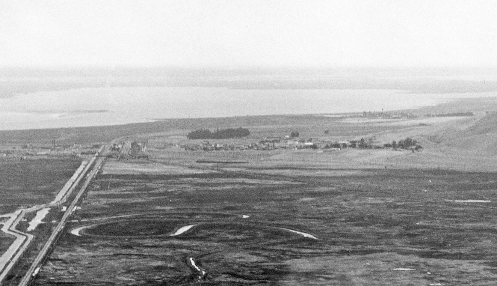
This update will feature the section between Bay Point or Port Chicago and Nichols. George Russell’s northeast oblique aerial circa 1929 shows the town of Bay Point in the center of the image and the town of Nichols in the upper right corner. Note the stands of trees that served as wind breaks for each town.
L170-05-George Russell Photo, Courtesy the California State Lands Commission, API 563 7 BOX 59, (Image 1 of 13)

The area was primarily agricultural before the Navy took it over in WWII, and was not of much interest to aerial photographers. Although somewhat remote, excursion trips on the SN allowed photographers to document the railroad neighbor to the north, the Atchison, Topeka and the Santa Fe. Amtrak still uses the latter track, but the area is not accessible by foot or car.
L170-10-Courtesy Earth Sciences and Map Library, University California, Berkeley, (Image 2 of 13)

Possibly the most detailed view of the area in question from a northeast oblique aerial circa 1929.
L170-15-George Russell Photo, Courtesy the California State Lands Commission API 563 8 BOX 59, (Image 3 of 13)

From the east end of the Port Chicago station area, here shown in an east view from 1957, the SN tracks converged to form a single track as it headed to Nichols.
L170-20-EK Muller Photo, Courtesy BAERA, Western Railway Museum Archives, 94649sn, (Image 4 of 13)

Two BAERA-sponsored excursions were noteworthy for catching views of passing Santa Fe passenger trains. The first from Tom Gray, shown here with MW 302 in a northwest view from Sept. 12, 1948, shows rail fans in position to record the plume discharged from SF no. 3459. Note the SP boxcar in the background on the SP right-of-way.
L170-25-Tom Gray Photo, Courtesy Tom Gray, (Image 5 of 13)

Fred Matthews sacrificed having more fans in the way for a look at the whole Santa Fe train, a later sequence of the plume of smoke, and a more panoramic sense of the area. West view, Sept. 12, 1948.
L170-30-Fred Matthews Photo, Moreau Coll., Courtesy BAERA, Western Railway Museum Archives, 91458sn, (Image 6 of 13)

By the time this May 2, 1954 northwest view was taken on a similar excursion, the Santa Fe’s “Golden Gate” train service was under diesel power. That deserves a color shot …
L170-35-Dudley Thickens Photo, Courtesy BAERA, Western Railway Museum Archives, 121579sn, (Image 7 of 13)

… as shown here, May 2, 1954, northwest view.
L170-40-Courtesy BAERA, Western Railway Museum Archives, 121400sn, (Image 8 of 13)

Based on the mile 40 marker, this 1950s northeast image of SN 1005 on excursion was taken between Port Chicago and Nichols. Mile markers 39.3 and 41.1 marked Port Chicago and Nichols, respectively.
L170-45-Arthur Lloyd Photo, Courtesy Arthur Lloyd, (Image 9 of 13)

This section between Port Chicago and Nichols provided the space to build a slowly rising berm that allowed the Santa Fe to pass over the right-of-way of the Southern Pacific’s route and gain access to the coastline. Northwest view of MW 302 on a NORCAL-sponsored excursion, Sept. 18, 1949.
L170-50-EK Muller, Courtesy BAERA, Western Railway Museum Archives, 91055sn, (Image 10 of 13)

One matter of confusion of this section of railway was the placement of small trestles to accommodate small creeks. This northeast view circa 1948 had to have been taken between Nichols and McAvoy based on the mile marker, but this structure no longer exists.
L170-55-Tom Gray Photo, CourtesyTom Gray, (Image 11 of 13)

Placed upon this 2016 north-facing aerial is an early 20th century list of the location of a seemingly large number of trestles or bridges between Bay Point and West Pittsburg. Only two remain today. The white arrow points to an existing trestle west of Nichols, while the turquoise arrow points to a grade crossing in the expected position of the trestle shown in L170-55.
L170-60-Courtesy BAERA, Western Railway Museum 22974 and Bing Maps, (Image 12 of 13)

Here shown is a closer north-facing view from 2016 of the trestle east of Nichols.
L170-65-Courtesy Bing Maps, (Image 13 of 13)