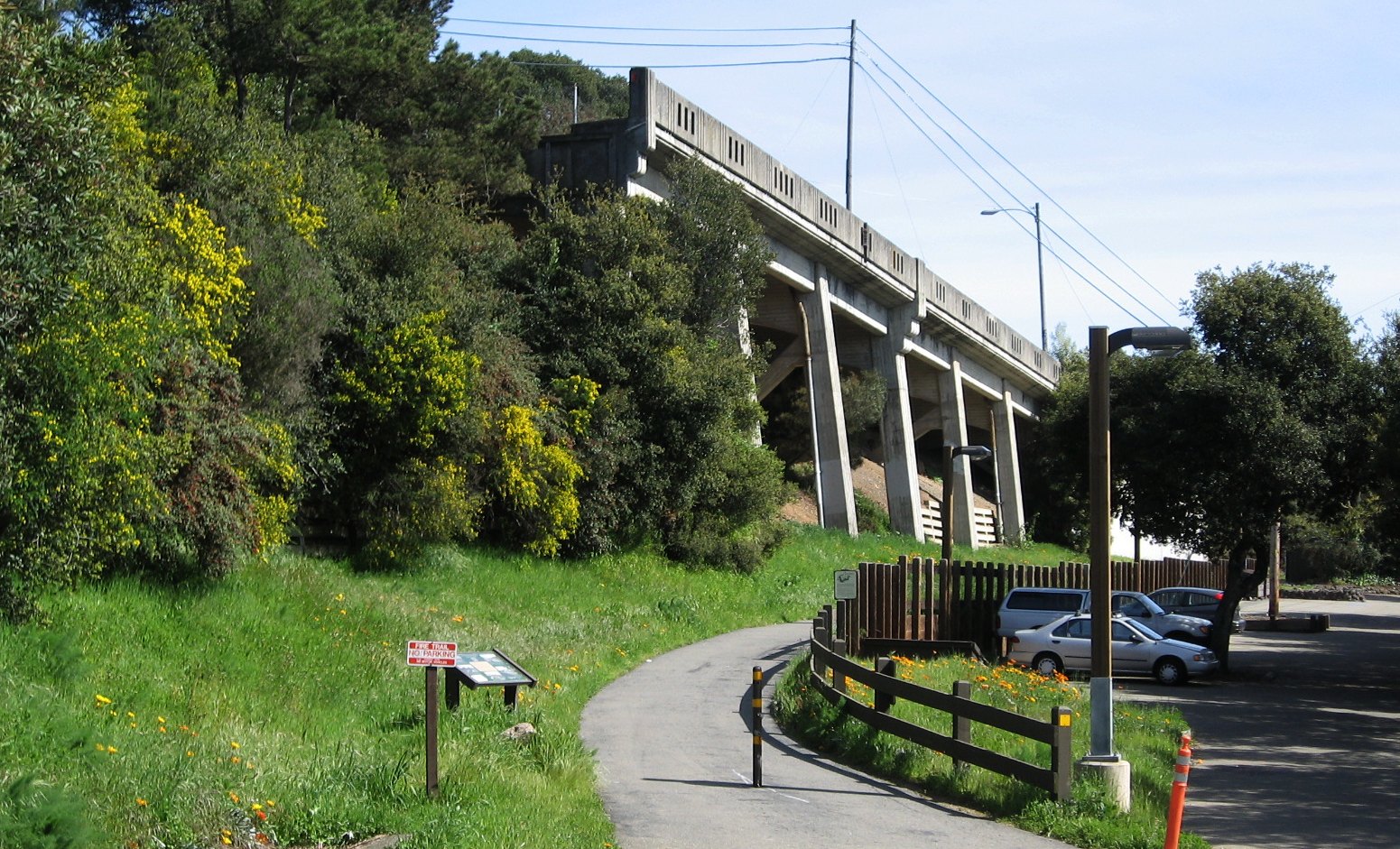
All Roads Lead to Temescal: Initial Construction in 1930s

This 2011 south view of the truncated Landvale Road dates back to a structure built in the 1930s when the configuration and access to Lake Temescal was altered during the construction of the Broadway Low Level Tunnel.
L2-05-Stuart Swiedler Photo, (Image 1 of 14)

The tunnel construction extended Broadway and shortened Chabot Road (red arrow), and extended Landvale road north to Old Tunnel Road (purple arrow.) The 1935 map fails to denote the elimination of the eastern finger of Lake Temescal. “Broadway Extension†refers to a pre-existing connection of Broadway to Chabot Road (blue arrow.)
L2-10-Courtesy Oakland History Room, Oakland Public Library , (Image 2 of 14)

Filling in the eastern finger of Lake Temescal meant elimination of the SN bridge, loss of trails and part of Chabot Road. Undated photo, east view.
L2-15-Louis L. Stein Collection, Courtesy East Bay Regional Park District and Fred Booker, (Image 3 of 14)

A southeast view from Chabot Canyon in the 1910s shows an open spillway from the dam. The structure’s alteration and its connection with Temescal Creek in Chabot Canyon requires further research. Note Old Tunnel Road at the upper left corner.
L2-20-Cheney Photo B-1319, Courtesy Ray Raineri , (Image 4 of 14)

The large amount of fill to extend Broadway can be gleamed from a comparison of this west view looking down Chabot Canyon from the northeast corner of Lake Temescal from Oct. 29, 1924 relative to the next image. The SN track is barely visible, but the next image will help locate it.
L2-25-Courtesy of East Bay Municipal Utility District, P-TR-37, (Image 5 of 14)

The same west view as L2-25, but it is now Oct. 23, 1934 and the grading of Broadway has reached the Lake, complete with the underpass to allow Lake access to the SN and Chabot Road. More on this underpass later.
L2-30-Courtesy of East Bay Municipal Utility District, P-TR-438, (Image 6 of 14)

Further south, this west view from Oct. 23, 1934 shows in the lower left corner the height of the Landvale Road with retaining wall necessary to produce a bridge over Broadway. Once extended to the north, the view of the SN would be obliterated from this angle.
L2-35-Courtesy of East Bay Municipal Utility District, P-TR-439, (Image 7 of 14)

The retaining wall with its Art Deco features in 2011, northeast view.
L2-40-Stuart Swiedler Photo, (Image 8 of 14)

An east view of the Lake from 1935 shows construction progress similar to L2-35 as Landvale Road has been graded up to the beginning of the retaining wall. See the enlarged detail next and the annotated version that follows it.
L2-45-HJW Geospatial Inc, Pacific Aerial Surveys, Oakland CA, Courtesy East Bay Regional Park Distr., (Image 9 of 14)

Detail of L2-45, east view, 1935.
L2-50-HJW Geospatial Inc, Pacific Aerial Surveys, Oakland CA, Courtesy East Bay Regional Park Distr., (Image 10 of 14)

Annotated detail L2-50, east view, 1935. The yellow arrows denote the SN right-of-way.
L2-51-HJW Geospatial Inc, Pacific Aerial Surveys, Oakland CA, Courtesy East Bay Regional Park Distr., (Image 11 of 14)

This northeast view is undated, but is later than L2-45 as the construction of the bridge that would carry the Landvale Road over Broadway to connect with Tunnel Road across Chabot Canyon is in progress, right middle. See the enlarged detail next and the annotated version that follows it.
L2-55-Courtesy East Bay Regional Park District, (Image 12 of 14)

Detail of L2-55, northeast view, undated.
L2-60-Courtesy East Bay Regional Park District, Detail, (Image 13 of 14)

Annotated detail L2-60, northeast view, undated. The yellow arrows denote the SN right-of-way.
L2-61-Courtesy East Bay Regional Park District, Detail, (Image 14 of 14)